
Reconstruction device and reconstruction method of digital elevation model

A technology of digital elevation model and altitude, applied in the field of radar development and safety monitoring, to achieve the effect of large measurement range, high precision and high resolution

Inactive Publication Date: 2019-06-28
INST OF ELECTRONICS CHINESE ACAD OF SCI
View PDF2 Cites 1 Cited by
  • Summary
  • Abstract
  • Description
  • Claims
  • Application Information

AI Technical Summary

Problems solved by technology

The invention adopts the arc-based ground-based synthetic aperture radar system, obtains large-scale high-resolution imaging results by performing arc continuous motion scanning and aperture synthesis technology in the horizontal distance, and realizes the interferometric phase under complex terrain by establishing multiple baselines in the height dimension Unwrapping effectively solves the problem of accurate and efficient reconstruction of digital elevation in large-scale complex terrain areas (such as jumps, cliffs, and steep slopes), and can realize three-dimensional display of regional deformation. This technology and device can be widely used in deformation-based ground monitoring systems middle

Method used


Image

  • Reconstruction device and reconstruction method of digital elevation model
  • Reconstruction device and reconstruction method of digital elevation model
  • Reconstruction device and reconstruction method of digital elevation model

Examples


Embodiment Construction

[0028] In order to make the object, technical solution and advantages of the present invention clearer, the present invention will be described in further detail below in conjunction with specific embodiments and with reference to the accompanying drawings.

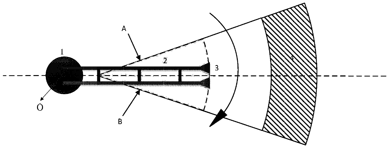
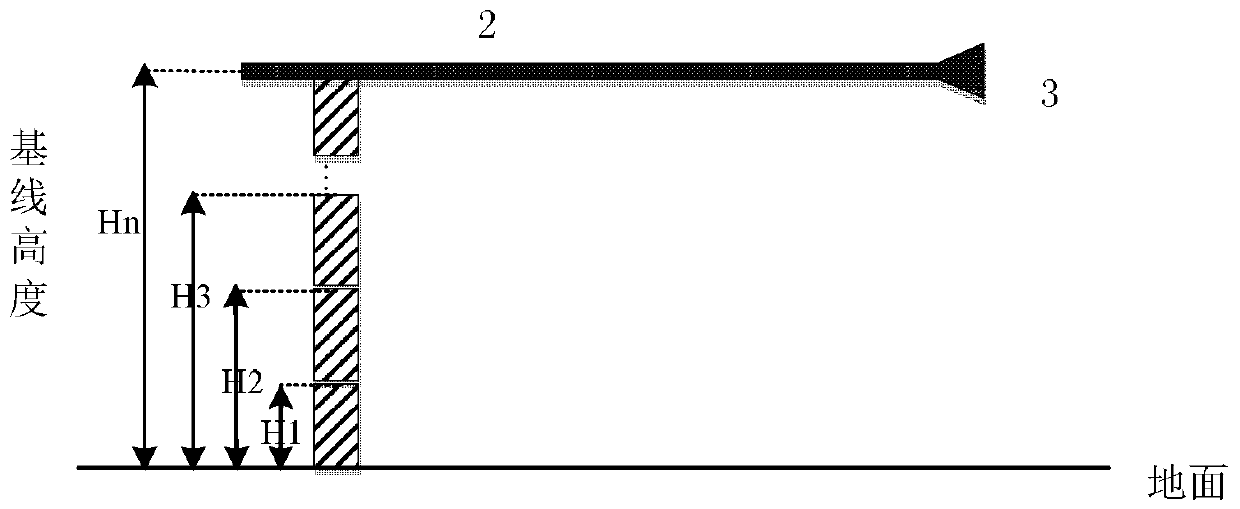
[0029] In an embodiment of the present invention, a digital elevation model reconstruction device is provided. like figure 1 As shown, the reconstruction device of the digital elevation model of the present invention includes an arc ground-based interference radar, and the arc ground-based interference radar includes: a rotating platform and an antenna unit, and the rotating platform is used to realize the arc motion of the antenna, which includes a high-precision turntable 1 and The rod arm 2, the antenna unit includes at least two antennas for simultaneous transmission and reception of signals. In this embodiment, two horn antennas 3 are used. One end of the rod arm 2 is arranged on the turntable 1, and the other end is...


PUM


Abstract

The invention provides a reconstruction device and reconstruction method of a digital elevation model. The reconstruction device comprises an arc foundation interference radar, the arc foundation interference radar comprises a rotating platform and an antenna unit; the antenna unit comprises at least two antennas connected with the rotating platform, the continuous arc movement of the antennas isrealized through the rotating platform; the antennas are used for the simultaneous transceiving of the signal, a radar original echo of an observation target region is observed through the antennas, and the synthetic aperture imaging processing is performed, thereby acquiring a single-lock complex image of the imaging region; the height of the rotating plate is adjustable and used for acquiring asingle-lock complex image sequence of the observation target region under different heights, and acquiring an interference image sequences under different heights; the joint phase unwrapping processing is performed on multiple groups of acquired interference image sequences, thereby acquiring the unwrapped phase diaphragm and accomplishing the precise reconstruction of the digital elevation modelthrough the conversion between the phase and the elevation.

Description

technical field [0001] The invention relates to the fields of radar development and safety monitoring, in particular to a digital elevation model reconstruction device and reconstruction method. Background technique [0002] Digital elevation model reconstruction technology is a high-precision and complex terrain surveying and mapping technology, which has important applications in military applications, anti-terrorism and stability maintenance, earthquake relief and other fields. According to its technical principles, there are mainly the following categories: one is photogrammetry technology, which restores the elevation information of the terrain by overlapping images from different perspectives; the second is based on lidar, which realizes three-dimensional monitoring of the monitored area through laser point cloud Reconstruction; the last category is the emerging interferometric synthetic aperture radar technology, which is realized through SAR image interference proces...

Claims


Application Information

Patent Timeline
Patent Type & Authority Applications(China)
IPC IPC(8): G01S13/90
Inventor 罗运华喻忠军徐正赵耀
Owner INST OF ELECTRONICS CHINESE ACAD OF SCI
Learn More