Method and device for realizing wireless sensor network (WSN) node positioning by establishing virtual synthetic aperture radar (SAR) image
A technology for node positioning and image realization, which is used in measurement devices, reflection/re-radiation of radio waves, and beacon systems using radio waves, etc. It can solve the problems of insufficient WSN node positioning accuracy and high energy consumption.
- Summary
- Abstract
- Description
- Claims
- Application Information
AI Technical Summary
Problems solved by technology
Method used
Image
Examples
specific Embodiment 1
[0098] In the embodiment of the present invention, the PAST technology refers to a projection approximation subspace tracking technology (Projection Approximation Subspace Tracking, PAST for short).
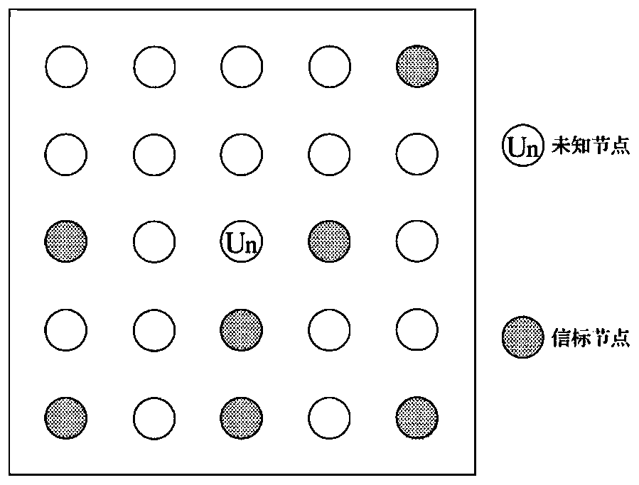
[0099] Assuming that there is an unknown node O in the three-dimensional space where the WSN is located, its real coordinates are (x o ,y o ,z o ). There are N beacon nodes connected to the unknown node O, respectively S 1 S 2 S 3 ... ... S N , where the nth connected beacon node S n The coordinates are (x n ,y n ,z n ), the wavelength of the transmitted signal between nodes is λ, without loss of generality, the initial phase of all transmitted signals is set to 0, and the signal between the beacon node and the unknown node O under ideal conditions without considering noise interference is:
[0100]
[0101] Among them, d n To connect to the beacon node S n The real physical distance from the unknown node O. Have:
[0102]
[0103] It can be seen from formu...
specific Embodiment 2
[0184] Such as Figure 8 As shown, the embodiment of the present invention provides a device for WSN node positioning by constructing a virtual SAR image, including:
[0185] A construction module 201, configured to perform multiple samplings of signals between WSN nodes and construct a virtual SAR image according to the similarity between the SAR range unit signal and the signal between WSN nodes;
[0186] The estimation module 202 is used to estimate the signal subspace by using each range unit signal of the virtual SAR image based on the PAST technology, suppress noise interference, and determine phase information between WSN node signals at the same time;
[0187] The positioning module 203 is configured to analyze the difference between the actual received signal and the theoretical received signal between the nodes based on the cosine similarity principle based on the phase information between the WSN node signals, so as to realize WSN node positioning.
[0188] Prefera...
PUM
 Abstract
Description
Claims
Application Information
 - R&D
- Intellectual Property
- Life Sciences
- Materials
- Tech Scout
- Unparalleled Data Quality
- Higher Quality Content
- 60% Fewer Hallucinations
Browse by: Latest US Patents, China's latest patents, Technical Efficacy Thesaurus, Application Domain, Technology Topic, Popular Technical Reports.
© 2025 PatSnap. All rights reserved.Legal|Privacy policy|Modern Slavery Act Transparency Statement|Sitemap|About US| Contact US: help@patsnap.com


