Single beam and towing water depth measurement data consistency check method

A bathymetry and single-beam technology, which is applied in the field of single-beam and towed bathymetry data consistency check, can solve problems such as inability to obtain data and terrain information.

Inactive Publication Date: 2019-05-17
SHANDONG UNIV OF SCI & TECH
View PDF2 Cites 2 Cited by
  • Summary
  • Abstract
  • Description
  • Claims
  • Application Information

AI Technical Summary

Problems solved by technology

The traditional bathymetry system can map the underwater terrain very well, and the laser scanner can obtain the spatial location information on the ground, but in the intertidal zone where the underwater and the ground are connected, the data cannot be obtained well by using these two methods
Integrating laser radar, GNSS, single-beam sounding system and towed measurement system, relying on mobile platforms such as vehicles and ships, constitutes a relatively complete mobile measurement system, and develops a new integrated technology system for land and water integrated information acquisition. Solved the problem that the terrain information could not be obtained in the intertidal zone at the junction of the ocean and the land

Method used


Image

  • Single beam and towing water depth measurement data consistency check method
  • Single beam and towing water depth measurement data consistency check method
  • Single beam and towing water depth measurement data consistency check method

Examples


Embodiment 1

[0117] 1. The Axyz industrial measurement system of Swiss Leica Company is selected. Its hardware equipment includes two high-precision electronic theodolite TM5100A (the nominal accuracy of horizontal and vertical angle measurement is ±0.5″), a desktop or portable computer, and a carbon fiber ruler ( The length is 900.045mm, and the inspection accuracy reaches ±0.003mm), high-stability aluminum tripod, connection cable, dual serial port PC card, used for single serial port notebook computers, etc.

[0118] Select the appropriate station location according to the placement of the instrument. Complete and verify the connection of the instrument used.

[0119] Create a new work file, the file name is established according to the measurement date; modify the length of the default standard ruler to 900.045 scale. Refresh processing to verify whether the modification is correct; establish a station. Click "Theodolite Manager" (theodolite management) under the "Tools" menu to star...


PUM


Abstract

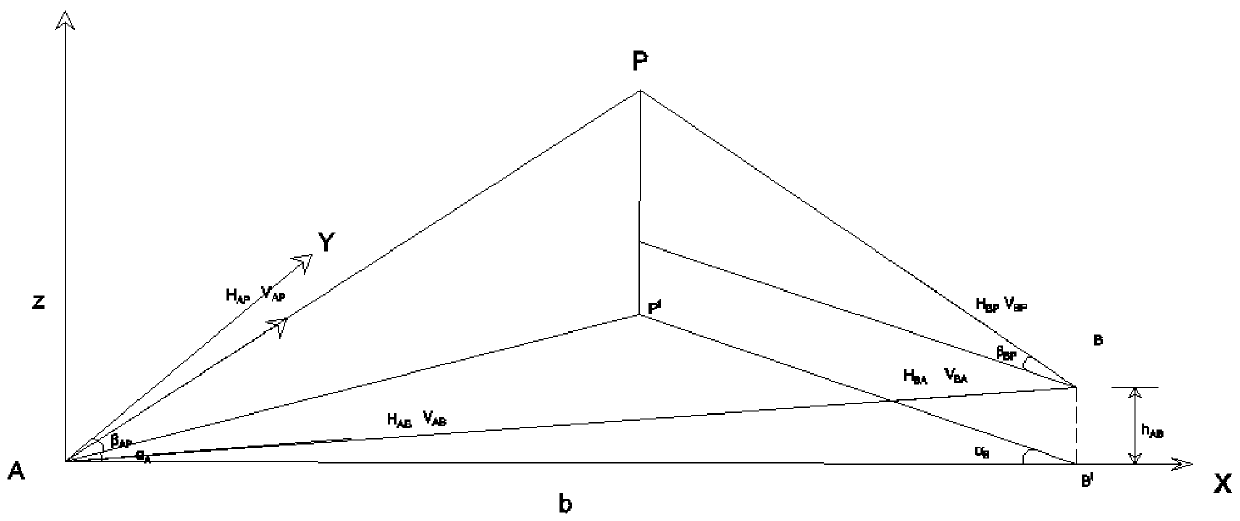
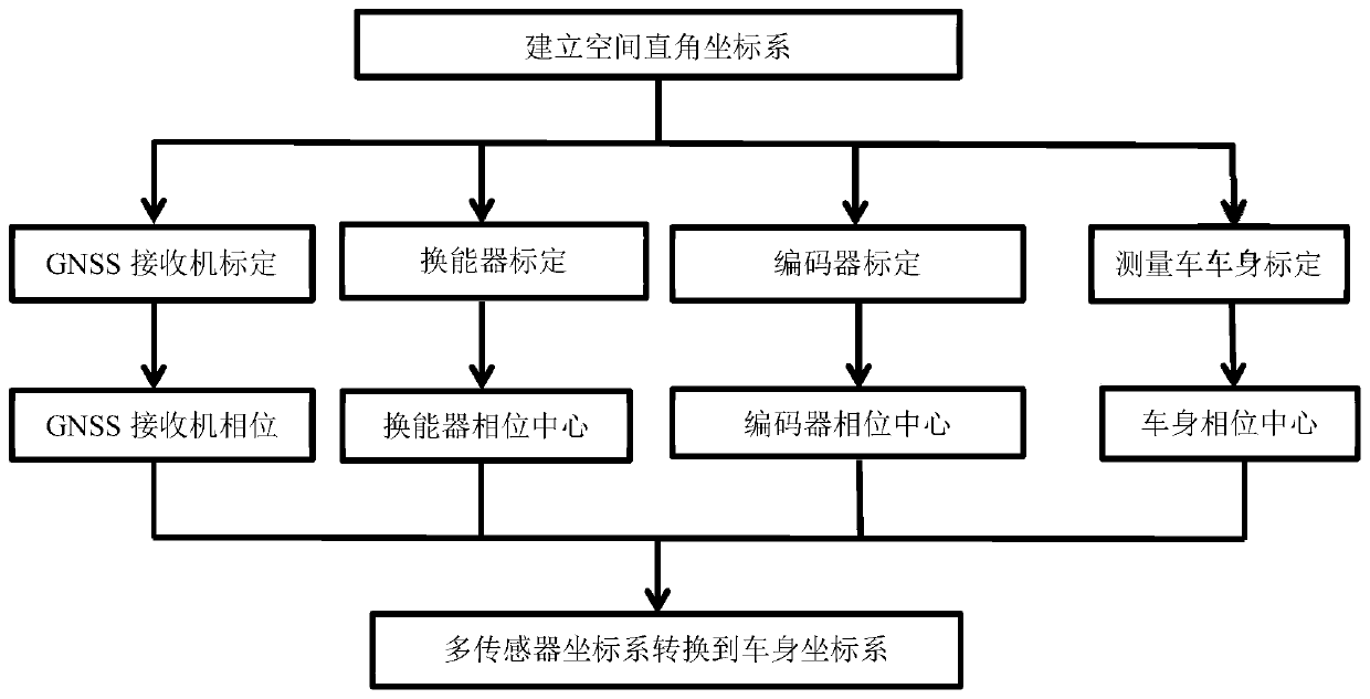
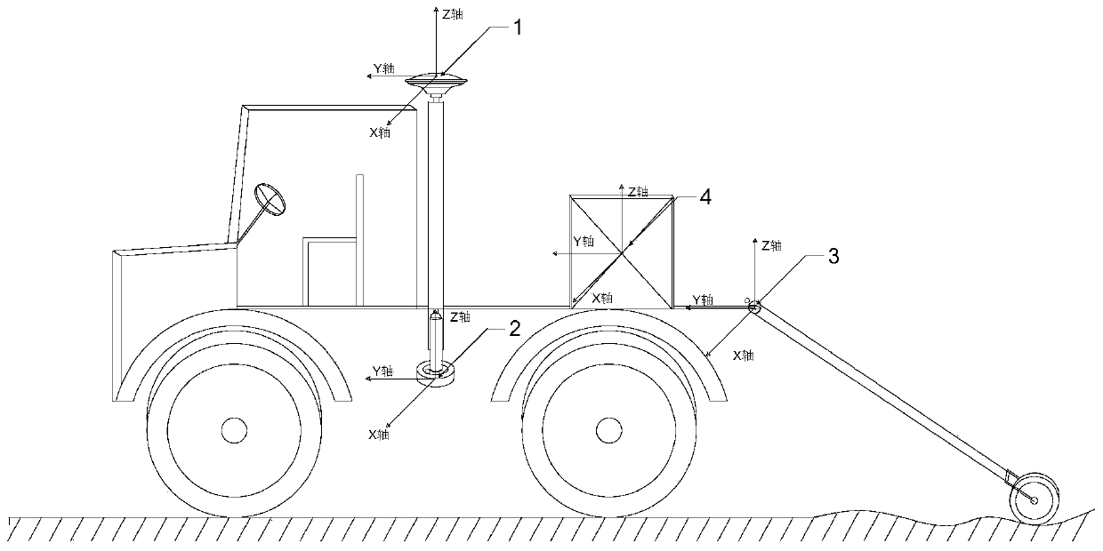
The invention provides a single beam and towing water depth measurement data consistency check method. The invention provides a measurement device; the measurement device comprises a measurement car,a GNSS receiver, a single-beam depth finder energy converter and a towing measurement system encoder are arranged on the measurement car; the method comprises the following steps: firstly establishinga space rectangular coordinate system through a theodolite, and then computing phase centers of the sensor and a measurement car body by utilizing a space forward intersection measurement principle calibration sensor and a space coordinate of the measurement car body, and then converting the phase center coordinate of each sensor to the car body coordinate system of the measurement car, thereby realizing the single-beam and towing measurement data consistency check. And the problem that the intertidal zone at the connecting part of the ocean and the land cannot acquire the terrain informationis solved.

Description

technical field [0001] The invention belongs to the field of mobile measurement data processing, and in particular relates to a consistency check method for single beam and towed water depth measurement data. Background technique [0002] With the proposal of China's marine strategy and the requirements of the development of marine economy, people urgently need to obtain more comprehensive information on water and land integration in the process of production and construction. The traditional bathymetry system can map the underwater terrain very well, and the laser scanner can obtain the spatial position information on the ground, but in the intertidal zone where the underwater and the ground are connected, the data cannot be obtained well by using these two methods. Integrating laser radar, GNSS, single-beam sounding system and towed measurement system, relying on mobile platforms such as vehicles and ships, constitutes a relatively complete mobile measurement system, and d...

Claims


Application Information

Patent Timeline
IPC IPC(8): G01S7/40G01S7/497G01S19/23G01C1/02
Inventor 石波俞家勇田茂义卢秀山
Owner SHANDONG UNIV OF SCI & TECH
Why Eureka
Try Eureka