
A Method for Predicting the Location of Underwater Nodes in a Fixed-depth Underwater Sensor Network

An underwater sensor, node location technology, used in location-based services, satellite radio beacon positioning systems, instruments, etc., can solve problems such as wasting energy

Active Publication Date: 2021-05-11
HOHAI UNIV CHANGZHOU
View PDF3 Cites 0 Cited by
  • Summary
  • Abstract
  • Description
  • Claims
  • Application Information

AI Technical Summary

Problems solved by technology

[0003] The current positioning method for underwater sensor networks is mainly based on multilateral positioning based on ranging. This method needs to frequently broadcast node position information, which wastes energy.

Method used


Image

  • A Method for Predicting the Location of Underwater Nodes in a Fixed-depth Underwater Sensor Network
  • A Method for Predicting the Location of Underwater Nodes in a Fixed-depth Underwater Sensor Network
  • A Method for Predicting the Location of Underwater Nodes in a Fixed-depth Underwater Sensor Network

Examples


Embodiment Construction

[0031] In order to enable those skilled in the art to better understand the technical solutions in the application, the technical solutions in the embodiments of the application are clearly and completely described below. Obviously, the described embodiments are only part of the embodiments of the application, and Not all examples. Based on the embodiments in this application, all other embodiments obtained by persons of ordinary skill in the art without creative efforts shall fall within the scope of protection of this application.

[0032] Below in conjunction with accompanying drawing, technical scheme of the present invention has been described in further detail:

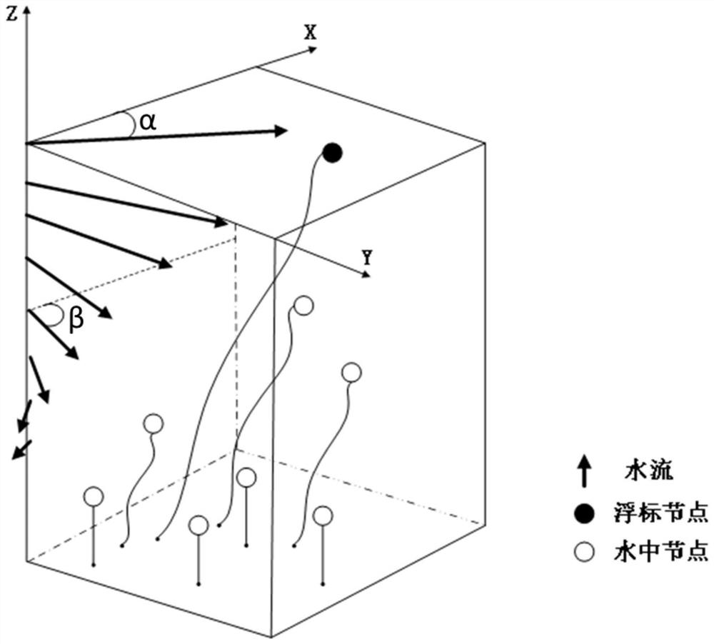
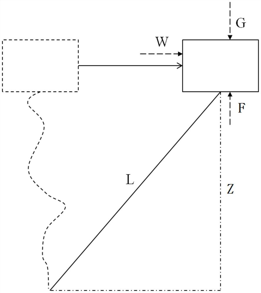
[0033] A method for predicting the position of underwater nodes of a fixed-depth underwater sensor network, the specific steps are as follows:

[0034] Step 1: Network model, the mobile sink walks on the water surface, and the underwater nodes are deployed in the underwater three-dimensional environment, includ...


PUM


Abstract

The invention discloses an underwater node position prediction method for a fixed-depth underwater sensor network, which is suitable for a three-dimensional underwater sensor network with a fixed node depth. Among them, the mobile sink on the water surface is positioned by the satellite positioning system, calculates the water velocity and offset angle, and periodically broadcasts this information to the buoy node, and the buoy node forwards the information to the underwater node again; the underwater node uses Ekman to drift The model calculates the current velocity and offset angle at the depth, and finally calculates the drifting displacement, so as to predict the position information. Compared with conventional ranging-based underwater positioning methods, this method can reduce the position information broadcast behavior of buoy nodes and reduce energy consumption.

Description

technical field [0001] The invention relates to an underwater node position prediction method for a fixed-depth underwater sensor network, which belongs to the field of three-dimensional underwater sensor network node positioning. Background technique [0002] Underwater sensor networks show great application prospects in military surveillance, underwater navigation, disaster prevention, pollution detection, resource extraction, earthquake monitoring, etc. In most applications, network deployment, maintenance, and data collection require the support of geographic location information. Therefore, the research and development of efficient and stable underwater sensor network positioning technology is becoming a focus of attention. [0003] The current positioning method for underwater sensor networks is mainly based on multilateral positioning based on ranging, which requires frequent broadcasting of node position information and wastes energy. Contents of the invention ...

Claims


Application Information

Patent Timeline
Patent Type & Authority Patents(China)
IPC IPC(8): H04W4/029H04W64/00G01S19/42
CPCG01S19/42H04W64/006H04W4/029Y02D30/70
Inventor 张杰蔡梦颖钱玉洁
Owner HOHAI UNIV CHANGZHOU
Learn More