A method for establishing remote sensing depth model of multi-layered soil medium

A technology of soil medium and establishment method, which is applied in the field of microwave remote sensing, can solve the problems of uneven soil, error, and non-isothermal, etc., and achieve the effect of reducing error and ensuring data accuracy

Active Publication Date: 2019-02-15
NORTHWEST INST OF ECO-ENVIRONMENT & RESOURCES CAS
View PDF13 Cites 0 Cited by
  • Summary
  • Abstract
  • Description
  • Claims
  • Application Information

AI Technical Summary

Problems solved by technology

[0009] The above penetration depth model and thermal emission depth model consider the soil medium with uniform physical properties in the vertical gradient direction. However, in reality, the soil is neither uniform nor isothermal, and the soil temperature and humidity vary significantly with depth. , which will lead to a large error between the calculated remote sensing depth and the actual remote sensing depth, which will affect the accuracy of the conclusions obtained in the subsequent analysis

Method used


Image

  • A method for establishing remote sensing depth model of multi-layered soil medium
  • A method for establishing remote sensing depth model of multi-layered soil medium
  • A method for establishing remote sensing depth model of multi-layered soil medium

Examples


Embodiment Construction

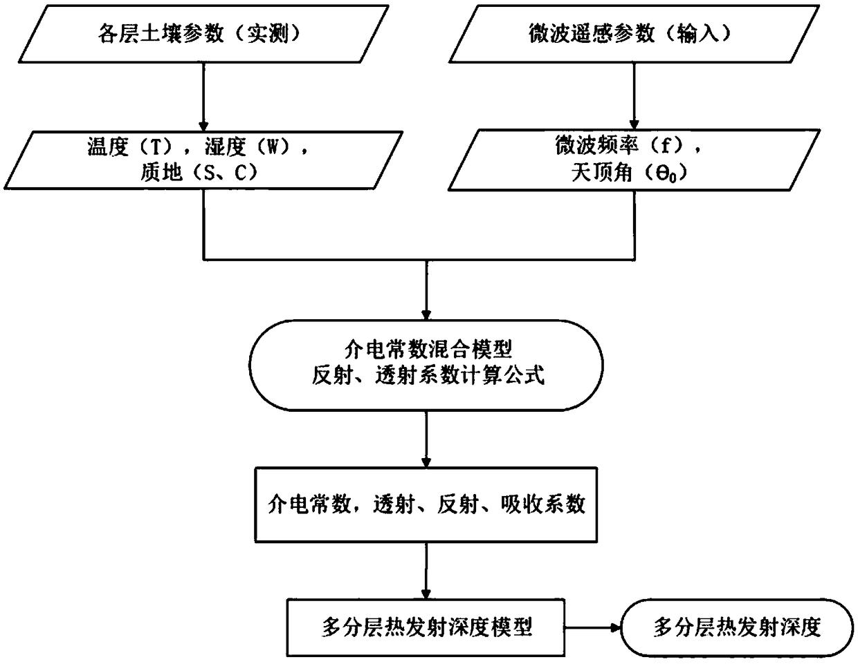
[0040] An embodiment of the present invention provides a method for establishing a multi-layered soil medium remote sensing depth model, which specifically includes the following steps.

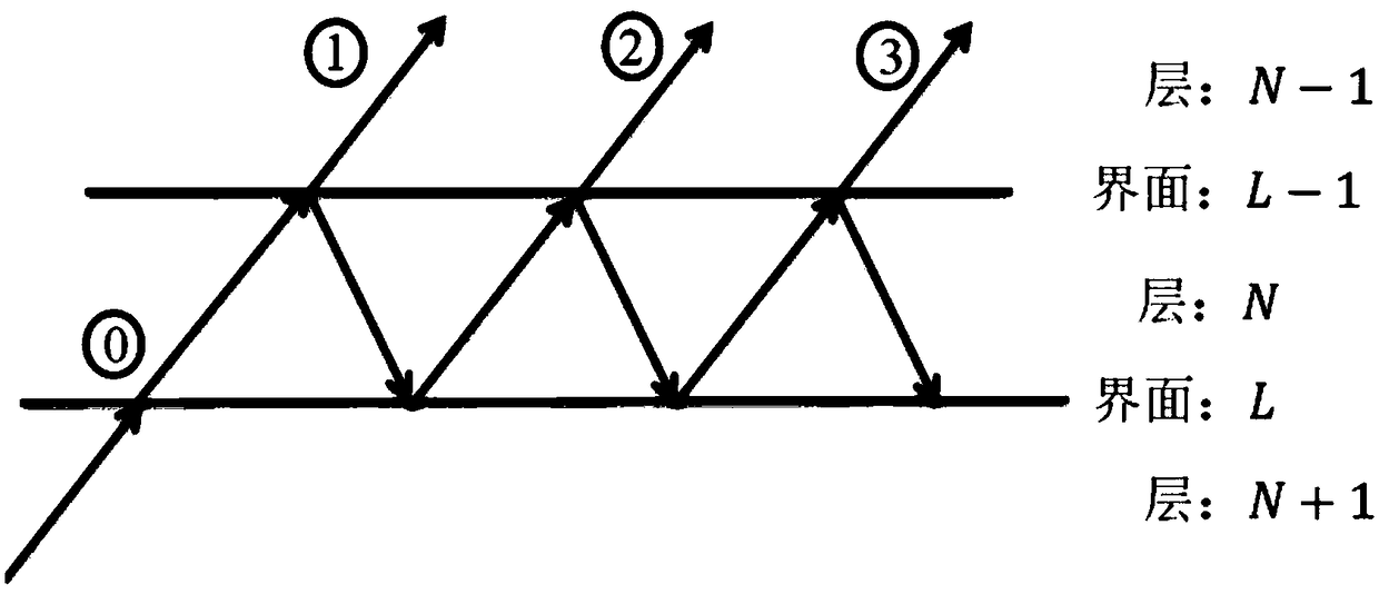
[0041] (1) Consider a non-homogeneous soil medium, which is assumed to be a plane-layered N-layer system.

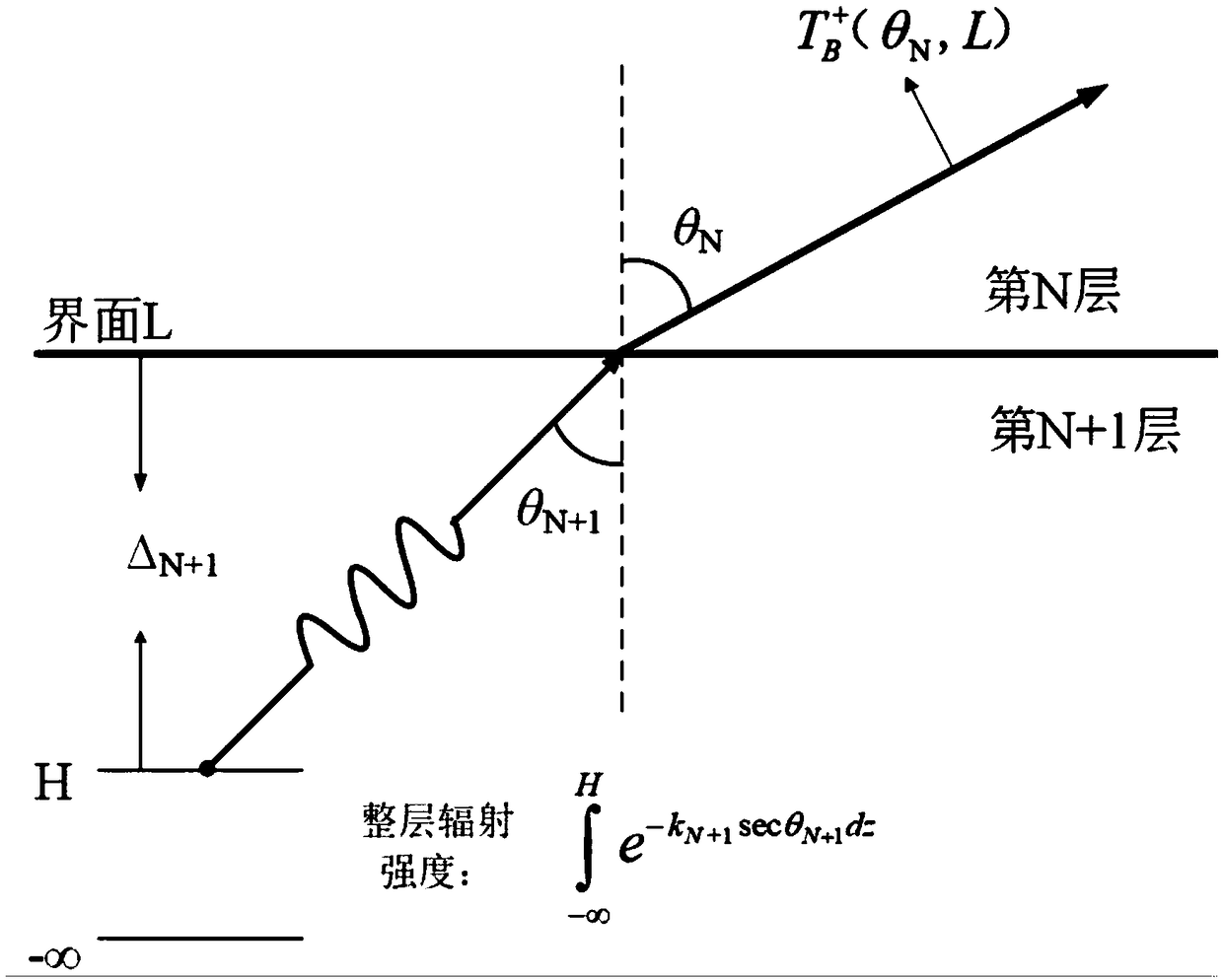
[0042] Among them, N≥2, and the 0th layer is defined as the free atmosphere, the N+1th layer is a semi-infinite medium, and the middle layer is soil; the upper interface of the Nth layer soil medium is L-1, and the lower interface is L (L=N ), the thickness of the i-th layer of soil medium is Δ i , i=1,2,3,···,N(L). Of course, if the soil medium under study is vegetative soil or snow-covered soil (that is, soil covered with a layer of vegetation or snow cover), then the first layer should be considered as vegetation or snow cover, and the second layer to N+ Layer 1 is soil, and layer N+2 is a semi-infinite medium. The following content of this paper takes the middle layer as soil as ...


PUM


Abstract

The invention relates to a method for establishing a remote sensing depth model of a multi-layered soil medium, comprising the following steps: considering a non-homogeneous soil medium, assuming thatit is a planar layered N-layer system, the 0th layer is a free atmosphere, and the N+1th layer is a semi-infinite medium; The interface on the N-layer soil medium is L-1, that low interface is L, L=N; Assuming that ray 0 is the transmitted radiation of the (N+1) th layer through interface L, calculate the ray 0 through interface L in the (N+1) th layer. 1, L is reflected and transmitted to the N-1 Interface in Layer 1 L 1 The sum of upward radiationis extended to the N layer to obtain air by analogy Radiation upward of soil interface, Then let obtain the formula model of multi-layer heat emission depth H. The invention considers the reflection and transmission of radiation between soil layers, can effectively reduce the error between the calculation result and the actual remote sensing depth, and provides data accuracy guarantee for subsequent analysis and use.

Description

technical field [0001] The invention relates to the technical field of microwave remote sensing, in particular to a method for establishing a multi-layered soil medium remote sensing depth model. Background technique [0002] In the study of surface and subsurface physical parameters retrieved by passive microwave remote sensing, remote sensing depth represents the penetration characteristics of microwaves, and the radiation signals received by microwave radiometers can be used to analyze and retrieve the temperature and humidity profile information of the entire layer of soil. Therefore, , the accurate remote sensing depth helps to deepen the understanding of the physical meaning of microwave remote sensing retrieval parameters. There are currently two remote sensing depth models, one is the penetration depth model, and the other is the thermal emission depth model. [0003] The penetration depth model is defined as follows: Consider a beam of electromagnetic waves inciden...

Claims


Application Information

Patent Timeline
Patent Type & Authority Applications(China)
IPC IPC(8): G06F17/50
CPCG06F30/20
Inventor 杨文高晓清靳潇
Owner NORTHWEST INST OF ECO-ENVIRONMENT & RESOURCES CAS
Why Eureka
Try Eureka