Cluster-like center determination method, device, computer device and storage medium
A technique for determining the method and cluster center, applied in the field of data processing, which can solve the problem of high computational complexity
- Summary
- Abstract
- Description
- Claims
- Application Information
AI Technical Summary
Problems solved by technology
Method used
Image
Examples
Embodiment 1
[0074] Figure 1a It is a flowchart of a method for determining a cluster center provided by Embodiment 1 of the present disclosure. This embodiment is applicable to the situation of quickly determining a cluster center. The method can be performed by a device for determining a cluster center. The device can be composed of It can be realized by means of software and / or hardware, and can generally be integrated in computer equipment. Correspondingly, such as Figure 1a As shown, the method includes the following operations:
[0075] S110. Convert each two-dimensional geographic location information in the geographic location information set to be processed into one-dimensional location coding information by using a geographic location coding technology.
[0076] Wherein, the geographic location coding technology may be a technology for coding geographic location data, for example, the geographic location coding technology may use a geohash algorithm (Geo hash). The two-dimensi...
Embodiment 2
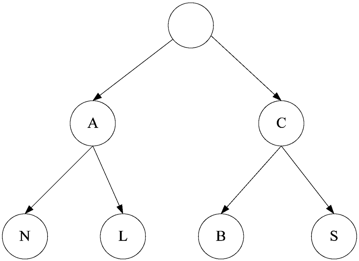
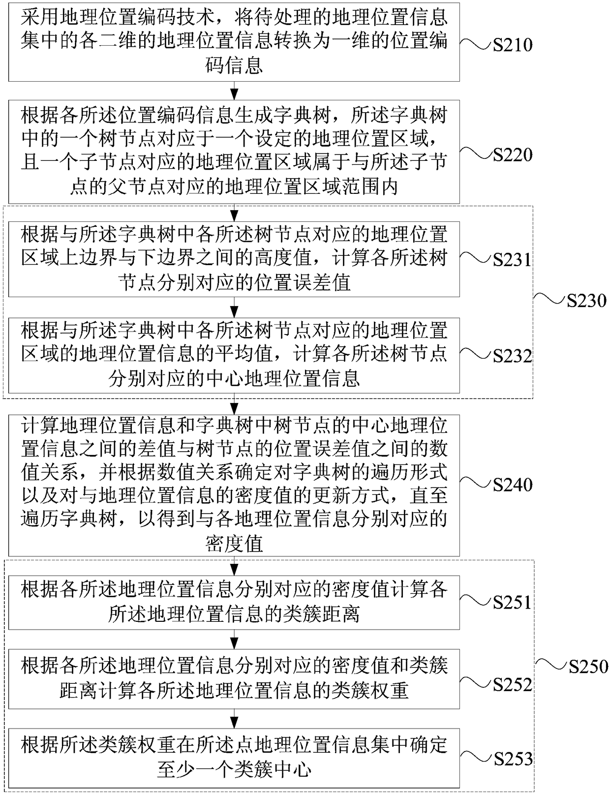
[0089] Figure 2a is a flow chart of a method for determining a cluster center provided in Embodiment 2 of the present disclosure, Figure 2b It is a flow chart of a method for calculating the density value corresponding to each geographic location information provided by Embodiment 2 of the present disclosure. This embodiment is embodied on the basis of the above-mentioned embodiments. The positional relationship between each tree node in the dictionary tree and each geographic location information, and the quantitative value of the geographic location information associated with each tree node are calculated and corresponding to each geographic location information The density value of , and the specific implementation method of determining the center of the cluster according to the density value. Correspondingly, such as Figure 2a As shown, the method of this embodiment may include:
[0090] S210. Convert each two-dimensional geographic location information in the geograp...
Embodiment 3
[0142] image 3 is a schematic diagram of a device for determining a cluster center provided in Embodiment 3 of the present disclosure, such as image 3 As shown, the device includes: an information conversion module 310, a dictionary tree generation module 320, a density value calculation module 330 and a cluster center determination module 340, wherein:
[0143] The information conversion module 310 is configured to convert each two-dimensional geographic location information in the geographic location information set to be processed into one-dimensional location coding information by using geographic location coding technology;
[0144] The dictionary tree generation module 320 is used to generate a dictionary tree according to each of the position code information, a tree node in the dictionary tree corresponds to a set geographical location area, and a geographical location area corresponding to a child node belongs to the set geographic location area. within the geograp...
PUM
 Abstract
Description
Claims
Application Information
 - R&D
- Intellectual Property
- Life Sciences
- Materials
- Tech Scout
- Unparalleled Data Quality
- Higher Quality Content
- 60% Fewer Hallucinations
Browse by: Latest US Patents, China's latest patents, Technical Efficacy Thesaurus, Application Domain, Technology Topic, Popular Technical Reports.
© 2025 PatSnap. All rights reserved.Legal|Privacy policy|Modern Slavery Act Transparency Statement|Sitemap|About US| Contact US: help@patsnap.com


