
Highway accident monitor method and system based on ground-space collaborative sensing

A highway, collaborative perception technology, applied in the direction of road vehicle traffic control system, traffic control system, traffic flow detection, etc., can solve problems such as low work efficiency, achieve strong mobility, accurate observation results, and improve processing efficiency. Effect

Inactive Publication Date: 2019-01-22
BEIHANG UNIV
View PDF8 Cites 14 Cited by
  • Summary
  • Abstract
  • Description
  • Claims
  • Application Information

AI Technical Summary

Problems solved by technology

However, this method often has low work efficiency when judging real-time road conditions, and there is a large error with the actual situation.

Method used


Image

  • Highway accident monitor method and system based on ground-space collaborative sensing
  • Highway accident monitor method and system based on ground-space collaborative sensing
  • Highway accident monitor method and system based on ground-space collaborative sensing

Examples


Embodiment Construction

[0023] The present invention will be further described in detail below in conjunction with the accompanying drawings and practical examples.

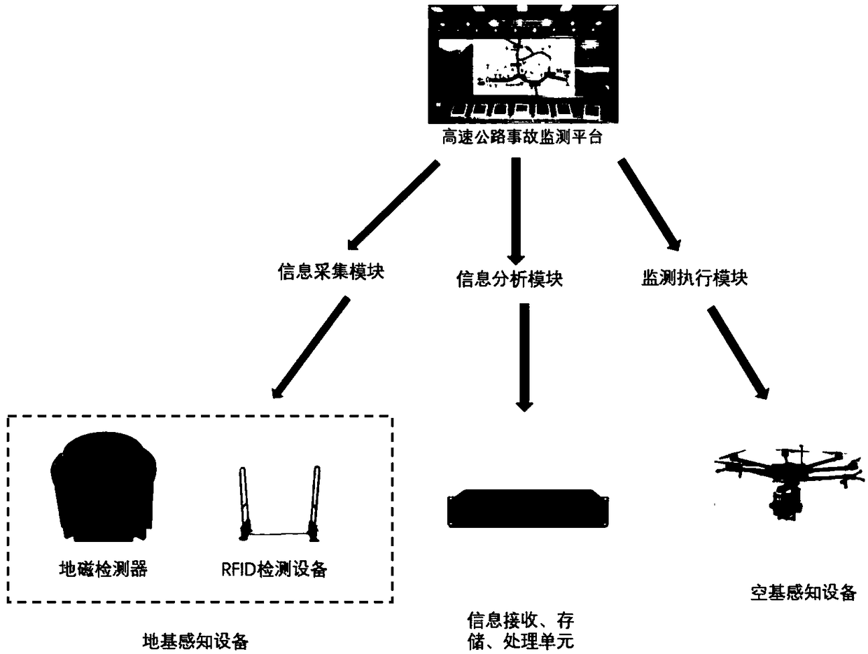
[0024] figure 1 As shown, a highway accident monitoring platform based on the cooperative control of fixed detectors and UAVs includes the following steps:

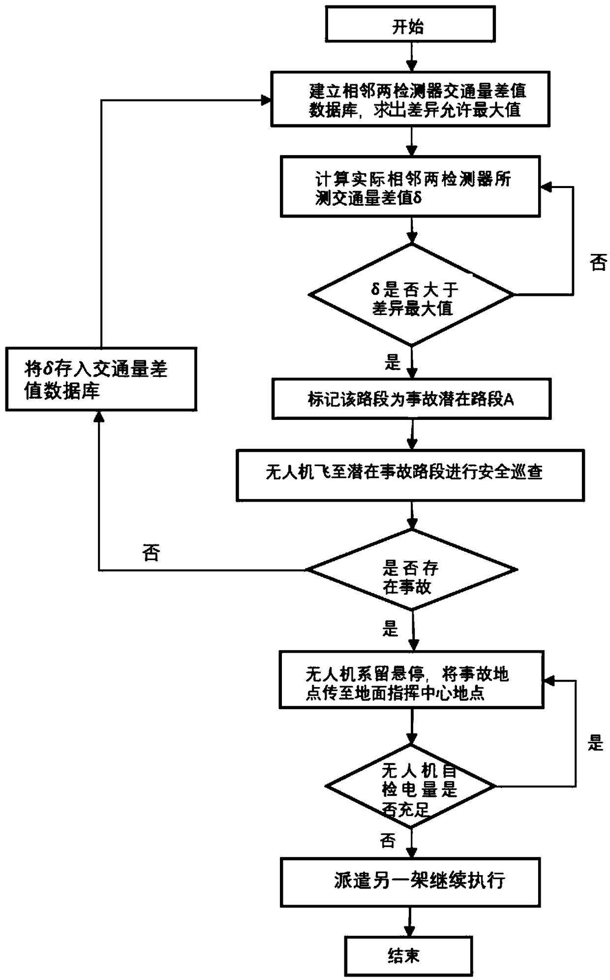
[0025] Step 1: Determine the potential accident section A of the expressway.

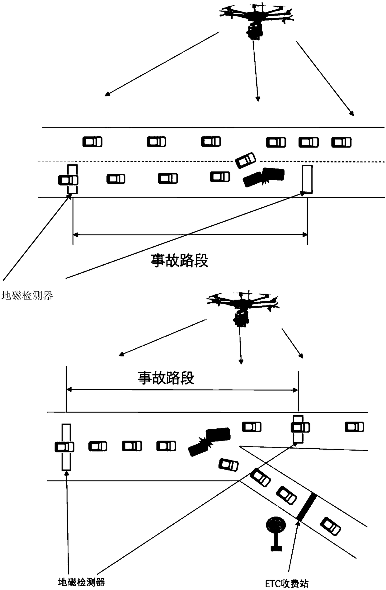
[0026] Use fixed information detectors such as ground-based sensing equipment (geomagnetic detectors and RFID) arranged on expressways to calculate traffic parameters such as traffic volume and vehicle density, and calculate traffic conditions under different traffic conditions on expressways after removing scattered points. Traffic flow and traffic density, get the traffic flow-density map on each lane under normal traffic conditions, compare the data of two adjacent ground-based sensing devices (geomagnetic detectors and RFID), if it exceeds the allowable difference error δ max , then mark the sectio...


PUM


Abstract

The invention discloses a highway accident monitor method and system based on ground-space collaborative sensing. The method comprises the steps that a ground-based sensing device acquires real-time speed and quantity of vehicles on a highway, the speed and quantity are calculated and processed into traffic volume and vehicle flow density, and analysis and processing help determine a potential accident road section; then data of the potential accident road section is transmitted to a monitor execution system according to analysis data acquired by the ground-based sensing device, and a nearestUAV is selected according to a UAV scheduling algorithm and sent to the site rapidly to confirm the accident; at the same time, the UAV stays and hovers at the accident road section so as to keep monitoring the situation on the site. Through adoption of the highway accident monitor method and system, advantages of high mobility and wide observation range of a space-based sensing device are fully utilized, desired data is relatively simple and is easy to obtain, real-time road conditions can be monitored rapidly, accurate point-to-point control is realized, the observation result is accurate, direct and clear, and processing efficiency of the traffic accident is improved greatly.

Description

technical field [0001] The invention belongs to the field of traffic information and control, in particular to a highway accident monitoring method and system based on ground-based and space-based cooperative sensing, especially a highway accident monitoring platform, which aims to sense and wirelessly detect accidents through geomagnetism, RFID, etc. Human-machine and other space-based perception cooperate to accurately grasp road traffic conditions. Background technique [0002] The rapid development of the national economy and the increasing material and cultural needs of the people have promoted the vigorous development of my country's road transportation industry, and vigorously developing the transportation industry is also the need of the national strategic development plan. By the end of 2017, the total mileage of expressways in my country had reached 131,000 kilometers, ranking first in the world. The gradual improvement of expressway network infrastructure not onl...

Claims


Application Information

Patent Timeline
IPC IPC(8): G08G1/01G08G1/042G08G1/052G08G1/065
CPCG08G1/01G08G1/0104G08G1/0125G08G1/042G08G1/052G08G1/065
Inventor 于海洋王飞任毅龙王子睿杨阳张力
Owner BEIHANG UNIV
Learn More