
High-resolution satellite image and rational polynomial parameter transformation method

A rational polynomial and satellite image technology, applied in the field of surveying and mapping remote sensing, can solve problems affecting the speed and accuracy of surveying and mapping, display freeze, instantaneous up and down parallax, etc., to achieve the effect of not affecting operation efficiency, ensuring calculation accuracy, and improving applicability

Pending Publication Date: 2019-01-18
CHINA RAILWAY ERYUAN ENG GRP CO LTD
View PDF4 Cites 4 Cited by
  • Summary
  • Abstract
  • Description
  • Claims
  • Application Information

AI Technical Summary

Problems solved by technology

However, due to the high resolution, the amount of image data has increased sharply. A single image is generally about 2GB, and some even exceed 4GB, which leads to a decrease in computer processing speed and slow encryption and matching
At present, the existing domestic mapping workstations do not support large image data enough. As the amount of data increases, mapping software cannot open high-resolution satellite images, or the display will appear stuck and instantaneous up and down parallax phenomena, affecting Mapping speed and accuracy

Method used


Image

  • High-resolution satellite image and rational polynomial parameter transformation method
  • High-resolution satellite image and rational polynomial parameter transformation method
  • High-resolution satellite image and rational polynomial parameter transformation method

Examples


Embodiment Construction

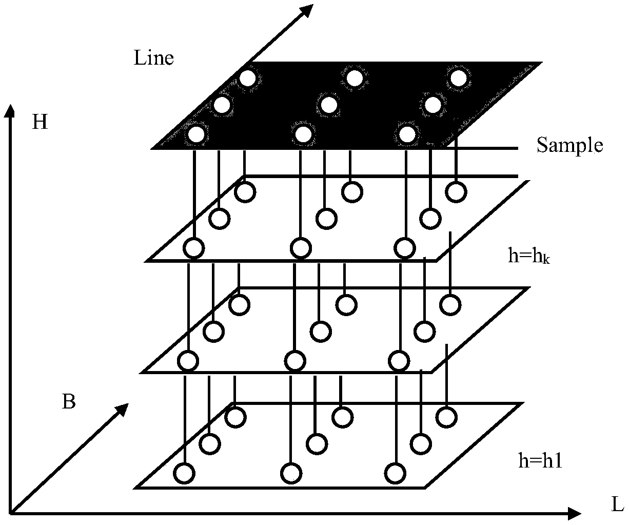
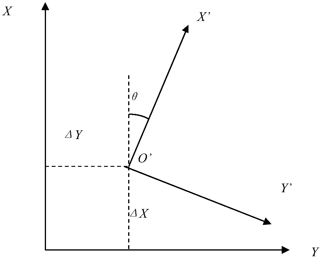
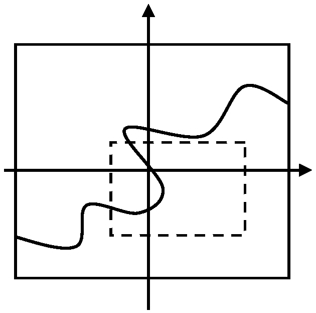
[0020] The present invention will be further described below in conjunction with the accompanying drawings and implementation examples. refer to figure 1 , 2 , 3, the specific implementation steps of a kind of high-resolution satellite image of the present invention and rational polynomial parameter transformation method are as follows:

[0021] ① if figure 1 As shown, the image is divided into m rows and n columns, and (m+1)×(n+1) uniformly distributed image points are obtained;

[0022] ② Divide the elevation of the image coverage area into k layers, each layer has the same elevation h, and has the above (m+1)×(n+1) image points, so the (m+1)×( n+1)×k grid points uniformly distributed on the plane and elevation, and the image coordinates (x, y) and elevation Z of each point are known;

[0023] ③ Utilize rational polynomial function to calculate the object space coordinates (X, Y) according to the image point coordinates (x, y) and elevation Z of each grid point, and the ...


PUM


Abstract

The invention relates to a high-resolution satellite image and rational polynomial parameter transformation method so as to adapt to requirements of a mapping workstation in the aspects of a data volume, an image angle and the like and ensure that accuracy after transformation still meets the mapping requirement. The high-resolution satellite image and rational polynomial parameter transformationmethod comprises the steps of: compiling a grid on an original image at a certain interval; in a set elevation range, replicating such grid at different elevations, and acquiring three-dimensional coordinates of each point on all the grids; when image space coordinates and the elevations are known, determining ground coordinates of each grid point by rational polynomial forward transformation; after a coordinate system of the image is transformed, determining new coordinates of all the grid points, wherein the new coordinates of the grid points correspond to object space coordinates; accordingto the transformed image, solving a normalized parameter of a rational polynomial after transformation; and when the normalized parameter is known, carrying out iteration on a corresponding relationship between the new coordinates of the grid points and the object space coordinates E, N and H to resolve a new rational polynomial parameter.

Description

technical field [0001] The invention relates to the field of surveying and mapping remote sensing, in particular to a high-resolution satellite image and a parameter transformation method thereof. Background technique [0002] With the advancement of sensor technology, electronic technology and earth observation technology, countries have successively launched many high-resolution remote sensing satellites to conduct all-round and all-weather observation of the earth. At present, the existing high-resolution satellites include 1.5-meter Spot7, 1-meter Ikonos, 0.5-meter Pleiades, 0.41-meter GeoEye, and 0.3-meter WorldView-3. The map has high precision; the single-scene image covers a large area and the mapping area is wide. However, due to the high resolution, the amount of image data has increased dramatically. A single image is generally about 2GB, and some even exceed 4GB, which reduces the processing speed of the computer and slows down the encryption and matching of aer...

Claims


Application Information

Patent Timeline
Patent Type & Authority Applications(China)
IPC IPC(8): G01S19/37
CPCG01S19/37
Inventor 王义张刚许懿娜梅熙
Owner CHINA RAILWAY ERYUAN ENG GRP CO LTD
Learn More