
Submarine topographic measurement method based on precision POS

A topographic surveying and precise technology, applied in the direction of electric/magnetic solid deformation measurement, measuring device, electromagnetic measuring device, etc., can solve the problems such as the influence and step of the matching error between the plane position and the depth information of the accuracy of the measurement results, and reduce the intermediate process, reduce the accumulation of errors, and improve the effect of operation accuracy

Inactive Publication Date: 2018-12-21
TIANJIN UNIV
View PDF6 Cites 7 Cited by
  • Summary
  • Abstract
  • Description
  • Claims
  • Application Information

AI Technical Summary

Problems solved by technology

In traditional bathymetry work, the accuracy of measurement results will inevitably be affected by errors in the matching of plane position and depth information, water level control, and water depth calculation.
In addition, due to the "step" phenomenon in the depth datum in different sea areas or even in the same sea area, it is still a big challenge to realize the seamless splicing of measurement data

Method used

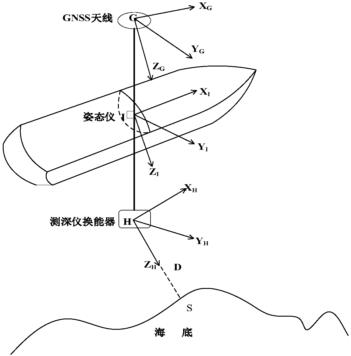
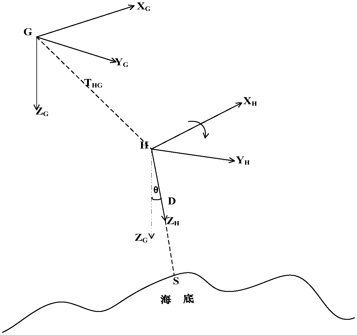
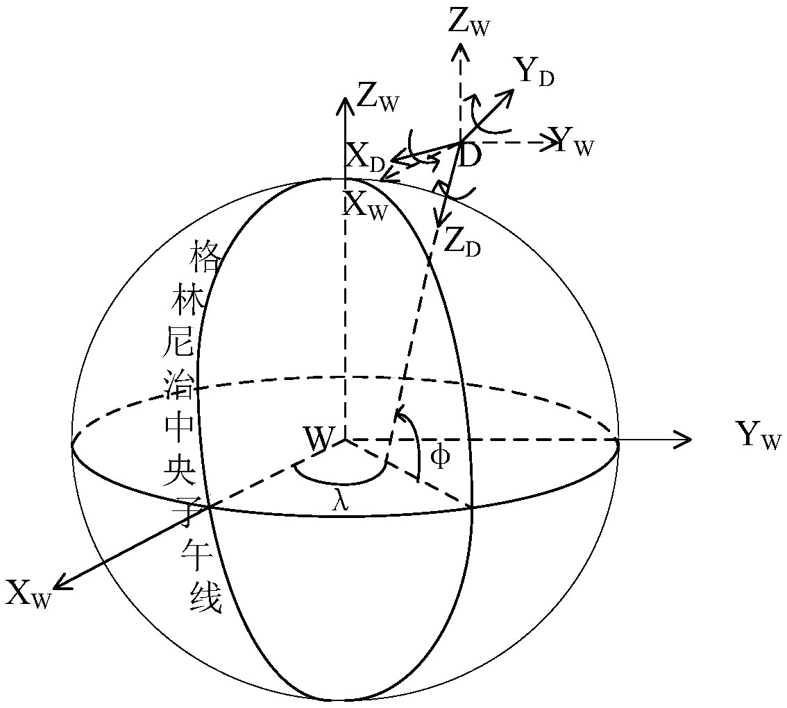

Image

  • Submarine topographic measurement method based on precision POS
  • Submarine topographic measurement method based on precision POS
  • Submarine topographic measurement method based on precision POS

Examples


Embodiment Construction

[0016] In order to make the purpose and technical solution of the present invention clearer, the present invention is further described below.

[0017] The invention introduces a seabed topography measurement method based on precision POS. The so-called precision POS refers to a precision measurement system based on high-precision GNSS positioning and formed by a GNSS receiver, an attitude meter and a depth sounder. The purpose is to collect the three-dimensional coordinate information of the survey ship, and realize the integrated expression of the land-sea coordinate system under the WGS-84 coordinate system based on the reference ellipsoid; to improve the traditional bathymetry work, the accuracy of the measurement results is affected by the plane position and depth information. Matching, water level control, water depth reduction, etc.

[0018] The present invention is based on the precision POS-based seabed topography measurement method, which is composed of three main pa...


PUM


Abstract

The invention relates to the technical field of submarine topographic measurement, in particular to a submarine topographic measurement method based on a precision POS. The submarine topographic measurement method aims to collect the three-dimensional coordinate information of a hull measurement system by the precision POS composed of a GNSS receiver, an attitude instrument and a depth sounding instrument based on high-precision GNSS positioning. A reference ellipsoid surface is taken as the reference when calculating three-dimensional coordinates of measuring points. A WGS-84 coordinate system is adopted uniformly to solve the problem that the accuracy of measurement results is affected by matching of the plane position and depth information, water level control, water depth reduction andthe like in traditional water depth measurement work.

Description

technical field [0001] The invention relates to the technical field of seabed topography measurement, in particular to a seabed topography measurement method based on precise POS. Background technique [0002] The concept of seafloor topography is inherited and developed from bathymetry. Traditional bathymetry is mainly composed of three parts: positioning, bathymetry and tidal observation. When solving the three-dimensional coordinates of the underwater measuring point, firstly obtain the instantaneous water depth of the point by correcting the depth measured by the instrument, the speed of sound and the draft of the instrument, and then obtain the chart water depth of the point according to the tidal correction, and finally the depth of the point The information is matched with the plane position information to obtain the three-dimensional coordinate information of the point. In traditional bathymetry work, the accuracy of measurement results is inevitably affected by er...

Claims


Application Information

Patent Timeline
Patent Type & Authority Applications(China)
IPC IPC(8): G01B7/16G01S19/13
CPCG01B7/16G01S19/13
Inventor 张安民刘荣霞刘禹张豪候泽北刘帅宁一伟欧阳知雨
Owner TIANJIN UNIV
Learn More