
Method for monitoring and evaluating integrity of Beidou satellite navigation system

A technology for integrity monitoring and navigation systems, applied in satellite radio beacon positioning systems, radio wave measurement systems, measurement devices, etc., can solve the problems of not reflecting the integrity of the system, lack of technical implementation methods, etc., and achieve true detection results Credibility, good marketing prospects, and cost-reducing effects

Inactive Publication Date: 2018-10-19
PLA STRATEGIC SUPPORT FORCE INFORMATION ENG UNIV PLA SSF IEU
View PDF7 Cites 6 Cited by
  • Summary
  • Abstract
  • Description
  • Claims
  • Application Information

AI Technical Summary

Problems solved by technology

[0003] However, how to use the Stanford Plot to monitor and evaluate the integrity of the Beidou system is still less discussed at present. In addition, the Stanford Plot is applied to the system integrity monitoring and evaluation based on the static positioning mode. The method is as follows: Multiple monitoring stations with known coordinates perform static positioning of the corresponding system, and obtain the system positioning error at each moment by comparing with the known coordinates. Based on the principle of mathematical statistics, the system's performance monitoring and evaluation results are given; the method is simple It is easy to implement and has been successfully applied to the integrity monitoring field of multiple satellite navigation systems. How to use this method to reasonably evaluate the integrity of the Beidou system still lacks practical and feasible technical implementation methods, and the existing Stanford Plot method only uses static positioning Model-based application to system integrity monitoring and evaluation cannot reflect the integrity of the system under user dynamic conditions

Method used

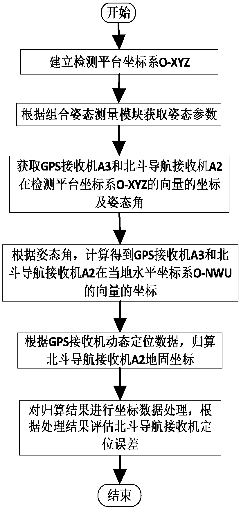
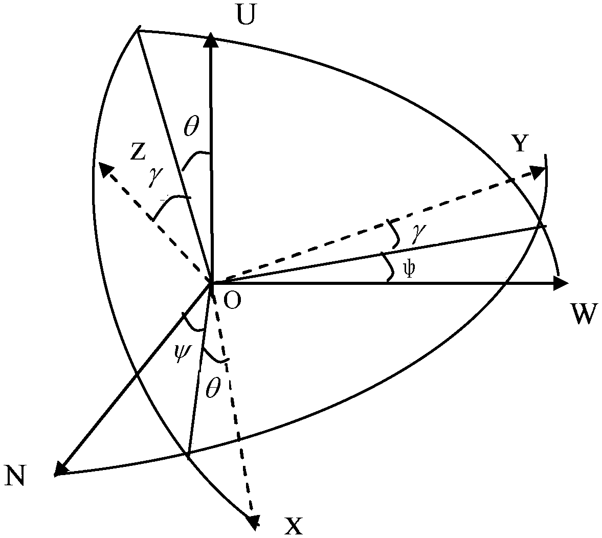

Image

  • Method for monitoring and evaluating integrity of Beidou satellite navigation system
  • Method for monitoring and evaluating integrity of Beidou satellite navigation system
  • Method for monitoring and evaluating integrity of Beidou satellite navigation system

Examples


Embodiment Construction

[0033] The present invention will be described in further detail below in conjunction with the accompanying drawings and technical solutions, and the implementation of the present invention will be described in detail through preferred embodiments, but the implementation of the present invention is not limited thereto.

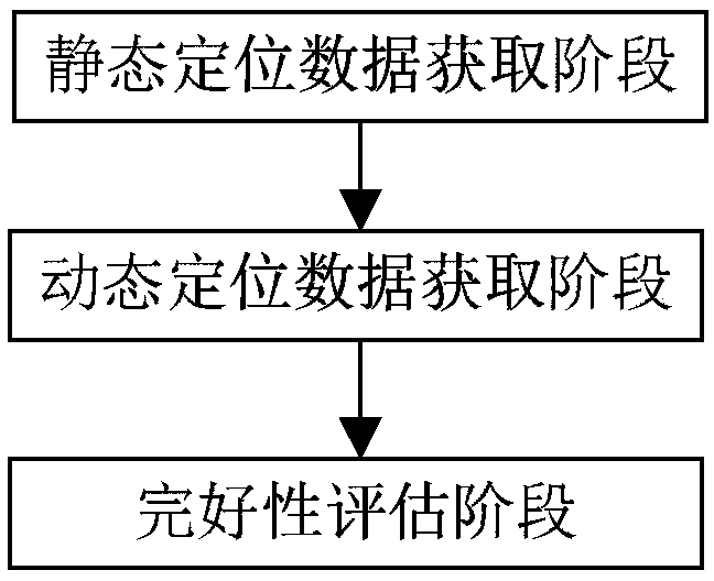
[0034] Aiming at the situation that in the prior art, only the static positioning mode is used as the basis for system integrity monitoring and evaluation, which cannot fully reflect the system integrity status under the dynamic conditions of users. For this reason, embodiment of the present invention, see figure 1 As shown, a Beidou satellite navigation system integrity monitoring and evaluation method includes: static positioning data acquisition phase, dynamic positioning data acquisition phase and integrity evaluation phase, wherein,

[0035] In the static positioning data acquisition stage, the static data of the Beidou satellite navigation system is obta...


PUM


Abstract

The invention belongs to the field of performance monitoring of satellite navigation receivers, and especially relates to a method for monitoring and evaluating the integrity of a Beidou satellite navigation system. The method comprises a static monitoring data obtaining stage: obtaining the static data of the Beidou satellite navigation system through vehicle-mounted equipment in a static state,and calculating a static positioning error of the static data of the Beidou satellite navigation system; a dynamic positioning data obtaining stage: obtaining the dynamic data of the Beidou satellitenavigation system through vehicle-mounted equipment in a dynamic state, and calculating a dynamic positioning error of the dynamic data of the Beidou satellite navigation system; an integrity estimating stage: carrying out the estimating of the integrity of the system according to the positioning errors through combining with a preset error protection level and a warning threshold value, wherein the positioning errors comprise the calculated static positioning error and the calculated dynamic positioning error. The method employs the vehicle-mounted equipment for the monitoring of the integrity of the system in the static and dynamic modes, enables the estimation data to be more complete and reliable, and is of great significance to the monitoring of the performances of the Beidou satellite navigation system.

Description

technical field [0001] The invention belongs to the field of performance monitoring of satellite navigation receivers, and in particular relates to a method for monitoring and evaluating integrity of a Beidou satellite navigation system. Background technique [0002] my country's BeiDou Navigation Satellite System (BDS) is driven by the "three-step" strategy. At present, the Space Signal Interface Control Document (ICD) has been announced, and it will officially provide Asia-Pacific regional services from the end of 2012. According to the construction experience of GPS, GLONASS, and Galileo, the performance of a satellite navigation system is not only directly related to its positioning accuracy, but also closely related to the performance indicators such as system availability, continuity, and integrity. most important. In order to promote BDS to build an international leading satellite navigation system, it is necessary to strengthen the research on integrity and its moni...

Claims


Application Information

Patent Timeline
Patent Type & Authority Applications(China)
IPC IPC(8): G01S19/23G01S19/33
CPCG01S19/23G01S19/33
Inventor 刘伟平郝金明吕志伟
Owner PLA STRATEGIC SUPPORT FORCE INFORMATION ENG UNIV PLA SSF IEU
Learn More