
Task distribution and route planning method of unmanned aerial vehicle

A technology for route planning and task allocation, which is applied in vehicle position/route/altitude control, non-electric variable control, instruments, etc., and can solve problems such as difficulty in establishing mathematical models and complex track search algorithms.

Active Publication Date: 2018-06-22
HUBEI UNIV OF TECH
View PDF8 Cites 26 Cited by
  • Summary
  • Abstract
  • Description
  • Claims
  • Application Information

AI Technical Summary

Problems solved by technology

[0004] (1) Since the planning area of ​​aircraft trajectory planning is very wide and involves various constraints at the same time, it is very difficult to establish a mathematical model
The research on aircraft track search algorithm is currently mainly aimed at flight missions under different conditions, and it is more complicated to find a suitable track search algorithm

Method used


Image

  • Task distribution and route planning method of unmanned aerial vehicle
  • Task distribution and route planning method of unmanned aerial vehicle
  • Task distribution and route planning method of unmanned aerial vehicle

Examples


Embodiment Construction

[0087] In order to facilitate those of ordinary skill in the art to understand and implement the present invention, the present invention will be described in further detail below in conjunction with the accompanying drawings and embodiments. It should be understood that the implementation examples described here are only used to illustrate and explain the present invention, and are not intended to limit this invention.

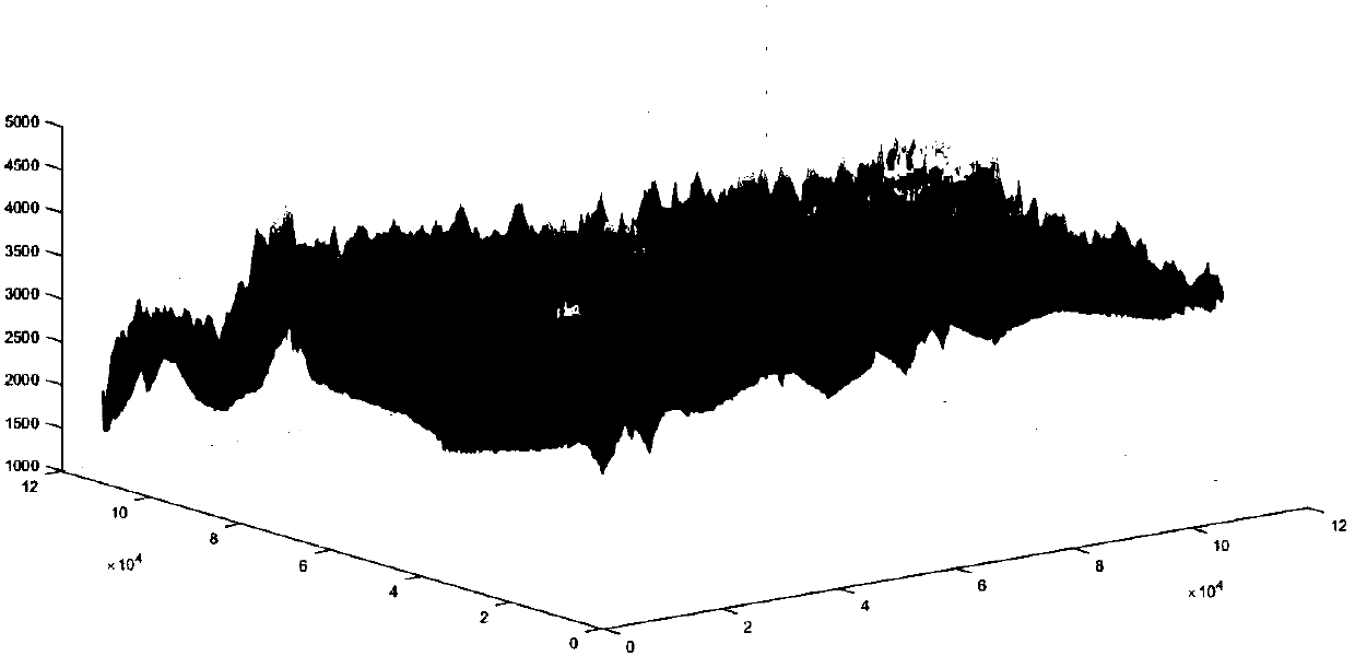
[0088] On August 8, 2017, a magnitude 7.0 earthquake occurred in Jiuzhaigou County, Aba Prefecture, Sichuan Province, causing irreparable casualties and major property losses. In the three-dimensional coordinates of the disaster area (X, Y axes indicate the relative position, Z axis is the altitude of the coordinates), UAV base H, and give the coordinates of the five areas A, B, C, D, E that need to be inspected , through UAV route optimization and task allocation methods, the UAV cruise mission is planned. figure 1 A topographic map of the earthquake zone. ...


PUM


Abstract

The invention discloses a task distribution and route planning method of an unmanned aerial vehicle. The route planning is divided into two steps. The first step is that a flying route of the unmannedaerial vehicle from a base station to every key patrolling zone is acquired through Dijkstra algorithm; the second step is that the zone where the unmanned aerial vehicle cannot pass is set as a barrier for considering about the altitude factor; an ant colony algorithm is applied to focus on inspecting the longest distance of flying in the key inspection zone within specified four hours under thecondition of returning to a base station and avoiding the barrier. The method can meet different task demands; firstly, the method can rapidly learn about the disaster area, avoid barrier while fly from the base station to a target zone within the shortest time, and inspect as more as ranges during the duration of flight, so as to take it as the target to plan the flight route of the unmanned aerial vehicle; secondly, the patrolling tasks and the flight route are reasonably distributed for fully using the resource in the presence of multiple unmanned aerial vehicle base stations; thus the utilization rate of the unmanned aerial vehicle in the base station is maximized.

Description

technical field [0001] The invention belongs to the technical field of automatic control, and relates to a task allocation and route planning method for an unmanned aerial vehicle, in particular to a route optimization and task allocation method for emergency rescue and disaster relief of an unmanned aerial vehicle. Background technique [0002] A UAV (Unnamed Aerial Vehicle, referred to as UAV) is an aircraft that is autonomously controlled by a program or controlled by wireless remote control). Since it is difficult to predict earthquakes, timely and efficient post-disaster rescue is an important measure to reduce earthquake losses. As a new type of vehicle, drones can play an important role in rescue operations. Therefore, it is necessary to study the coordination tasks, track planning, and inspection of UAVs. [0003] The U.S. Air Force Wright Aeronautical Laboratory first proposed the concept of "tactical flight management system". In the early 1980s, trajectory plann...

Claims


Application Information

Patent Timeline
IPC IPC(8): G05D1/10G01C21/20
CPCG01C21/20G05D1/101G05D1/104
Inventor 席自强彭瑞许诚柳慧梅王琪
Owner HUBEI UNIV OF TECH
Learn More