Method of automatic construction of remote-sensing image segmentation reference library and system thereof
A remote sensing image and automatic construction technology, applied in image analysis, image enhancement, image data processing, etc., can solve the problems of small scale and low efficiency
- Summary
- Abstract
- Description
- Claims
- Application Information
AI Technical Summary
Problems solved by technology
Method used
Image
Examples
Embodiment Construction
[0031] Specific embodiments of the present invention will be described in detail below in conjunction with the accompanying drawings. It should be understood that the specific embodiments described here are only used to illustrate and explain the present invention, and are not intended to limit the present invention.
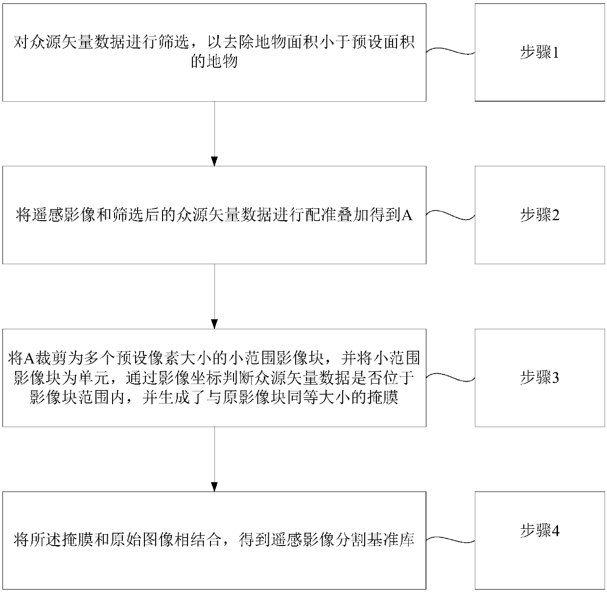
[0032] The present invention provides a method for automatically constructing a remote sensing image segmentation reference library, the automatic construction method for the remote sensing image segmentation reference library includes:
[0033] Step 1. Filter the crowd-sourced vector data to remove features whose area is smaller than the preset area;
[0034] Step 2, register and superimpose the remote sensing image and the filtered crowd-source vector data to obtain A;
[0035] Step 3: Crop A into multiple small-scale image blocks with preset pixel sizes, and use the small-scale image blocks as units to determine whether the crowd-sourced vector data is withi...
PUM
 Abstract
Description
Claims
Application Information
 - R&D Engineer
- R&D Manager
- IP Professional
- Industry Leading Data Capabilities
- Powerful AI technology
- Patent DNA Extraction
Browse by: Latest US Patents, China's latest patents, Technical Efficacy Thesaurus, Application Domain, Technology Topic, Popular Technical Reports.
© 2024 PatSnap. All rights reserved.Legal|Privacy policy|Modern Slavery Act Transparency Statement|Sitemap|About US| Contact US: help@patsnap.com


