Parcel height limitation analysis system and method based on current situation visual corridor

A technology for analyzing systems and status quo, applied in the field of plot height limit analysis systems, can solve problems such as the lack of base system predictive space control strategies

Active Publication Date: 2018-04-20
SHANGHAI MUNICIPAL ENG DESIGN INST GRP
View PDF1 Cites 7 Cited by
  • Summary
  • Abstract
  • Description
  • Claims
  • Application Information

AI Technical Summary

Problems solved by technology

However, the current stage and the special urban (visual) planning generally lack the systematic prediction of the current construction conditions of the base and the preliminary research on the space control strategy

Method used


Image

  • Parcel height limitation analysis system and method based on current situation visual corridor
  • Parcel height limitation analysis system and method based on current situation visual corridor
  • Parcel height limitation analysis system and method based on current situation visual corridor

Examples


Embodiment Construction

[0027] The data analysis method of the sponge city planning space control in the present invention is mainly written based on the framework and algorithm of ESRIarcGIS.

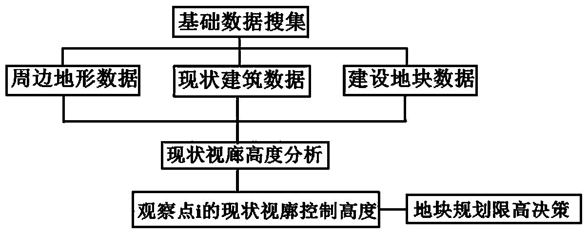
[0028] The method system includes three modules: the basic data collection module, the status quo viewing gallery height analysis module, and the plot planning height limit decision-making module. figure 1 An exemplary corresponding analysis procedure is shown.

[0029] ①Basic data collection module

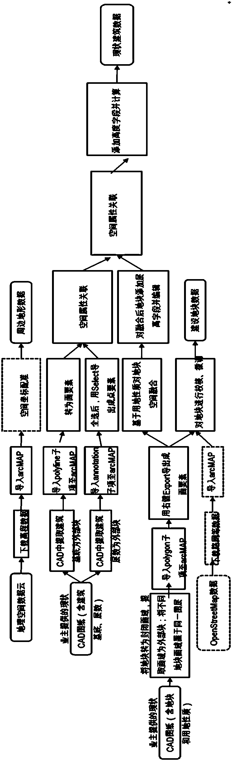
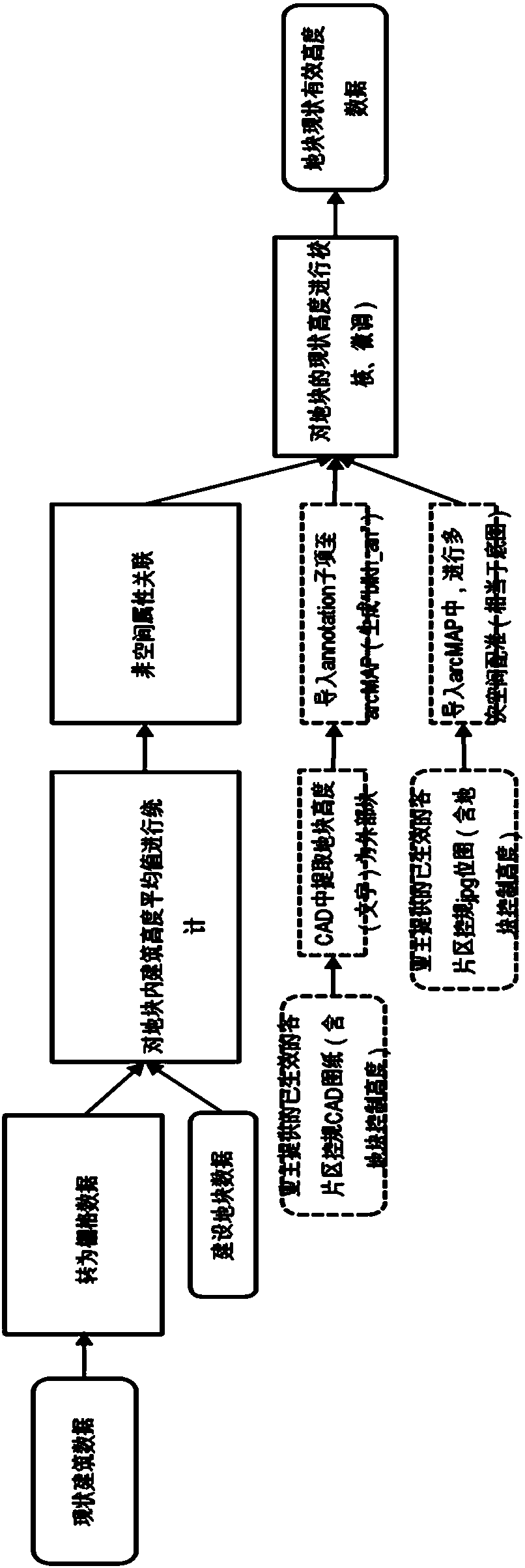
[0030] a) Surrounding terrain data preprocessing: mainly based on the spatial raster data of the Geospatial Data Cloud (Scientific Data Center of the Computer Network Information Center of the Chinese Academy of Sciences, http: / / www.gscloud.cn); the terrain data is registered through spatial reference points , calibrated to be consistent with vector data such as road network, construction area, water system, and green space; it includes large-scale geographic elements around the city (such as surrounding mounta...


PUM


Abstract

The invention discloses a parcel height limitation analysis system and method based on a current situation visual corridor. The system is characterized in comprising the following modules of a basic data searching module, a current situation visual corridor analysis module and a parcel height limitation decision module, wherein the basic data searching module is used for collecting the data of a surrounding terrain, a current situation building and a construction parcel; the current situation visual corridor analysis module carries out current situation parcel height statistics, current situation visual corridor target analysis and current situation visual corridor height calculation to obtain the current situation visual corridor control height of an observation point; and the parcel height limitation decision module reads the current situation visual corridor height of the point as limited height from the spatial position of any one point in space, and the minimum value of the current situation visual corridor height of all points in a parcel boundary is taken as the planned height limitation of the parcel. The method is quick and accurate in calculation, required data can be searched according to a conventional process, and the method has a high application value on the aspects of city visual corridor special project control, parcel or building height limitation planning andthe like.

Description

technical field [0001] The invention relates to a land block height limit analysis system and analysis method based on the current viewing gallery. Background technique [0002] Urban research topics have the characteristics of high comprehensiveness, strong operability, and wide range of specialties, and often involve multiple data such as sites, verticals, roads, buildings, terrains, and plots. Therefore, it is necessary to explore the interactive design of data in the process of 3D design , multi-factor collaborative design and data mining technical specifications provide hardware support for improving the recognition of the current situation and deepening the understanding of existing functions. However, the current stage and the special urban (visual) planning generally lack the systematic prediction of the current construction conditions of the base and the preliminary research on the space control strategy. [0003] The ESRI arcGIS platform provides rich and flexible...

Claims


Application Information

Patent Timeline
Patent Type & Authority Applications(China)
IPC IPC(8): G06F17/50G06F17/30G06T17/05G06Q50/08G06Q50/26
CPCG06F16/29G06Q50/08G06Q50/26G06T17/05G06F30/13Y02A90/10
Inventor 杨天翔陈国生
Owner SHANGHAI MUNICIPAL ENG DESIGN INST GRP
Why Eureka
Try Eureka