
Error correction method and device of electronic map

An electronic map and error technology, applied in the field of geographic information, can solve the problems of unguaranteed data return speed, huge amount of data in the correction database, frequent database interaction, etc., to reduce the amount of data interaction, shorten the error correction time, and be easy to implement Effect

Inactive Publication Date: 2018-03-23
AERIAL PHOTOGRAMMETRY & REMOTE SENSING CO LTD
View PDF4 Cites 7 Cited by
  • Summary
  • Abstract
  • Description
  • Claims
  • Application Information

AI Technical Summary

Problems solved by technology

For example, you can use the correction database based on your own or the real-time vehicle monitoring function and track playback function based on the GIS system. Among them, the former has a huge amount of data in the correction database based on all longitude and latitude points, while the latter requires a large and complex data set for correction. Frequent interaction with the database, a single query correction library will put a lot of pressure on the database, and the data return speed cannot be guaranteed

Method used


Image

  • Error correction method and device of electronic map
  • Error correction method and device of electronic map
  • Error correction method and device of electronic map

Examples


Embodiment Construction

[0037] In order to make the purpose, technical solutions and advantages of the embodiments of the present invention clearer, the technical solutions in the embodiments of the present invention will be clearly and completely described below in conjunction with the drawings in the embodiments of the present invention. Obviously, the described embodiments It is a part of embodiments of the present invention, but not all embodiments. The components of the embodiments of the invention generally described and illustrated in the figures herein may be arranged and designed in a variety of different configurations.

[0038] Accordingly, the following detailed description of the embodiments of the invention provided in the accompanying drawings is not intended to limit the scope of the claimed invention, but merely represents selected embodiments of the invention. Based on the embodiments of the present invention, all other embodiments obtained by persons of ordinary skill in the art wi...


PUM


Abstract

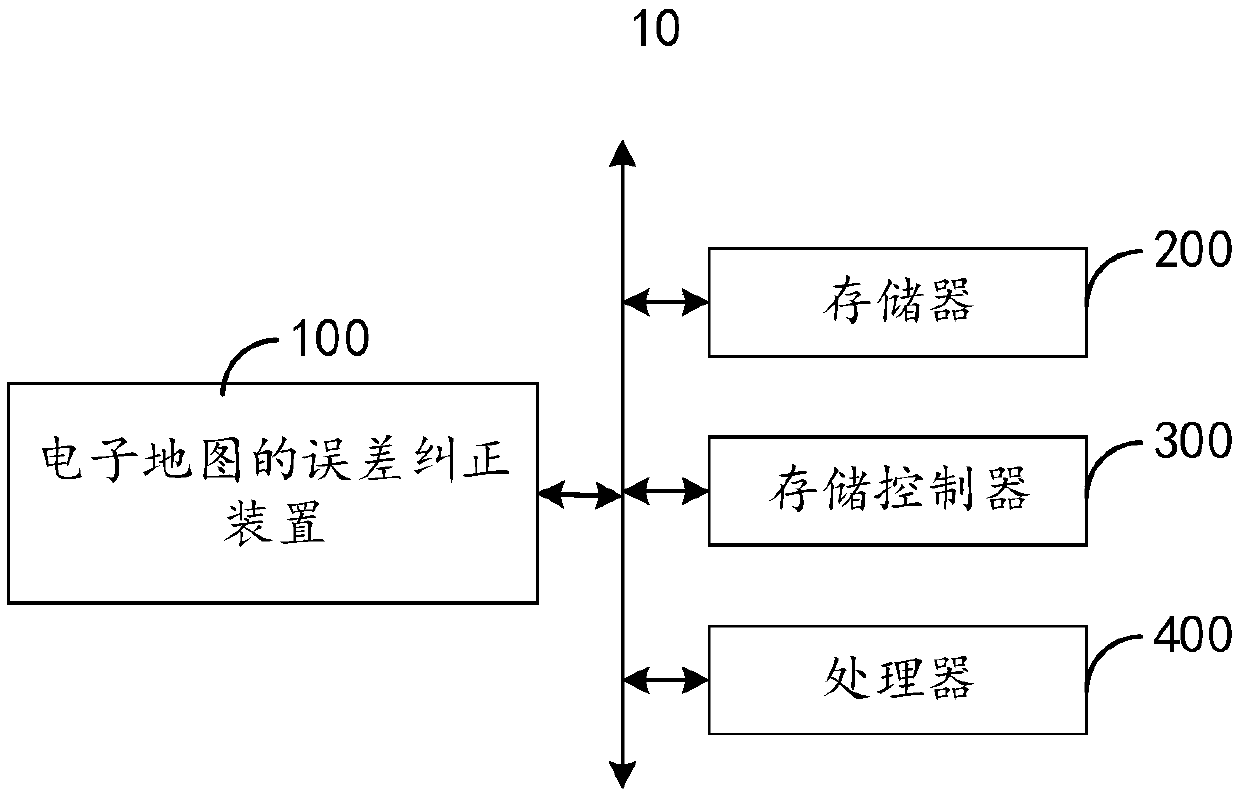
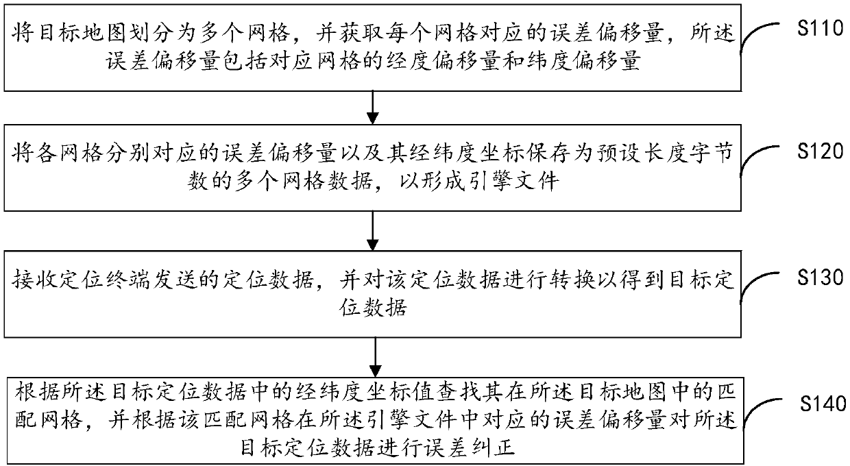
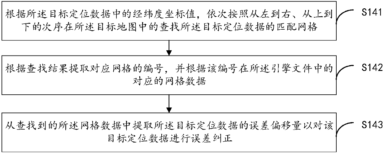
The invention provides an error correction method and device of an electronic map. The method comprises the steps that a target map is divided into multiple grids, and the error offset amount corresponding to each grid is obtained; the error offset amounts respectively corresponding to the grids and their longitude and latitude coordinates are stored as multiple piece of grid data having preset length byte numbers to form an engine file; positioning data sent by a positioning terminal is received and is converted to obtain target positioning data; according to the longitude and latitude coordinate values in the target positioning data, matched grids in the target map are looked up, and error correction is conducted on the target positioning data according to the corresponding error offsetamounts of the matched grids in the engine file. The data interaction amount during error correction is effectively decreased by pre-generating the engine file for error correction, the error correction efficiency is improved, and error correction accuracy is high.

Description

technical field [0001] The invention relates to the technical field of geographic information, in particular to an electronic map error correction method and device. Background technique [0002] Aiming at the problem that the navigation and positioning industry needs to reflect the uploaded GPS point coordinates on the map in real time, the existing electronic maps such as Google and AutoNavi all have the problem of data offset, which leads to the inability to accurately feed back the GPS coordinate points of the vehicle on the map . In this regard, due to the different applications of various industries, the solutions adopted are not the same. For example, you can use the correction database based on your own or the real-time vehicle monitoring function and track playback function based on the GIS system. Among them, the former has a huge amount of data in the correction database based on all longitude and latitude points, while the latter requires a large and complex dat...

Claims


Application Information

Patent Timeline
IPC IPC(8): G06F17/30
CPCG06F16/29
Inventor 张三奇
Owner AERIAL PHOTOGRAMMETRY & REMOTE SENSING CO LTD
Learn More