Regional land use control policy simulation and effect analysis method
An analysis method and land technology, applied in data processing applications, complex mathematical operations, instruments, etc., to achieve effective interaction, expand application scope, and improve accuracy
- Summary
- Abstract
- Description
- Claims
- Application Information
AI Technical Summary
Problems solved by technology
Method used
Image
Examples
specific Embodiment
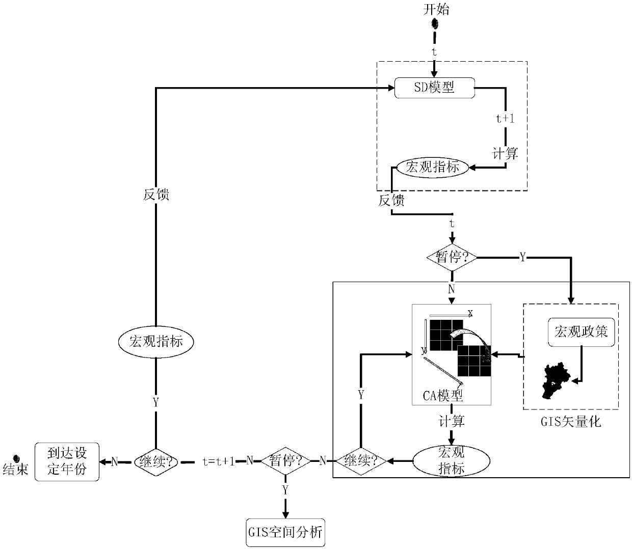
[0132] The embodiment of the present invention provides a method of regional land use control policy simulation and effect analysis, such as the evolution of urban land use, etc., implemented according to the following steps:
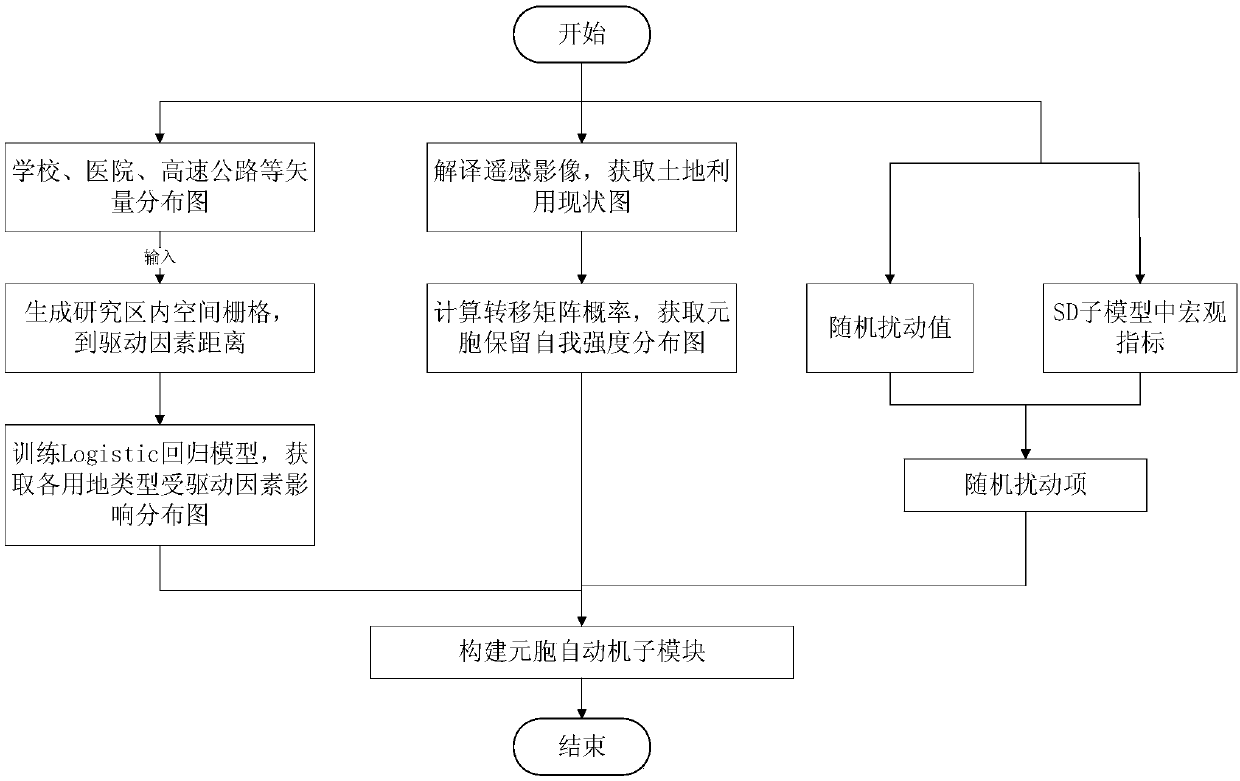
[0133] Step 1: Data determination. The data used in the present invention include land use status map, regional population data, GDP data, statistical data of the area of each land use type, vector data of environmental elements, such as appropriate distribution of schools, hospitals, and roads.
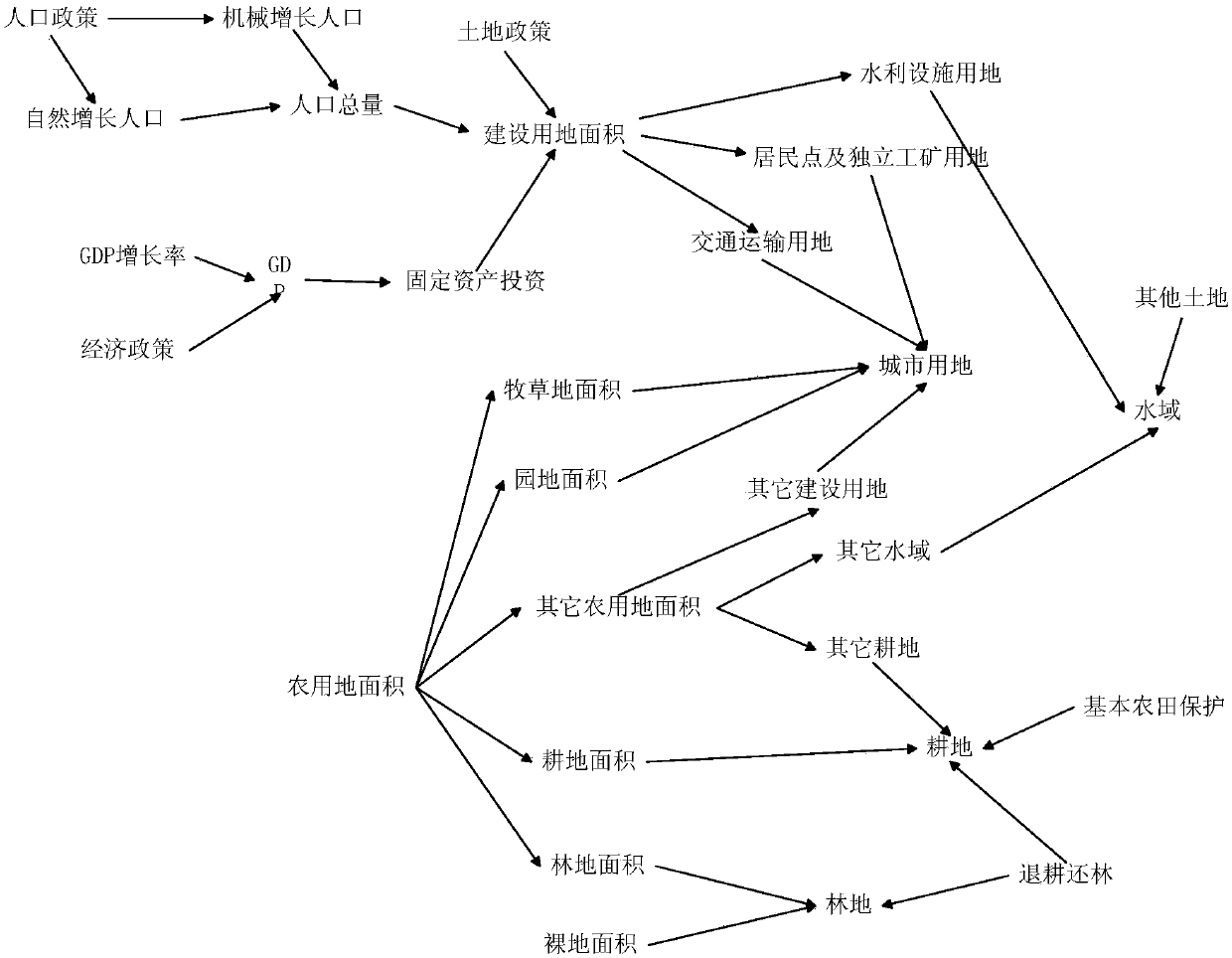
[0134] Step 2: Construct the system dynamics sub-module. according to figure 2 The system flow diagram provided constructs the various formulas in the system dynamics sub-module. This module mainly constructs the total changes of population, GDP and each land use type based on the macro-population policy, economic policy and land policy.
[0135] Step 3: Construct the GIS sub-module. This module is mainly used to import the vectorized macro policy into t...
PUM
 Abstract
Description
Claims
Application Information
 - R&D Engineer
- R&D Manager
- IP Professional
- Industry Leading Data Capabilities
- Powerful AI technology
- Patent DNA Extraction
Browse by: Latest US Patents, China's latest patents, Technical Efficacy Thesaurus, Application Domain, Technology Topic, Popular Technical Reports.
© 2024 PatSnap. All rights reserved.Legal|Privacy policy|Modern Slavery Act Transparency Statement|Sitemap|About US| Contact US: help@patsnap.com


