Comprehensive quantification method for morphological characteristics of slope rill development based on multiple dimensions
A technology of morphological features and quantitative methods, which is applied in design optimization/simulation, special data processing applications, complex mathematical operations, etc., to achieve the effect of improving scientificity and accuracy and reducing the total number of indicators
- Summary
- Abstract
- Description
- Claims
- Application Information
AI Technical Summary
Problems solved by technology
Method used
Image
Examples
Embodiment 1
[0051] This example studies the evolution process of the rill form on the loess slope.
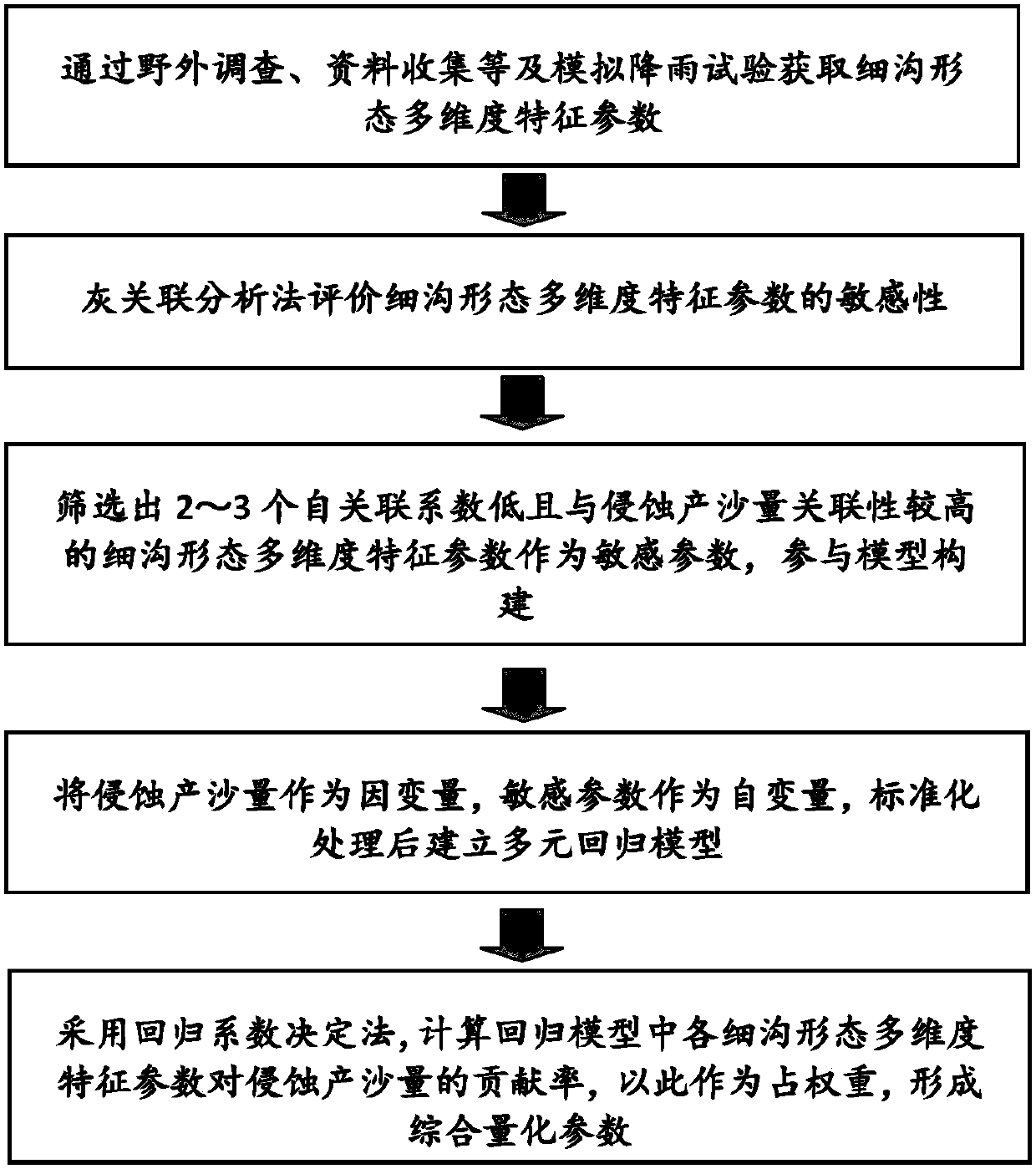
[0052] A comprehensive quantification method based on multi-dimensional morphological characteristics of slope rill development, the method includes the following steps:
[0053] (1) Obtain multi-dimensional characteristic parameters of rill shape and sediment production process data;
[0054] Three artificial simulated rainfall tests with rainfall intensities of 66mm / h, 94mm / h, and 127mm / h were carried out on a 20° steep slope test soil tank with a size of 5m×1m×0.6m, and rill erosion occurred on the slope during the rainfall , the rain stopped after 60 minutes; then the Trimble GS200 3D laser scanning system was used to measure the topography of slope erosion. After the scanning was completed, the complete slope DEM (that is, digital elevation model) data was obtained, and then the DEM data was imported into Arcgis for data processing (this processing The process is to import DEM data i...
Embodiment 2
[0108] This embodiment quantifies the rill development morphological characteristics using the comprehensive quantitative parameters of the rill morphology constructed in Example 1 (that is, the verification test of the comprehensive quantitative parameters of the rill morphology constructed in Example 1), as follows:
[0109] Using the simulated rainfall method, it is carried out in a 20° steep slope test soil tank with a size of 5m×1m×0.6m, and the soil bulk density is 1.25g / cm 3 , the rainfall intensity is 120mm / h. After the test, the statistics of the rill network graphs under different rainfall durations were carried out. Table 15 shows:
[0110] Table 9 Statistics of the number of tributary ditches at different levels under different rainfall times
[0111]
[0112] Table 10 Calculation process of bifurcation ratio of average rill network in 14 minutes of rainfall
[0113]
[0114] Table 11 Calculation process of the bifurcation ratio of the average rill network...
PUM
 Abstract
Description
Claims
Application Information
 - R&D Engineer
- R&D Manager
- IP Professional
- Industry Leading Data Capabilities
- Powerful AI technology
- Patent DNA Extraction
Browse by: Latest US Patents, China's latest patents, Technical Efficacy Thesaurus, Application Domain, Technology Topic, Popular Technical Reports.
© 2024 PatSnap. All rights reserved.Legal|Privacy policy|Modern Slavery Act Transparency Statement|Sitemap|About US| Contact US: help@patsnap.com


