Satellite Visibility Analysis and Ephemeris Prediction Method Considering Satellite Blocking Conditions
An analysis method and satellite technology, applied in satellite radio beacon positioning systems, instruments, measurement devices, etc., can solve the problems of deviation of analysis results, inaccurate ephemeris forecast, etc.
- Summary
- Abstract
- Description
- Claims
- Application Information
AI Technical Summary
Problems solved by technology
Method used
Image
Examples
Embodiment Construction
[0042] The present invention will be further described in detail below in conjunction with the accompanying drawings and specific embodiments, but the present invention is not limited to these embodiments.
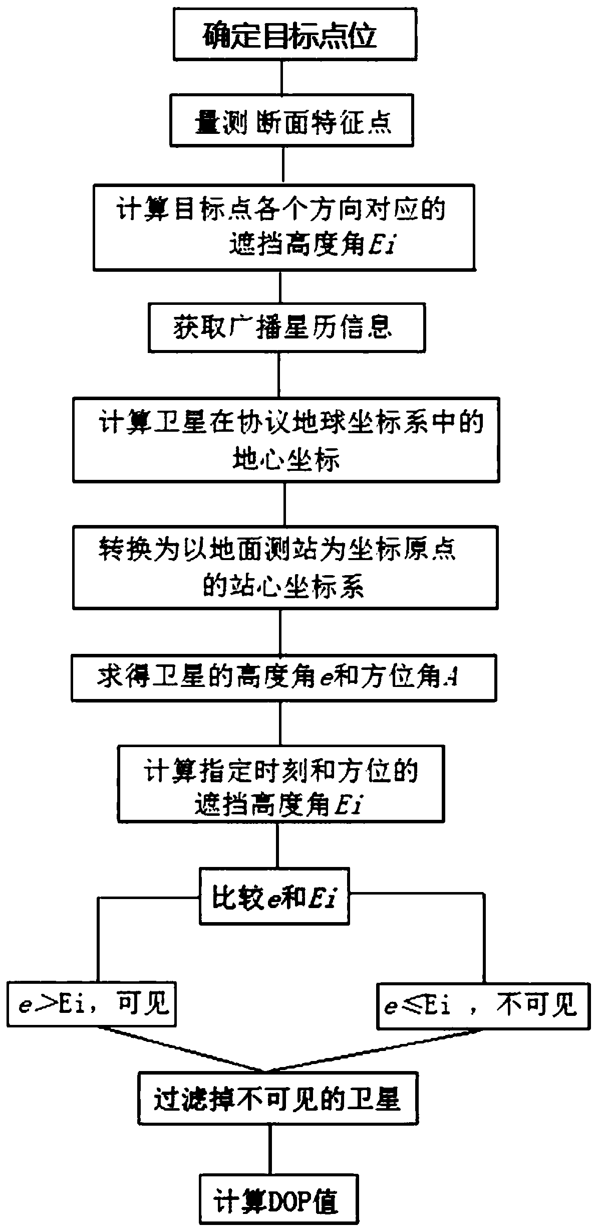
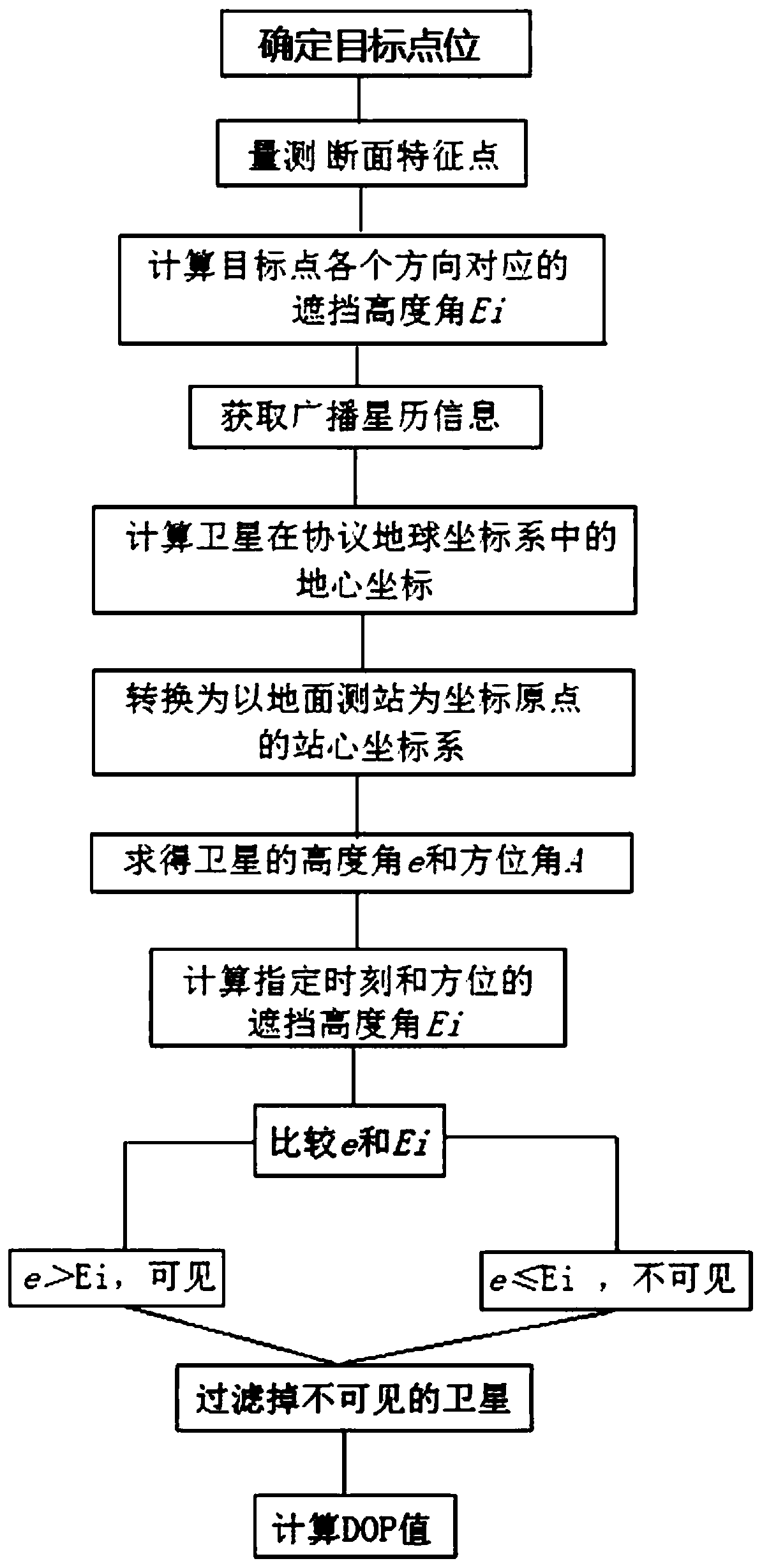
[0043] The satellite visibility analysis method considering the satellite occlusion condition of the present invention, refer to figure 1 , including the following steps:
[0044] Step 1, measuring the satellite occlusion altitude angle of the target point;
[0045] Based on topographic maps, digital elevation models (DEM) or other digital geographic information products with elevation attributes, the elevation angle of a single station satellite is measured.
[0046] First determine the coordinates of the target point, and then measure a section at a certain angle (for example, 5°) clockwise from the north direction with the target point as the center (the distance of the cross section is determined according to the actual situation), according to the measured feature po...
PUM
 Abstract
Description
Claims
Application Information
 - R&D
- Intellectual Property
- Life Sciences
- Materials
- Tech Scout
- Unparalleled Data Quality
- Higher Quality Content
- 60% Fewer Hallucinations
Browse by: Latest US Patents, China's latest patents, Technical Efficacy Thesaurus, Application Domain, Technology Topic, Popular Technical Reports.
© 2025 PatSnap. All rights reserved.Legal|Privacy policy|Modern Slavery Act Transparency Statement|Sitemap|About US| Contact US: help@patsnap.com


