
High-resolution SAR image newly-added construction land extraction software based on variation function

A construction land, variogram technology, applied in the field of information technology image recognition, can solve the problems of insufficient ability to maintain high-resolution SAR image structural features, unable to meet the needs of practical applications, etc.

Active Publication Date: 2017-07-11
AEROSPACE INFORMATION RES INST CAS
View PDF2 Cites 4 Cited by
  • Summary
  • Abstract
  • Description
  • Claims
  • Application Information

AI Technical Summary

Problems solved by technology

However, the ability to maintain the structural features of high-resolution SAR images is not enough to meet the needs of practical applications.

Method used


Image

  • High-resolution SAR image newly-added construction land extraction software based on variation function
  • High-resolution SAR image newly-added construction land extraction software based on variation function
  • High-resolution SAR image newly-added construction land extraction software based on variation function

Examples


Embodiment Construction

[0030] 1. Image filtering

[0031] Specific steps such as figure 2 Shown:

[0032] 1. Strong point target marking and retention

[0033] Strong point targets in SAR images are common and important targets in SAR images. They often correspond to some artificial ground objects similar to corner reflectors. The precise positioning of these points for certain specific targets and the selection of image points with the same name important and should therefore be retained. If the specificity of these point objects is not considered, the filter can easily smooth them out as noise. In addition, these strong reflection points will also seriously affect the filtering process of its surrounding pixels. Therefore, strong point targets should be marked so that they do not participate in the filtering calculation of surrounding pixels.

[0034] The identification method of strong point target is as follows:

[0035] Using a 5*5 rectangular window, if the average ratio of the central p...


PUM


Abstract

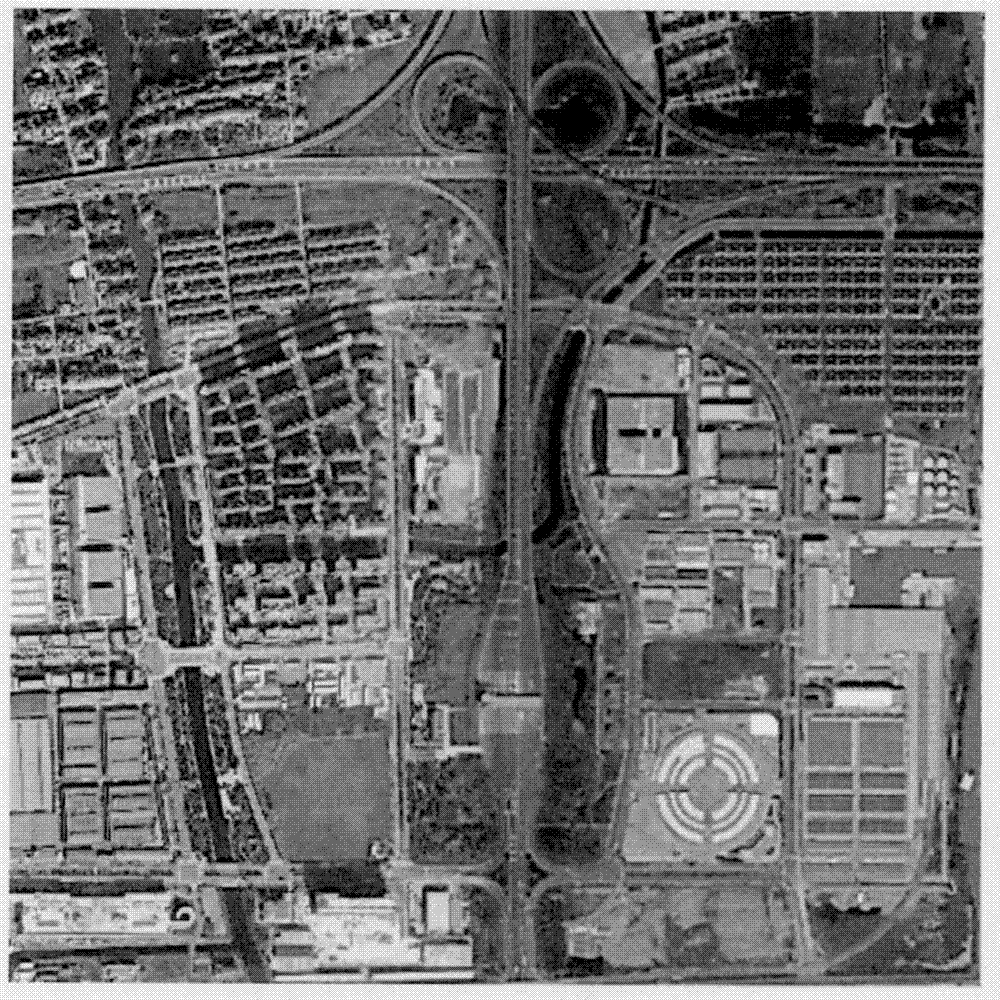
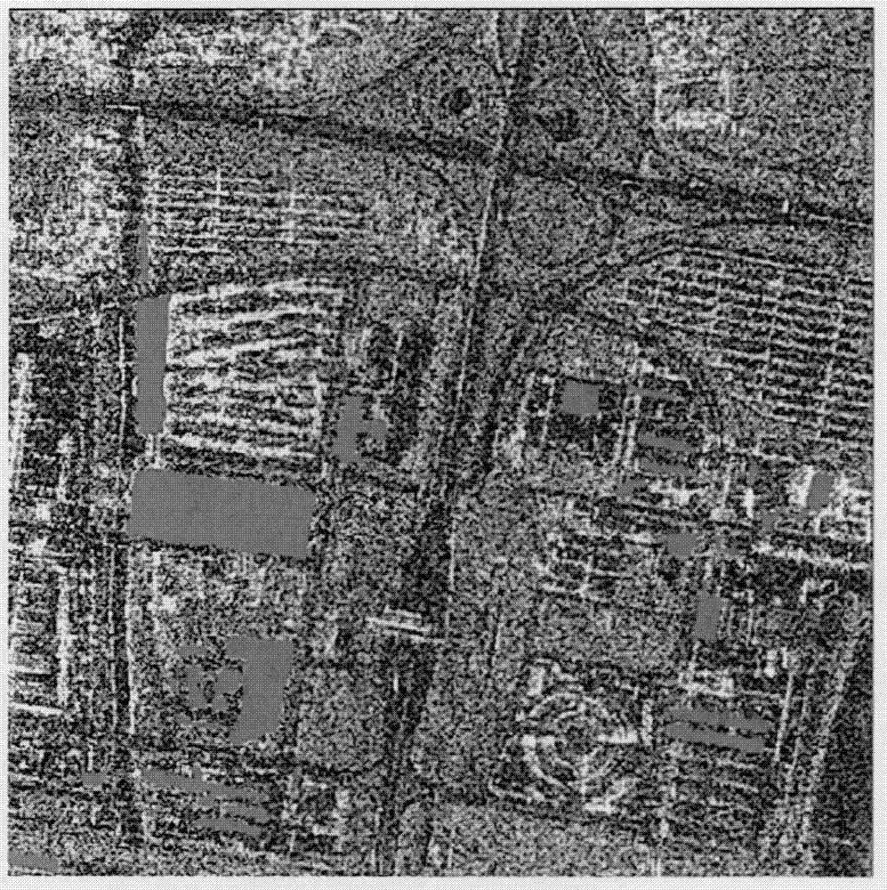
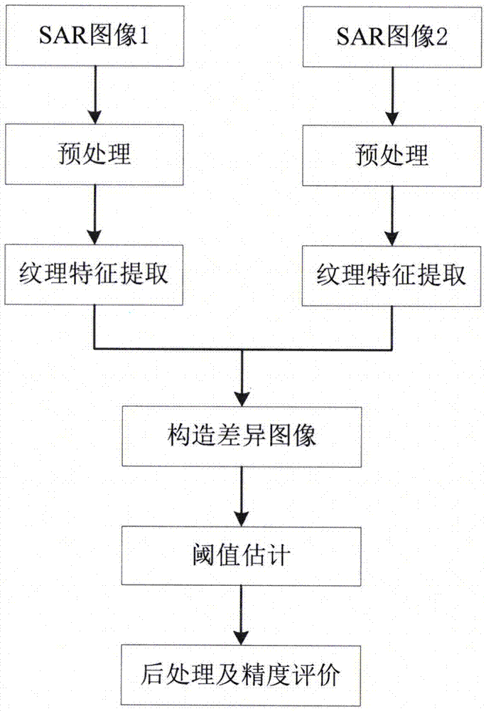
The software aims to automatically extract a newly-added construction land in a high-resolution SAR image and belongs to the field of image recognition. Based on a variation function method, the software can automatically and accurately extract the newly-added construction land in the high-resolution SAR image, and mainly comprises the following steps of: first, preprocessing (filtering) an input image; second, calculating a variance function to obtain the texture features of two images; third, calculating a ratio of the texture features of the two images to create a difference image; fourth, subjecting a ratio image to threshold segmentation to generate a binary image that is a preliminary newly-added construction land extraction result; and fifth, post-processing the binary image to generate a final extraction result and to perform accuracy evaluation. The extraction accuracy of the software can reach more than 80% according to a built-in test, and the soft ware can be applied to the detection of building change areas such as urban planning, determination for demolition compensation, and the like.

Description

technical field [0001] This software belongs to the field of information technology image recognition, and can be used to extract newly added construction land in high-resolution Synthetic Aperture Radar (SAR) images of different time phases. Background technique [0002] SAR has become one of the important means of earth observation with its advantages of all-day, all-weather reconnaissance and high-resolution imaging. In recent years, with the acquisition of a large number of meter-level and sub-meter-level high-resolution SAR images, urban environment research based on SAR images has become one of the important topics in the field of SAR image interpretation. As a key link, image recognition provides a basis for thematic interpretation of urban land use investigation, change detection, map drawing, and disaster monitoring. At present, SAR image recognition is mainly based on statistical methods based on image gray distribution models and methods based on texture analysis...

Claims


Application Information

Patent Timeline
Patent Type & Authority Applications(China)
IPC IPC(8): G06K9/00
CPCG06V20/176G06V10/443
Inventor 程博崔师爱刘岳明李婷王燕红
Owner AEROSPACE INFORMATION RES INST CAS
Learn More