
High-precision real-time satellite positioning method

A satellite positioning, high-precision technology, applied in the field of satellite navigation and positioning, to achieve the effect of reasonable design, convenient use and low cost

Active Publication Date: 2017-03-15
博盛尚(苏州)电子科技有限公司
View PDF4 Cites 13 Cited by
  • Summary
  • Abstract
  • Description
  • Claims
  • Application Information

AI Technical Summary

Problems solved by technology

[0004] The purpose of the present invention is to overcome the deficiencies in the prior art, provide a high-precision real-time satellite positioning method, and solve the problem of positioning accuracy of satellite positioning receivers

Method used


Image

  • High-precision real-time satellite positioning method
  • High-precision real-time satellite positioning method
  • High-precision real-time satellite positioning method

Examples


Embodiment Construction

[0027] Embodiments of the present invention are described in further detail below in conjunction with the accompanying drawings:

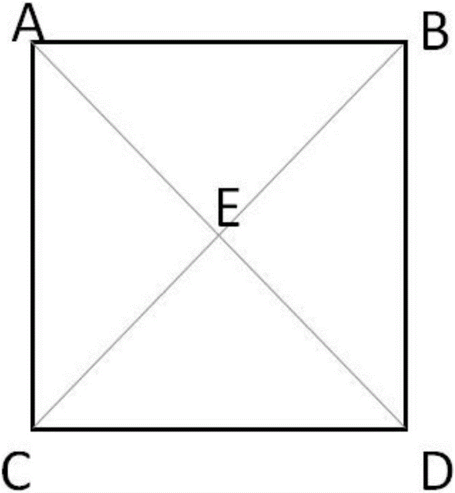
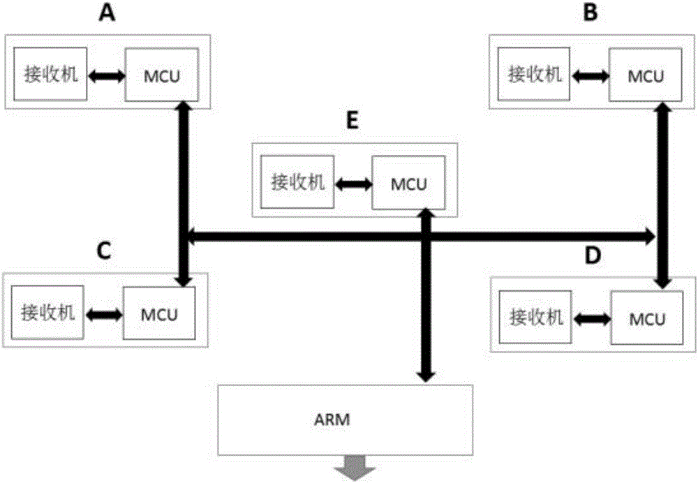
[0028] The present invention utilizes a high-precision real-time satellite positioning device composed of a plurality of satellite positioning receivers arranged in a certain geometric shape, and adopts a corresponding high-precision positioning algorithm to improve positioning accuracy. The antenna oscillators of the satellite positioning receiver are distributed on the same plane, and the geometric figures formed by the receiver array antenna oscillators are triangles, quadrilaterals, pentagons or hexagons and other arbitrary geometric figures, and the antenna phases of each satellite positioning receiver The center is located at each vertex and center point of the polygonal array (or at other positions within the range of the area enclosed by each vertex receiver).

[0029] Below to figure 1 The high-precision real-time satellite positioning de...


PUM


Abstract

The invention relates to a high-precision real-time satellite positioning method. The method is technically characterized in that a polygonal satellite positioning receiver array formed by a plurality of satellite positioning receiving mechanisms is built; each satellite positioning receiver sends respective ID and observed value coordinate to a processor module; the processor module calculates to obtain a physical geometric figure and an observed value geometric figure; the physical geometric figure and the observed value geometric figure are compared, a deviation vector caused by an error is extracted and a deviation vector function library is formed; the deviation vector is subtracted from an observed value of a satellite positioning receiver antenna phase center, thereby obtaining a corrected satellite positioning value. The high-precision real-time satellite positioning method provided by the invention is reasonable in design, can maximally eliminate positioning errors existing in the satellite positioning receivers, can remarkable improve positioning precision, has the characteristics of reasonable design, high precision, low cost, convenient use and the like, and can be extensively applied and popularized to the general civil field of high-precision real-time satellite positioning navigation.

Description

technical field [0001] The invention belongs to the technical field of satellite navigation and positioning, in particular to a high-precision real-time satellite positioning method. Background technique [0002] Satellite positioning and navigation systems mainly include GPS, Beidou, GLONASS, Galileo, etc. With the rapid development of satellite positioning technology, people's demand for fast and high-precision location information is becoming increasingly strong. At present, the application range of high-precision real-time satellite positioning and navigation is becoming wider and wider, requiring the positioning accuracy of user receivers to reach decimeter or even centimeter level. [0003] Satellite positioning receiver technology is very mature. According to known principles, satellite positioning is realized by using observations such as pseudorange, ephemeris, and satellite launch time of a group of satellites and user clock differences. To obtain the three-dimen...

Claims


Application Information

Patent Timeline
IPC IPC(8): G01S19/40G01S19/42
CPCG01S19/40G01S19/42G01S19/35G01S19/41
Inventor 申研李渊博
Owner 博盛尚(苏州)电子科技有限公司
Learn More