A simulation method of space-based radar clutter
A simulation method, space-based radar technology, applied in radio wave measurement systems, instruments, etc., can solve problems such as the inability to generalize elliptical orbits, the position of the equidistant ring is not given, and the ground position of the distance ring cannot be obtained.
- Summary
- Abstract
- Description
- Claims
- Application Information
AI Technical Summary
Problems solved by technology
Method used
Image
Examples
specific Embodiment approach
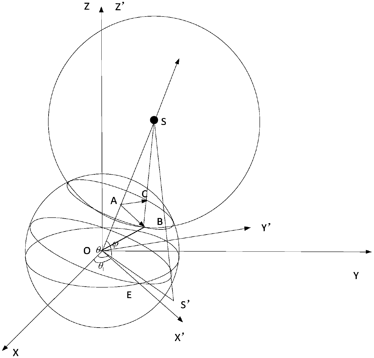
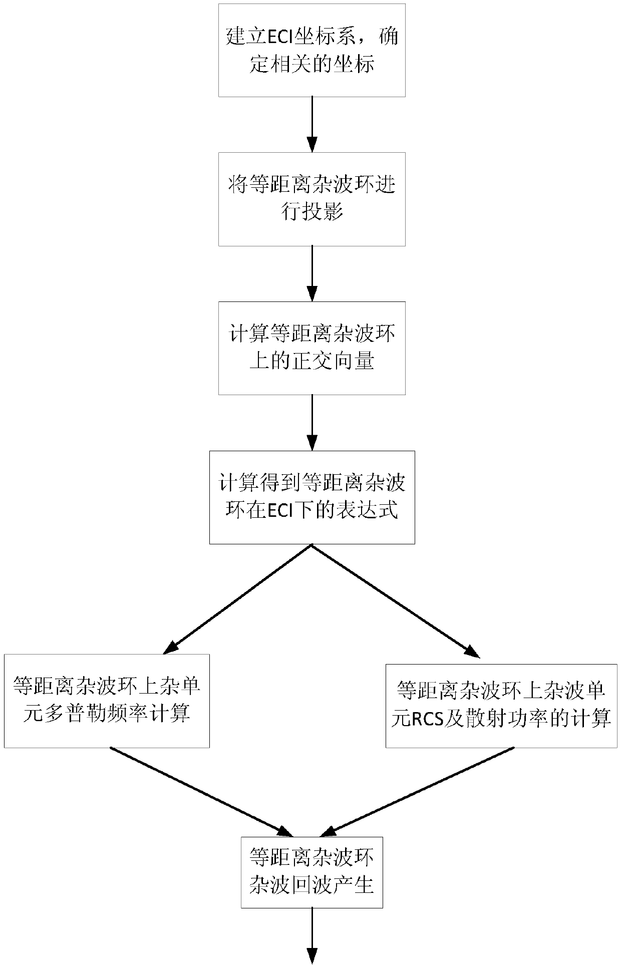
[0075] The present invention proposes a space-based radar clutter simulation method, the method flow chart is as follows figure 2 , the specific implementation is as follows:
[0076] (1) Establish a coordinate system and related position vectors.
[0077] Suppose the coordinate system is the earth inertial coordinate system ECI, such as figure 1 shown. The coordinate origin O is the center of the earth, the XOY plane is located on the equator plane, the X axis points to the vernal equinox, and the Z axis is the direction of the earth's rotation angular velocity; the earth's radius is R e ; The radar satellite moves along the orbit, assuming that the radar satellite moves to S(x 0 ,y 0 ,z 0 ), S(x 0 ,y 0 ,z 0 ) is the measured coordinates of the radar satellite in the earth’s inertial coordinate system ECI; S’ is the projection of S on the XOY plane; with the radar as the origin, the intersection line between the equidistant sphere with radius R and the earth on the s...
PUM
 Abstract
Description
Claims
Application Information
 - Generate Ideas
- Intellectual Property
- Life Sciences
- Materials
- Tech Scout
- Unparalleled Data Quality
- Higher Quality Content
- 60% Fewer Hallucinations
Browse by: Latest US Patents, China's latest patents, Technical Efficacy Thesaurus, Application Domain, Technology Topic, Popular Technical Reports.
© 2025 PatSnap. All rights reserved.Legal|Privacy policy|Modern Slavery Act Transparency Statement|Sitemap|About US| Contact US: help@patsnap.com


