A 3D visualization system of sea surface with drift model
A drift model, three-dimensional technology, applied in 3D modeling, climate sustainability, 3D image processing, etc., to achieve the effect of improving the success rate of search and rescue, high search and rescue success rate, and large scalability
- Summary
- Abstract
- Description
- Claims
- Application Information
AI Technical Summary
Problems solved by technology
Method used
Image
Examples
Embodiment Construction
[0024] The present invention will be further described below in conjunction with accompanying drawing:
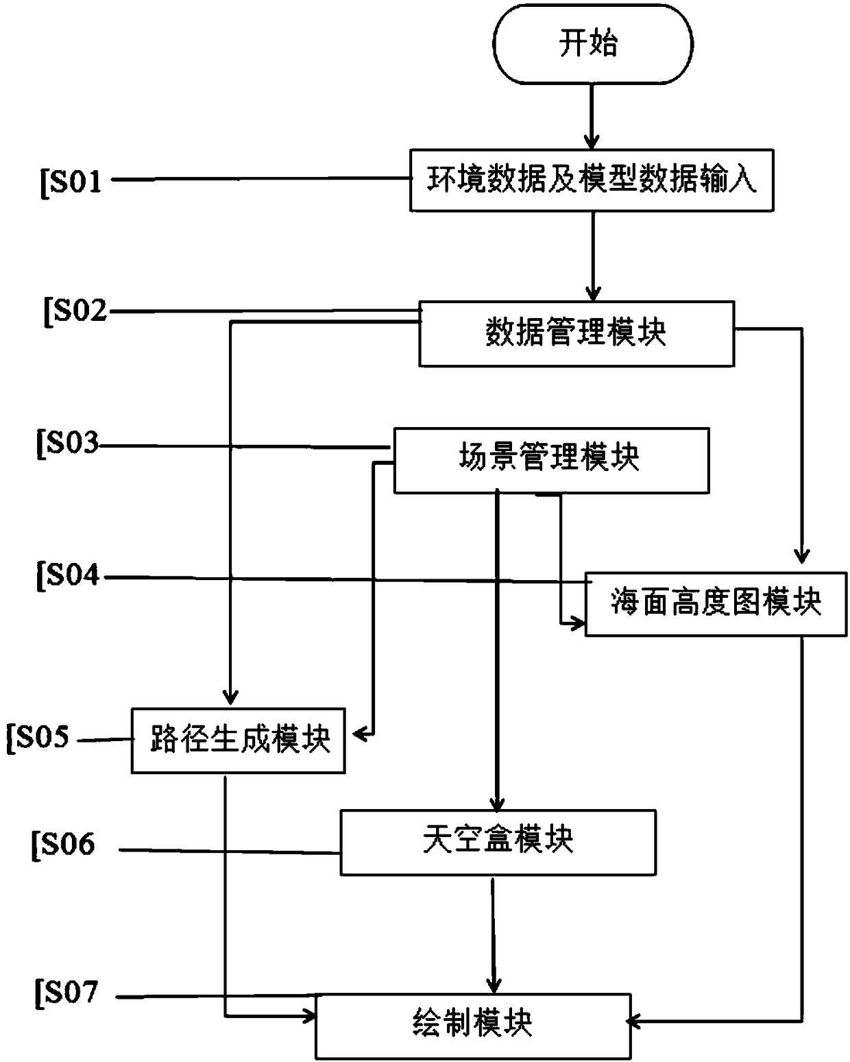
[0025] The data management module uniformly processes environmental data and model data from different input channels, and then distributes the processed data to the path generation module and sea surface height map module; the scene management module manages the scene and is responsible for the organization of objects and light sources in the scene and camera property settings, and then send the moving track of the floating object, the movement of the sea surface triangle and the position of the sky box to the path generation module, the sea surface height map module and the sky box module respectively; the sea surface height map module transmits the wind speed and The wind direction information generates a height map; the skybox module converts the position of the skybox transmitted by the scene management module into the sky on the sea surface; the path generation module ...
PUM
 Abstract
Description
Claims
Application Information
 - R&D Engineer
- R&D Manager
- IP Professional
- Industry Leading Data Capabilities
- Powerful AI technology
- Patent DNA Extraction
Browse by: Latest US Patents, China's latest patents, Technical Efficacy Thesaurus, Application Domain, Technology Topic, Popular Technical Reports.
© 2024 PatSnap. All rights reserved.Legal|Privacy policy|Modern Slavery Act Transparency Statement|Sitemap|About US| Contact US: help@patsnap.com


