
3D geologic digital reconnaissance report generating method

A technology for 3D geology and report generation, applied in image data processing, 3D modeling, instruments, etc., can solve the problems of combination of vertical and inclined section parameters, no unified construction of geological parameters, etc., to eliminate ambiguity and accurate data Effect

Active Publication Date: 2016-10-12
马鞍山城智信息技术有限公司
View PDF7 Cites 21 Cited by
  • Summary
  • Abstract
  • Description
  • Claims
  • Application Information

AI Technical Summary

Problems solved by technology

The disadvantage is that it is not suitable for modeling complex shapes and faults generated by multiple tectonic movements, and requires more mathematical geological expertise
However, this scheme only systematically produces horizontal geological sections, and does not combine the parameters of vertical and inclined sections, and there is no unified construction of geological parameters.

Method used


Image

  • 3D geologic digital reconnaissance report generating method
  • 3D geologic digital reconnaissance report generating method
  • 3D geologic digital reconnaissance report generating method

Examples


Embodiment 1

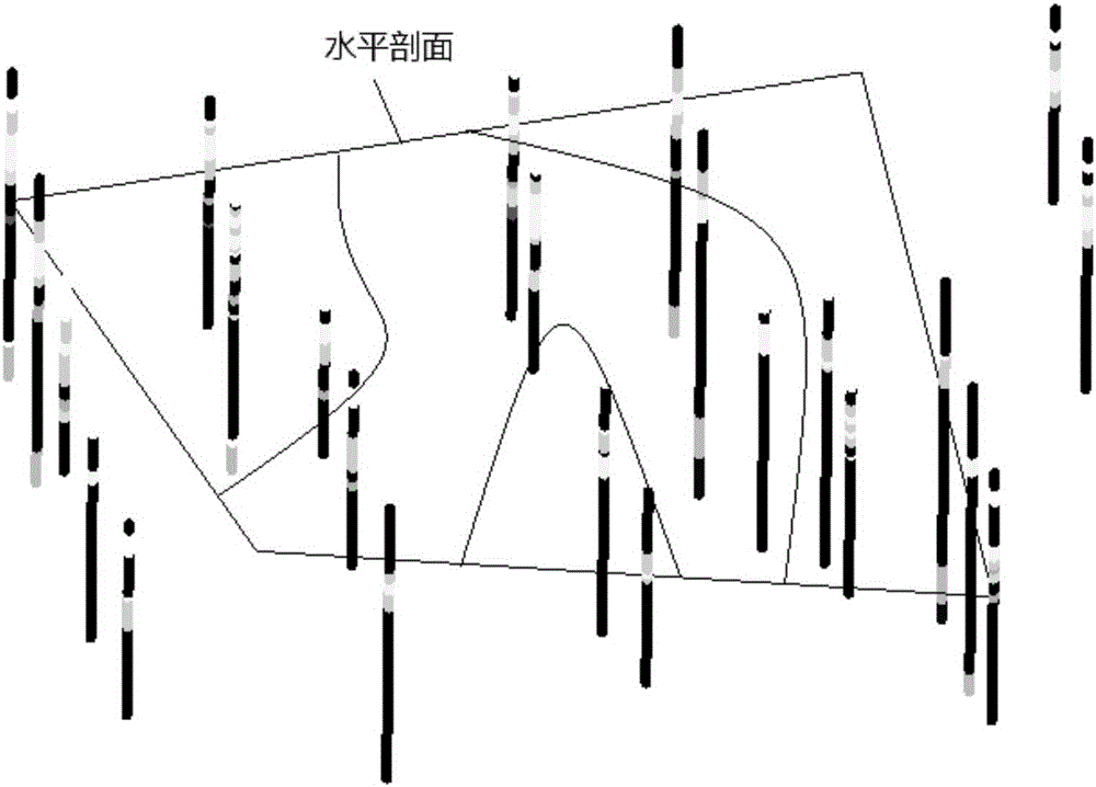
[0042] Such as figure 1 As shown, taking the geological survey of project A as an example to illustrate a method for generating a three-dimensional geological digital survey report, including the following steps:

[0043] Step 1. Obtain field geological raw data and indoor and outdoor test data according to the relevant technical specifications of energy, mineral geology and engineering geology; field geological drilling data include but not limited to drilling geological data, three-dimensional position information of drilling points, and geological and geophysical prospecting information .

[0044] Step 2, according to the input data, determine the stratification and the geological histogram of the geological borehole. , where the current engineering survey site area is a subset of the engineering survey scope determined based on field geological raw data and indoor and outdoor test data, and the determined scope includes but is not limited to the drilling histogram and the...

Embodiment 2

[0054] Taking the geological survey of project B as an example to illustrate a method for generating a three-dimensional geological digital survey report, it includes the following steps:

[0055] Step 1. Obtain field geological raw data and indoor and outdoor test data according to the relevant technical specifications of energy, mineral geology and engineering geology; field geological drilling data include but not limited to drilling geological data, three-dimensional position information of drilling points, and geological and geophysical prospecting information .

[0056] Step 2, according to the input data, determine the stratification and the geological histogram of the geological borehole;

[0057] Step 3, extract the geological background parameters of the current engineering survey site area; the borehole data is input into the system; the data table format of the borehole data is: borehole number, the bottom elevation of the borehole stratum, the horizontal position ...


PUM


Abstract

The invention discloses a 3D geologic digital reconnaissance report generating method and belongs to the field of 3D geologic modeling. The method comprises acquiring outdoor geologic original data and indoor and outdoor test data according to energy mineral product geology and engineering geology associated technical specification requirements, wherein the geologic original data includes drilling geologic data, drilling point 3D position information, geologic geophysical prospecting information, the drilling geologic data includes age geological background, lamination geological background, slide rock geological background, marine lamination geological background, riverbed alleviation geological background, and fracture structural geology; and generating corresponding geologic upright profile, geologic horizontal profile, a combined slope fault profile and generating a 3D geologic digital reconnaissance report with complete information. The method may generate horizontal, vertical, and slope geologic system in a unified way. The 3D report is comprehensive in information and good in correspondence.

Description

technical field [0001] The invention relates to the field of three-dimensional geological modeling, and more specifically relates to a method for generating a three-dimensional geological digital survey report. Background technique [0002] At present, the 3D representation and simulation technology of faults at home and abroad is still in the research and exploration stage. The mainstream fault modeling can be divided into two categories: the fault modeling method based on geological origin, also known as the whole method; the fault modeling method based on partition interpolation. Modular method, also known as local method. [0003] The integral method requires an in-depth investigation and understanding of the geological site, detailed and accurate geological data, including topographic maps, plane section geological maps, drilling information, etc., and requires users to have high professional knowledge of geological background, so this method It is a relatively complex...

Claims


Application Information

Patent Timeline
IPC IPC(8): G06T17/05
CPCG06T17/05G06T2200/08
Inventor 陈树铭
Owner 马鞍山城智信息技术有限公司
Learn More