
Method for estimating positions of images based on area mining and space encoding

A technology of spatial coding and region, applied in the field of retrieval of social network picture data, can solve the problems of unsatisfactory recognition results, neglect of spatial position relationship, BOW error, etc.

Inactive Publication Date: 2015-07-15
XI AN JIAOTONG UNIV
View PDF2 Cites 7 Cited by
  • Summary
  • Abstract
  • Description
  • Claims
  • Application Information

AI Technical Summary

Problems solved by technology

However, in the case of complex scenes, the generation of overall features will cover up the features we really want to retrieve, and the recognition results are often unsatisfactory.
[0004] Although the method of BOW and inverted index structure can improve the efficiency, because BOW will have errors in the quantization process, and the spatial position relationship between feature points is ignored, so people increase the spatial position relationship. Research

Method used


Image

  • Method for estimating positions of images based on area mining and space encoding
  • Method for estimating positions of images based on area mining and space encoding
  • Method for estimating positions of images based on area mining and space encoding

Examples


Embodiment Construction

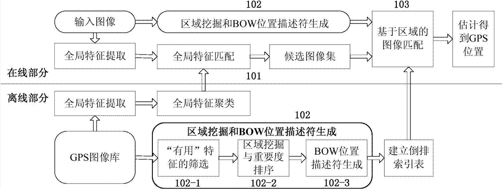
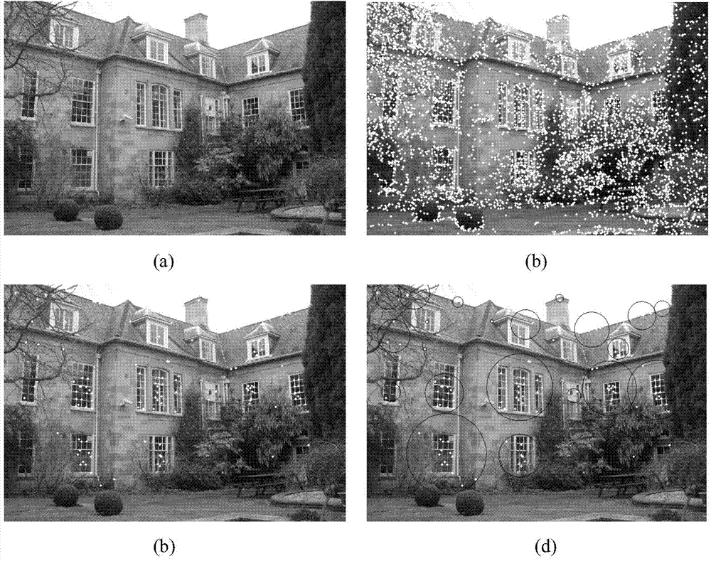
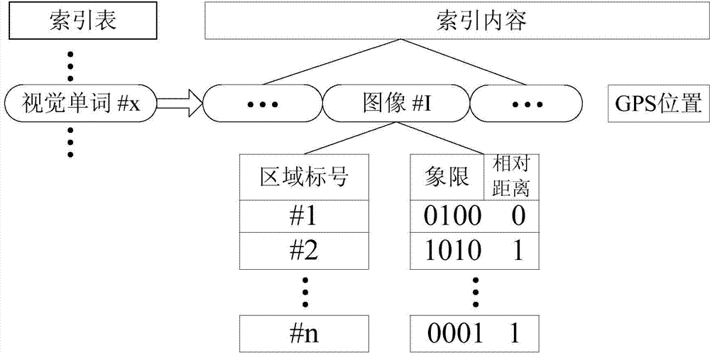
[0038] Such as figure 1 As shown, the image position estimation method based on region mining and spatial coding of the present invention consists of two parts: offline and online. In the offline part, first, we extract the global features of the images in the GPS image library, and cluster the images, and the clustered results are used for the global feature matching of the online part. Second, for each image in the GPS image library, we perform region mining and BOW location descriptor generation, namely figure 1 Step 102 in the offline section. This step includes three sub-steps: 102-1 is the screening of "useful" features (substeps a and b below), 102-2 is region mining and region importance ranking, 102-3 is BOW position descriptor generation. Finally, we built an inverted index table for the entire GPS image library based on sight words.

[0039]In the online part, step 101 is to obtain the candidate image set of the input image through global feature extraction and m...


PUM


Abstract

The invention discloses a method for estimating positions of images based on area mining and space encoding. The method comprises an offline part and an online part, wherein the offline part comprises the following steps of extracting whole features of the images in a GPS (global positioning system) image library, and clustering the images; performing the area mining and BOW (bag of words) position description character generation on each image in the GPS image library; finally, according to visual words, establishing a reverse index table for the whole GPS image library; the online part comprises the following steps of obtaining a candidate image set of the inputted images through the extracting and matching of the whole features; performing the operations on the inputted images, wherein the operations are the same as the area mining and BOW position description character generation of the offline part; utilizing the reverse index table in the offline part to match the images based on the area, and finally obtaining the GPS positions of the inputted images.

Description

technical field [0001] The invention relates to a multimedia retrieval technology for social network data management, in particular to a retrieval method for social network picture data. Background technique [0002] With the continuous popularization of social networks and the rapid development of multimedia technology, the scale of digital multimedia uploaded by users is growing at an explosive rate. Well-known picture sharing sites such as Flickr have uploaded 5 billion pictures in total. The number of pictures uploaded on social networks is even more astonishing. Facebook alone has reached 60 billion. In China, Renren and Kaixin have become the main social networking sites for uploading and sharing. Therefore, for large-scale multimedia data (picture data), how to quickly and effectively carry out information mining and image retrieval has become an urgent need for people, and content-based image retrieval has emerged as the times require. With the improvement of livi...

Claims


Application Information

Patent Timeline
IPC IPC(8): G06F17/30
Inventor 钱学明赵一斯
Owner XI AN JIAOTONG UNIV
Learn More