Satellite remote sensing monitoring method and processing device for straw burning fire points
A satellite remote sensing and remote sensing monitoring technology, applied in the field of monitoring, can solve problems such as the inability to ensure the efficiency and accuracy of supervision, and the difficulty of supervision
- Summary
- Abstract
- Description
- Claims
- Application Information
AI Technical Summary
Problems solved by technology
Method used
Image
Examples
Embodiment 1
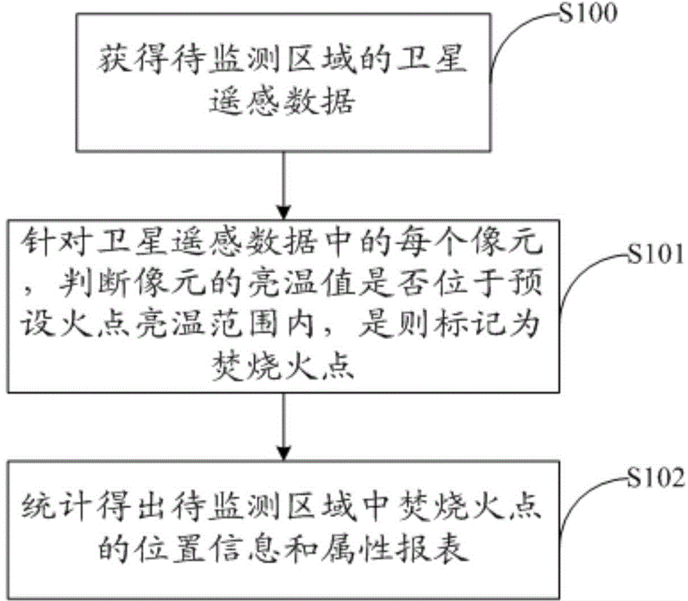
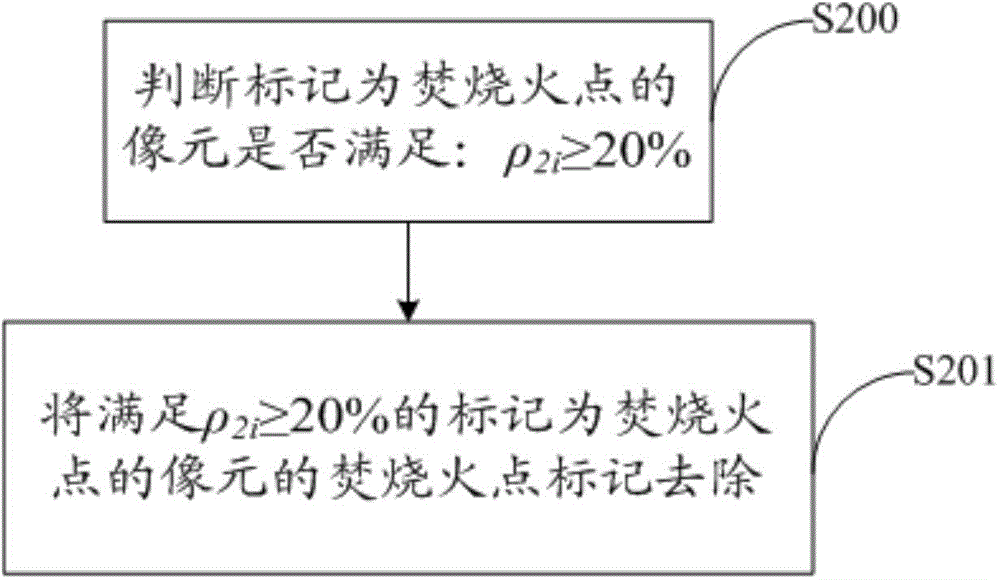
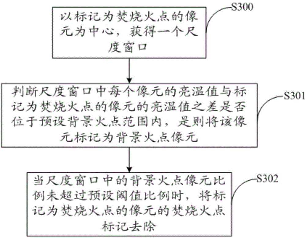
[0051] Nowadays, there is a habit of burning straw in many areas of our country. Large-scale straw burning will lead to serious deterioration of air quality and may even cause safety accidents. Therefore, straw burning has been banned in our country, but it has been repeatedly banned. The inventor found through research that the main reason for repeated bans is that Nowadays, manual supervision is mainly used for straw burning. Due to the scattered fire points of straw burning, the duration is short, it is difficult to verify, and it is difficult to count. Coupled with the limitation of manpower and material resources, it is difficult to use manual supervision and supervision of banning burning. The inventor believes that under the new situation, environmental supervision needs to be more scientific and efficient. If new technical means can be used, the accuracy and efficiency of law enforcement can be effectively improved. After many studies, it has been found that satellite r...
Embodiment 2
[0081] The embodiment of the present invention provides a satellite remote sensing processing device for fire point of straw burning, such as Figure 5 As shown, it includes: an obtaining unit 500 for obtaining the satellite remote sensing data of the area to be monitored obtained by the remote sensing monitoring device; a judging unit 501 for each of the satellite remote sensing data obtained by the obtaining unit 500 pixel, judging whether the brightness temperature value of the pixel is within the preset fire point brightness temperature range, and if so, mark it as a burning fire point; the processing unit 502 is used to mark all the pixels marked as burning fire points in the In the area to be monitored, the position information and attribute report of the burning fire point in the area to be monitored are obtained through statistics.
[0082] Wherein, the satellite remote sensing data includes: 3.7μm infrared channel T 3 Data and 11μm infrared channel T 4 data; the jud...
PUM
 Abstract
Description
Claims
Application Information
 - R&D
- Intellectual Property
- Life Sciences
- Materials
- Tech Scout
- Unparalleled Data Quality
- Higher Quality Content
- 60% Fewer Hallucinations
Browse by: Latest US Patents, China's latest patents, Technical Efficacy Thesaurus, Application Domain, Technology Topic, Popular Technical Reports.
© 2025 PatSnap. All rights reserved.Legal|Privacy policy|Modern Slavery Act Transparency Statement|Sitemap|About US| Contact US: help@patsnap.com


