Device and method of using radar remote sensing data for monitoring wheat lodging
A technology of remote sensing data and wheat, applied in the direction of measurement device, utilization of re-radiation, radio wave measurement system, etc., can solve problems such as lack of means of wheat lodging status
- Summary
- Abstract
- Description
- Claims
- Application Information
AI Technical Summary
Problems solved by technology
Method used
Image
Examples
Embodiment Construction
[0063] Embodiments of the present invention will be described in detail below with reference to the accompanying drawings.
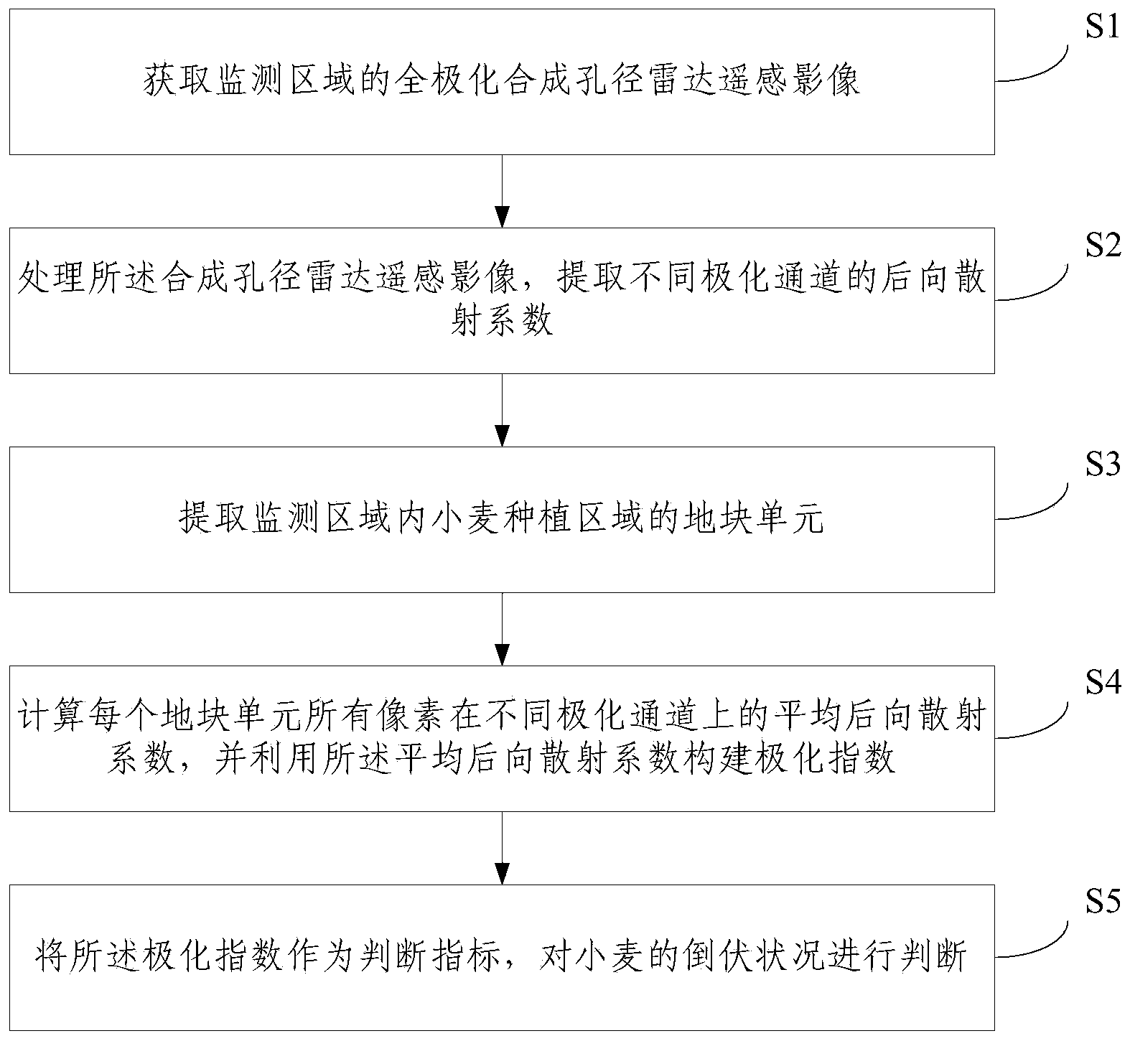
[0064] Embodiments of the present invention propose a method for monitoring wheat lodging using radar remote sensing data, such as figure 1 shown, including the following steps:
[0065] S1: Obtain the full polarization SAR remote sensing image of the monitoring area;
[0066] S2: process the synthetic aperture radar remote sensing image, and extract the backscatter coefficients of different polarization channels; specifically include: performing radiation calibration on the four polarization channels of the synthetic aperture radar remote sensing image; Generating intensity data from the complex data of each polarization channel; performing geocoding on the intensity data of each polarization channel; performing geometric fine correction and speckle noise removal processing on the geocoded image data.
[0067] Wherein, the intensity data generated fro...
PUM
 Abstract
Description
Claims
Application Information
 - R&D
- Intellectual Property
- Life Sciences
- Materials
- Tech Scout
- Unparalleled Data Quality
- Higher Quality Content
- 60% Fewer Hallucinations
Browse by: Latest US Patents, China's latest patents, Technical Efficacy Thesaurus, Application Domain, Technology Topic, Popular Technical Reports.
© 2025 PatSnap. All rights reserved.Legal|Privacy policy|Modern Slavery Act Transparency Statement|Sitemap|About US| Contact US: help@patsnap.com


