Data processing method and system for CAD urban pipeline as-built drawing based on ArcGIS platform
A technology for data processing and as-built drawings, applied in electrical digital data processing, special data processing applications, instruments, etc., can solve problems such as high error rate, inability to associate pipe points and pipeline attribute connection relationships, large errors, etc.
- Summary
- Abstract
- Description
- Claims
- Application Information
AI Technical Summary
Problems solved by technology
Method used
Image
Examples
Embodiment Construction
[0140] The present invention will be further described below in conjunction with the accompanying drawings and embodiments.
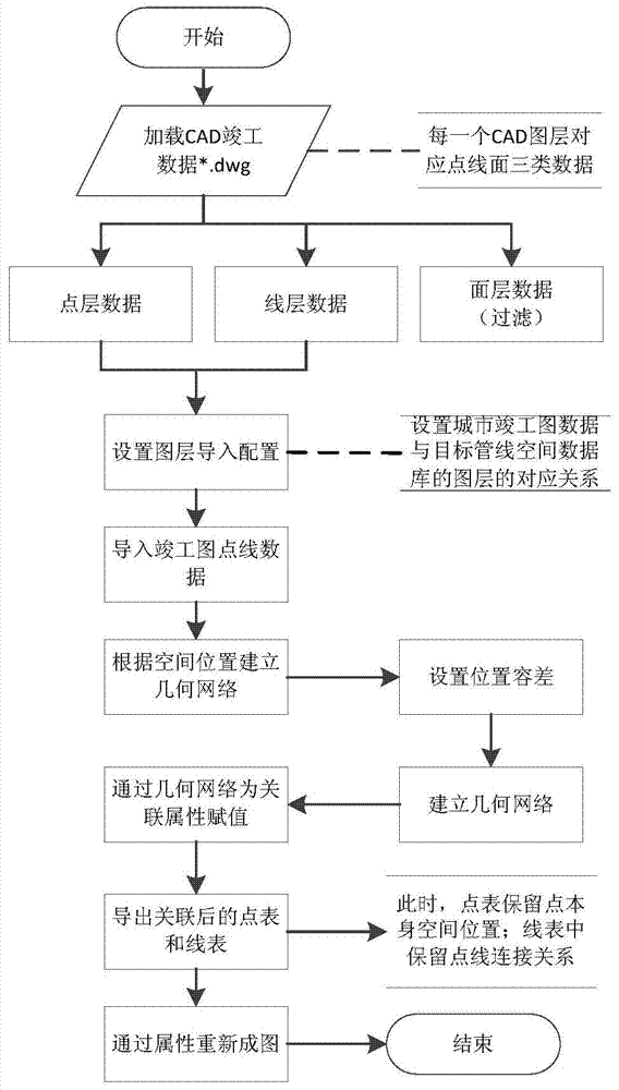
[0141] like figure 1 As shown, the data processing method of the as-built map of urban pipelines based on the ArcGIS platform includes the following steps:
[0142] Assume that the pipeline data contained in the CAD as-built drawing data is the water supply pipeline water (the comprehensive pipeline is a collection of single pipelines, and the operation is repeated, and the process is the same, so it will not be repeated here.)
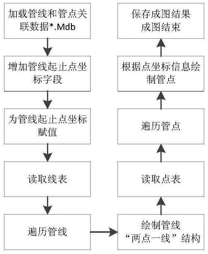
[0143] Step (1): Load CAD as-built drawing data (common format *.dwg); in the ArcGIS platform, it is reflected in three types of data: point, line, and plane. When laying urban pipelines, the construction unit will lay the pipelines according to the site conditions. In some cases, such as pipeline avoidance and pipeline penetration, on-site construction that cannot be completely consistent with the pipeline design drawings wi...
PUM
 Abstract
Description
Claims
Application Information
 - R&D
- Intellectual Property
- Life Sciences
- Materials
- Tech Scout
- Unparalleled Data Quality
- Higher Quality Content
- 60% Fewer Hallucinations
Browse by: Latest US Patents, China's latest patents, Technical Efficacy Thesaurus, Application Domain, Technology Topic, Popular Technical Reports.
© 2025 PatSnap. All rights reserved.Legal|Privacy policy|Modern Slavery Act Transparency Statement|Sitemap|About US| Contact US: help@patsnap.com


