An Underwater Intelligent Adaptive Terrain Matching Method Based on Terrain Information
A terrain matching and self-adaptive technology, applied in the direction of navigation calculation tools, etc., can solve the problem of incomplete evaluation of terrain information
- Summary
- Abstract
- Description
- Claims
- Application Information
AI Technical Summary
Problems solved by technology
Method used
Image
Examples
Embodiment 1
[0083] Embodiment 1 An underwater intelligent adaptive terrain matching method based on terrain information.
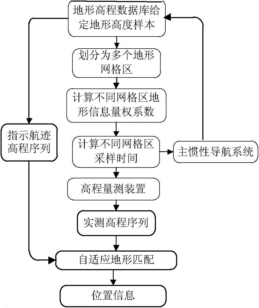
[0084] figure 1 It is a structural diagram of the intelligent adaptive terrain matching algorithm described in the present invention.
[0085] In the simulation experiment, the terrain elevation database is a rectangular area within the range of 10000m × 14000m, and the resolution of the database terrain is 100m × 100m. The area is divided into 9 grid areas, as shown in image 3As shown, the terrain information weight coefficients of the 9 grid areas are calculated. Table 1 shows the calculation results of the single terrain information values, comprehensive information weight coefficients and sampling time intervals of the 9 grid areas.
[0086] Among them, the calculation formula of terrain roughness r is:
[0087] r=(r λ + r φ ) / 2
[0088] where r λ and r φ are the roughness in the longitude direction and latitude direction respectively:
[0089] ...
PUM
 Abstract
Description
Claims
Application Information
 - Generate Ideas
- Intellectual Property
- Life Sciences
- Materials
- Tech Scout
- Unparalleled Data Quality
- Higher Quality Content
- 60% Fewer Hallucinations
Browse by: Latest US Patents, China's latest patents, Technical Efficacy Thesaurus, Application Domain, Technology Topic, Popular Technical Reports.
© 2025 PatSnap. All rights reserved.Legal|Privacy policy|Modern Slavery Act Transparency Statement|Sitemap|About US| Contact US: help@patsnap.com


