
Classification Method of Polarimetric SAR Objects Based on Semantic Information and Polarization Decomposition

A technology of semantic information and polarization decomposition, which is applied in the field of image processing and remote sensing, can solve problems such as poor consistency of classification regions, poor regional consistency, and the boundary is easily affected by noise, so as to achieve the effect of improving regional consistency

Active Publication Date: 2016-02-10
XIDIAN UNIV
View PDF3 Cites 0 Cited by
  • Summary
  • Abstract
  • Description
  • Claims
  • Application Information

AI Technical Summary

Problems solved by technology

Therefore, there are many defects in the traditional polarimetric SAR ground object classification method including the above method: (1) the regional consistency of the same ground object is not good, resulting in a classification result map of salt and pepper noise; (2) based on the traditional image processing method The polarimetric SAR ground object classification method, for the ground objects with light and dark gray scale changes, such as the traditional classification method based on pixel point and super pixel combination, it is difficult to classify such ground objects into one category; (3) for Complex ground features, such as building groups, since the ground features themselves contain houses, roads, etc., the scattering characteristics of the ground features are not single, and have light and dark ground features, so it is difficult to divide them into a complete area. Extracting various underlying features and using various methods of region merging are difficult to group these regions together, but for the classification of low-resolution polarimetric SAR images, it should be divided into one from the perspective of human vision and image understanding. kind
[0005] To sum up, the pixel classification methods of the above-mentioned polarization SAR ground object classification methods are fine, but there are still some defects, especially for the ground objects with aggregation characteristics (such as buildings, forests, etc.). Single, with light and dark ground object scattering characteristics, poor consistency of classification area, and the boundary is easily affected by noise, and it is easy to produce salt-and-pepper classification results

Method used


Image

  • Classification Method of Polarimetric SAR Objects Based on Semantic Information and Polarization Decomposition
  • Classification Method of Polarimetric SAR Objects Based on Semantic Information and Polarization Decomposition
  • Classification Method of Polarimetric SAR Objects Based on Semantic Information and Polarization Decomposition

Examples


Embodiment 1

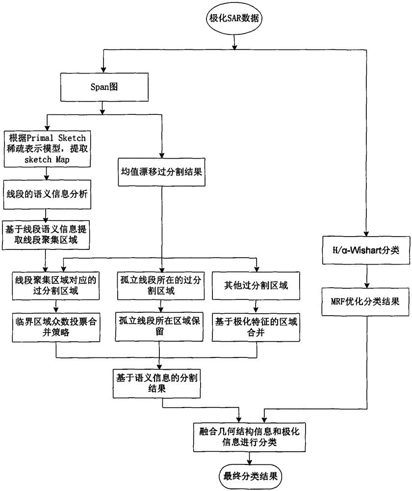
[0034] The present invention is a polarimetric SAR object classification method based on semantic information and polarization decomposition, and performs unsupervised object classification for low-resolution polarimetric SAR images obtained in advance. figure 1 , the classification process implementation steps of the present invention include:

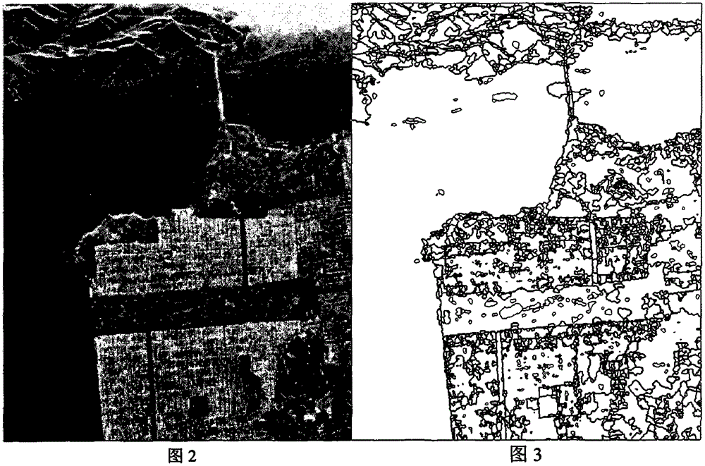
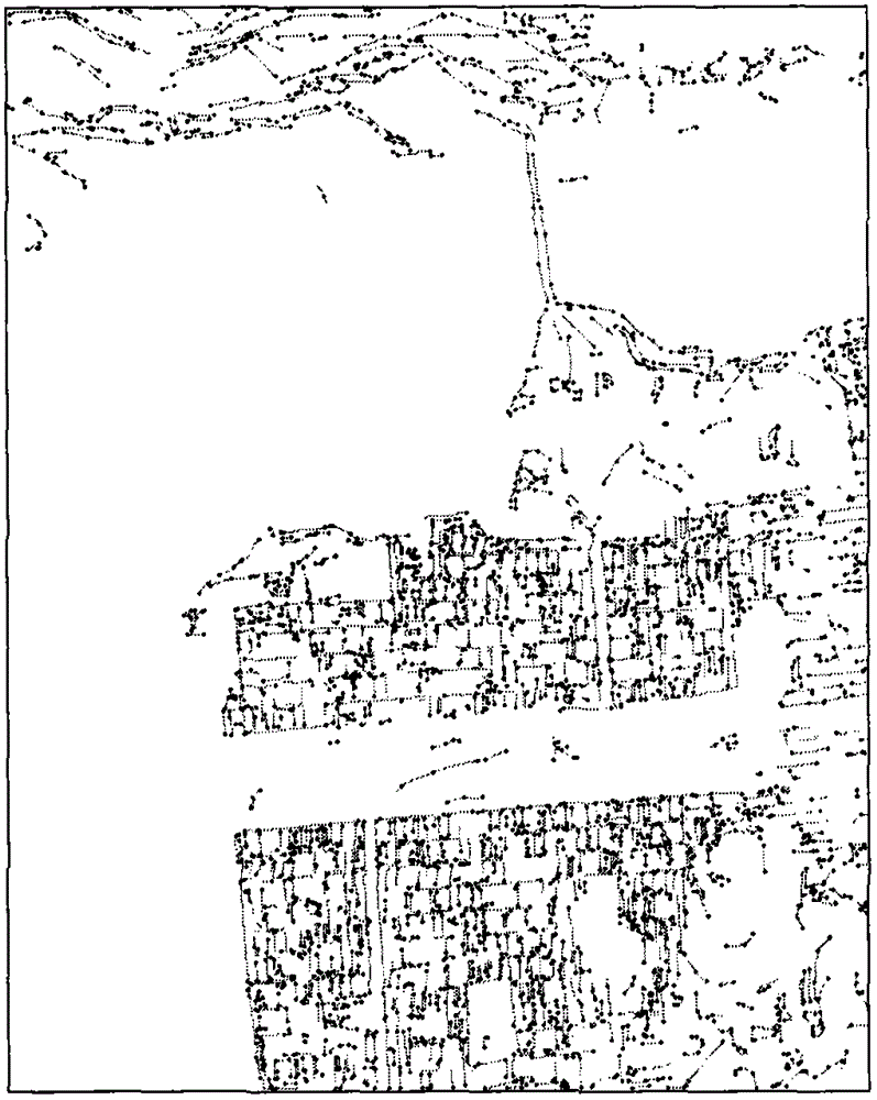
[0035] Step 1, input the data of the polarimetric SAR image to be classified, process the polarimetric SAR data, obtain the amplitude values ​​of the three channels of the polarimetric SAR data, and fuse the amplitude values ​​of the three channels to obtain the backscatter of the polarimetric SAR image total power graph, such as figure 2 Shown is the span diagram of the fully polarized SanFrancisco data in the NASA / JPLAIRSARL band. Use the mean shift on the span graph to obtain the over-segmentation result graph of the span graph; and extract the edge and ridge sketch of the span graph composed of line segments according to the pri...

Embodiment 2

[0081] The classification method of polarimetric SAR ground features based on semantic information and polarization decomposition is the same as that in embodiment 1, and the simulation data and images are described as follows:

[0082] 1. Simulation conditions

[0083] (1) Select the full polarization SanFrancisco data of NASA / JPLAIRSARL band;

[0084] (2) In the simulation experiment, the value of the parameter N in the PrimalSketch sparse representation model is 3, the value of M is 18, and the value of the threshold ε is 20;

[0085] (3) In the simulation experiment, the number of neighbors k is 9;

[0086] (4) In the simulation experiment, the seed segment threshold δ 1 Take 20; line segment growth threshold δ 2 take 12;

[0087] (5) In the simulation experiment, the region merging threshold U is set to 0.7;

[0088] (6) In the simulation experiment, the neighborhood window is selected as 3*3 in the MRF-based H / α-Wishart classification.

[0089] 2. Simulation conten...

Embodiment 3

[0092] The polarimetric SAR ground object classification method based on semantic information and polarization decomposition is the same as embodiment 1-2, wherein the H / α-Wishart classification method based on MRF is the same as step 5 in embodiment 1, as a comparative experiment of the present invention, simulation The data and results are as follows:

[0093] 1. Simulation conditions

[0094] (1) Select the full polarization SanFrancisco data of NASA / JPLAIRSARL band;

[0095] (2) In the simulation experiment, the neighborhood window selection in the MRF-based H / α-Wishart classification is 3*3.

[0096] 2. Simulation content and results

[0097] Using the full-polarization SanFrancisco data of NASA / JPLAIRSARL band, the H / α-Wishart classification method based on MRF is used for classification, which is a classification method based on pixel points. Figure 12 is a span graph, Figure 13It is the result of the MRF-based H / α-Wishart classification method. It can be seen fr...


PUM


Abstract

The invention discloses a polarimetric SAR (synthetic aperture radar) terrain classification method based on semantic information and polarimetric decomposition. The polarimetric SAR terrain classification method includes performing mean shift on a span image, extracting a sketch map of the span image, extracting a line segment gathering region in the sketch map by an region extracting technology based on the semantic information, merging span image mean shift over-segmentation regions based on the line segment gathering region as well as by the aid of a critical region majority vote merging strategy and based on a polarimetric feature merging strategy, acquiring an image segmentation result, and fusing the image segmentation result based on the semantic information and an H / alpha-Wishart classification result based on an MRF (markov random field) to acquire a final classification result. The semantic information, an image processing technique and a polarimetric scattering property are combined by the polarimetric SAR terrain classification method, the problem of bad region consistency of existing classification techniques based on the polarimetric decomposition to classification results with gathering-featured surface features (like forest, building groups and the like) is mainly solved, and region consistency and boundary retainability of the classification results with the gathering-featured surface features are improved.

Description

technical field [0001] The invention belongs to the technical field of image processing and remote sensing, and relates to the classification of ground objects in polarimetric SAR images, in particular to a classification method of polarimetric SAR ground objects based on semantic information and polarization decomposition, which can be used for low-level ground objects with aggregation characteristics. Resolving ground object classification in polarimetric SAR images. Background technique [0002] Polarimetric Synthetic Aperture Radar (POLSAR) image processing is an important subject of national defense construction and economic development, and has attracted more and more attention and research. Compared with ordinary single-polarization synthetic aperture radar (Synthetic Aperture Radar, SAR), polarimetric SAR performs full-polarization measurement, which can obtain more abundant object information of the target, and provides important information for more in-depth resear...

Claims


Application Information

Patent Timeline
Patent Type & Authority Patents(China)
IPC IPC(8): G06F17/30
Inventor 刘芳石俊飞李玲玲焦李成戚玉涛郝红侠武杰张向荣马晶晶尚荣华于昕
Owner XIDIAN UNIV
Learn More