
Method for analyzing soil pollution spatial distribution rule based on geographic information system technology

A geographic information system and soil pollution technology, which is applied in the field of analyzing the spatial distribution of soil pollution based on geographic information system technology, and can solve problems such as crop quality, yield impact, severely polluted soil, and impact on human health.

Inactive Publication Date: 2013-03-27
SHANDONG NORMAL UNIV
View PDF1 Cites 28 Cited by
  • Summary
  • Abstract
  • Description
  • Claims
  • Application Information

AI Technical Summary

Problems solved by technology

Heavy metal pollution has a long incubation time, and most heavy metals are stable and difficult to degrade, so it seriously pollutes the soil, has a certain impact on the quality and yield of crops, and can even affect human health through the food chain

Method used

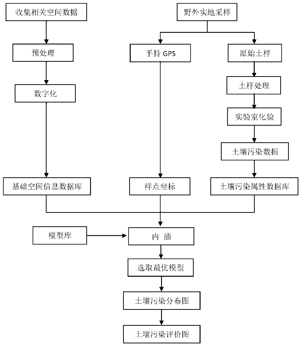

Image

  • Method for analyzing soil pollution spatial distribution rule based on geographic information system technology
  • Method for analyzing soil pollution spatial distribution rule based on geographic information system technology
  • Method for analyzing soil pollution spatial distribution rule based on geographic information system technology

Examples


Embodiment Construction

[0027] Below in conjunction with accompanying drawing and specific implementation process, the patent of the present invention will be further described.

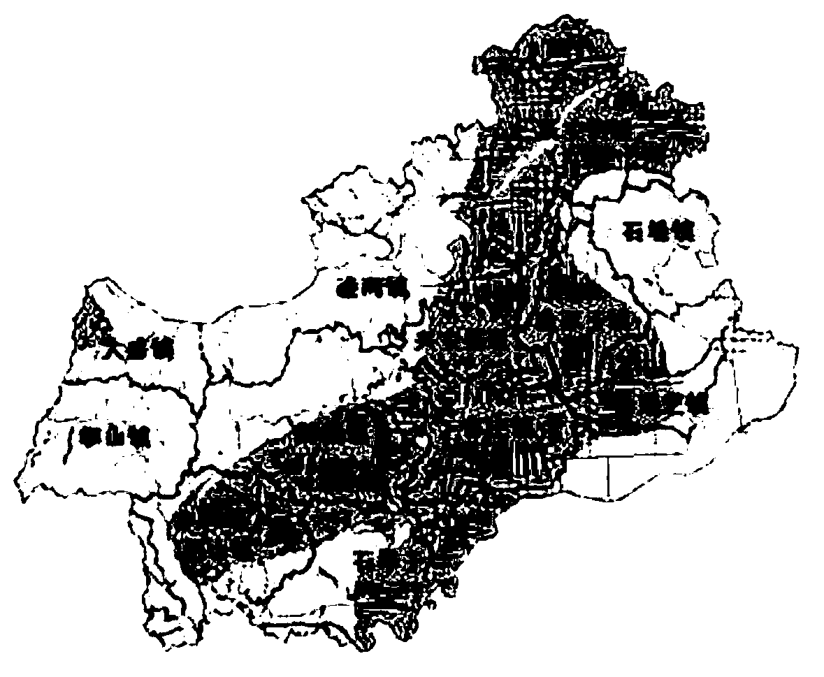
[0028] In order to better illustrate the specific implementation scheme of the patent of the present invention, the application of the method adopted in the present invention in Anqiu City, Shandong Province is taken as an example to illustrate the implementation process of the content of the present invention.

[0029] Anqiu City is located in the east-central part of Shandong Province, south of Weifang City, between 118°44′ and 119°27′ east longitude and 36°05′ and 36°38′ north latitude. Anqiu is located in the warm temperate humid monsoon zone, with a mild climate and four distinct seasons. The plains, hills, and mountains in the territory each account for about one-third, and the product resources are abundant, with many types of minerals and large reserves. Anqiu is an important water source in Shandong Province. More...


PUM


Abstract

The invention relates to a method for analyzing a soil pollution spatial distribution rule based on a geographic information system technology. The method comprises the following steps of: collecting related spatial data information of an area, and constructing a basic spatial information database by stratified digitalization; acquiring coordinate information of a field sampling point by a handheld GPS (global position system) receiver, processing acquired field images, testing to obtain soil pollution data indexes, and constructing a soil pollution attribute database; configuring the sampling point to the basic spatial information database according to the acquired coordinates of the sampling point; and carrying out interpolation treatment on different models according to a constructed interpolation model library, and selecting an optimal interpolation model to obtain a soil pollution distribution diagram and a soil pollution evaluation ranking diagram. The method provided by the invention has important practical meanings on guiding the agricultural production, controlling the soil pollution, promoting the sustainable agricultural development, and the like.

Description

[0001] Technical field [0002] The invention involves an analysis method for soil pollution, especially a method that analyzes the laws of soil pollution space based on geographical information system technical analysis. Background technique [0003] Soil is the material basis for life to survive, and it is an indispensable and renewable natural resource for human beings.All human activities are inseparable from the soil.With the development of productive forces, the continuous increase in the world's population, the increasing production activities that people engage in, and the disturbance and destruction of the natural ecosystem, especially the pollution caused by the soil, is gradually increasing.In agricultural production, in order to pursue food production, the amount of fertilizer and pesticides continues to increase, and the soil as an important part of the environment is facing an increasingly serious impact.According to relevant literature reports, my country's annual ...

Claims


Application Information

Patent Timeline
IPC IPC(8): G06F17/30
Inventor 常勇
Owner SHANDONG NORMAL UNIV
Learn More