
Spatial synchronization method of bistatic synthetic aperture radar (SAR)

A bistatic, space technology, applied in the field of radar, can solve the problem of poor beam alignment accuracy of transceiver antennas, and achieve the effect of high spatial synchronization accuracy and guaranteed accuracy

Active Publication Date: 2013-03-13
UNIV OF ELECTRONICS SCI & TECH OF CHINA
View PDF2 Cites 26 Cited by
  • Summary
  • Abstract
  • Description
  • Claims
  • Application Information

AI Technical Summary

Problems solved by technology

The problem with this method is that there is a certain error between the actual flight track of the aircraft and the predetermined track, which will lead to poor alignment accuracy of the transmitting and receiving antenna beams

Method used


Image

  • Spatial synchronization method of bistatic synthetic aperture radar (SAR)
  • Spatial synchronization method of bistatic synthetic aperture radar (SAR)
  • Spatial synchronization method of bistatic synthetic aperture radar (SAR)

Examples


Embodiment Construction

[0045] The present invention mainly adopts the method of computer simulation to verify, and all steps and conclusions are verified correctly on MATLAB-R2010b.

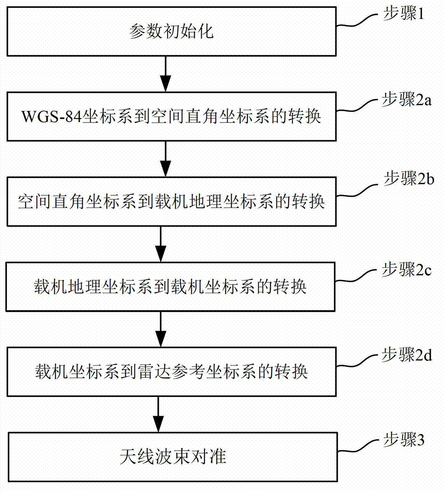
[0046] The schematic flow chart of the space synchronization method of the bistatic SAR of the present invention is as follows figure 1 As shown, the specific implementation steps are as follows:

[0047] Step 1. Initialization of relevant parameters:

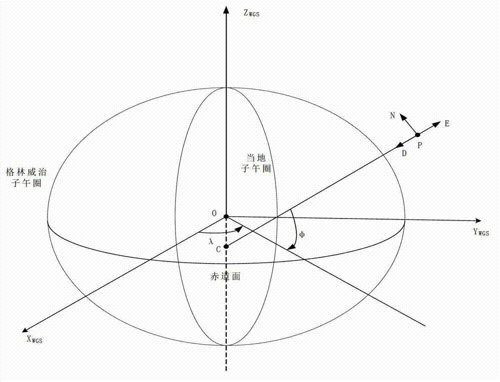
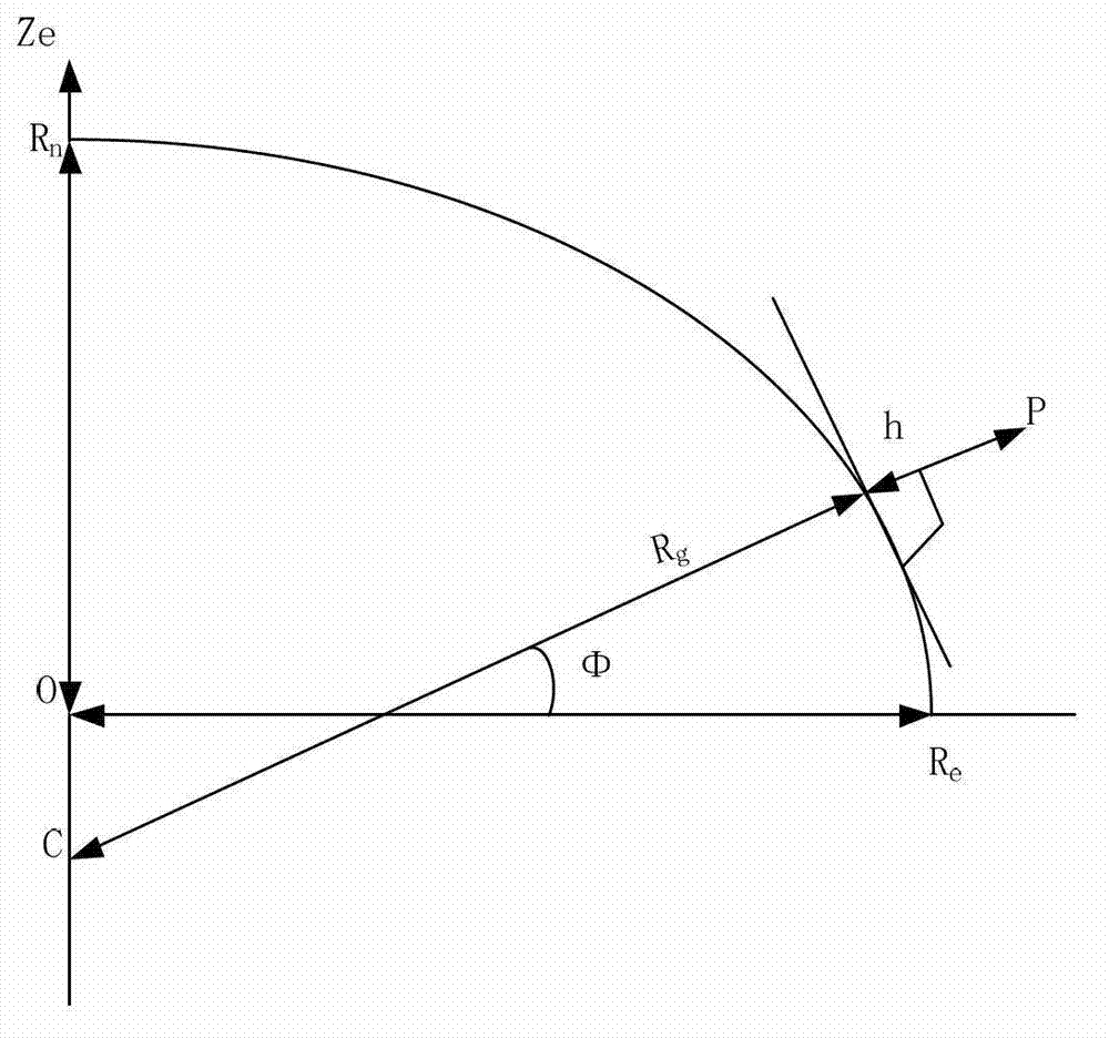
[0048] The initialization parameters are all known, including the following parameters: GPS space coordinate information of the carrier platform location Corresponding to the longitude, latitude and elevation of the carrier platform; the GPS space coordinate information of the location of the target space respectively corresponding to the longitude, latitude and elevation of the target space; the attitude information of the carrier platform (α t ,β t ,γ t )=(0°,0°,0°), corresponding to the heading angle, pitch angle and roll angle of the carrier platform; the anten...


PUM


Abstract

The invention discloses a spatial synchronization method of bistatic synthetic aperture radar (SAR). The method comprises steps of initializing parameters and converting a World Geodetic System (WGS)-84 coordinate system to a spatial rectangular coordinate system; converting the spatial rectangular coordinate system to an aerial carrier geographic coordinate system; converting the aerial carrier geographic coordinate system to an aerial carrier coordinate system; converting the aerial carrier coordinate system to a radar reference coordinate system; and aligning antenna beams. Global positioning system (GPS) special coordinate information and attitude information of an aerial carrier platform are used, the coordinate conversion is conducted in accordance with the sequence of the WGS-84 coordinate system, the spatial rectangular coordinate system, the aerial carrier geographic coordinate system, the aerial carrier coordinate system and the radar reference coordinate system, the accuracy of antenna pointing control parameters which are obtained finally can be guaranteed, the GPS special coordinate information and the attitude information of the aerial carrier platform are used, airborne bistatic SAR antenna pointing control parameters can be exported through the conversion of multi-coordinate systems, and the antenna beam pointing for receiving and transmitting the aerial carrier can be aligned through antenna pointing control parameters.

Description

technical field [0001] The invention belongs to the technical field of radar, and in particular relates to the design of a bistatic synthetic aperture radar (Synthetic Aperture Radar, SAR) space synchronization method. Background technique [0002] Bistatic SAR is a synthetic aperture radar with a new system of receiving and transmitting separately. It has different spatial geometric coordinate relations, anti-jamming performance, concealment, and strong anti-intercept ability. Bistatic SAR includes space-borne bistatic SAR for satellite launch and satellite reception, satellite bistatic SAR for satellite launch and aircraft reception, and airborne bistatic SAR for aircraft launch and aircraft reception. [0003] Due to the separation of transceivers, the airborne bistatic SAR has a new spatial geometry, which brings about the space synchronization problem of the airborne bistatic SAR. Space synchronization requires that the antenna beams of the transmitting station and the...

Claims


Application Information

Patent Timeline
IPC IPC(8): G01S7/02
Inventor 黄钰林罗华王园园杜雨洺杨建宇杨海光
Owner UNIV OF ELECTRONICS SCI & TECH OF CHINA
Learn More