Urban and rural address digitized map, doorplate and bus stop board
An address and map technology, applied in the directions of maps/plans/charts, instruments, display devices, etc., can solve problems such as large divisions, difficulty in making urban maps, and complex application of bus stop signs.
- Summary
- Abstract
- Description
- Claims
- Application Information
AI Technical Summary
Problems solved by technology
Method used
Image
Examples
Embodiment Construction
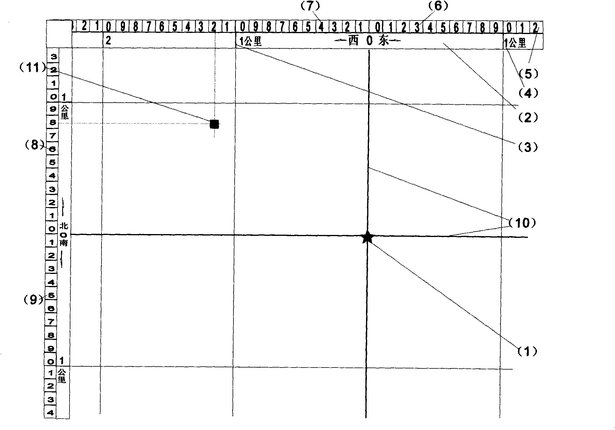
[0019] see figure 1 , the figure is an urban map, set the city center as the position of the five-pointed star, draw the 0-axis with a cross in the five-pointed star (1), and use this as the center to set up the first-level kilometer grid (2). In the first level, draw a grid line (3) representing the actual field for every 1 km, and mark the distance (4) from the 0-axis respectively. The numbers on the X-axis should be on the east side of the grid line, and the numbers on the Y-axis should be on the grid north side of the line. Then set up the second-level plot sub-grid (5), which is divided into 10 grids within 1 kilometer, each grid represents a 100-meter plot, the X axis is centered on the 0 axis, and 0, 1, 2, ..., 9 are used for eastward Mark 10 small grids (6), use 1, 2, ..., 9, 0 to mark 10 small grids (7) in the west of the 0 axis, use 0, 1, 2, ... to the north of the Y axis 0 axis , 9 sorting marks 10 small grids (8), south of the 0 axis, use 1, 2, ..., 9, 0 sorting...
PUM
 Abstract
Description
Claims
Application Information
 - R&D
- Intellectual Property
- Life Sciences
- Materials
- Tech Scout
- Unparalleled Data Quality
- Higher Quality Content
- 60% Fewer Hallucinations
Browse by: Latest US Patents, China's latest patents, Technical Efficacy Thesaurus, Application Domain, Technology Topic, Popular Technical Reports.
© 2025 PatSnap. All rights reserved.Legal|Privacy policy|Modern Slavery Act Transparency Statement|Sitemap|About US| Contact US: help@patsnap.com


