
Semi-automatic detection method of road centerline in high-resolution urban remote sensing images

A high-resolution, remote sensing image technology, applied in the field of image processing, can solve the problems of poor application, poor extraction effect, cumbersome process, etc., and achieve the effect of avoiding misjudgment, reducing interference, and accurate search direction

Active Publication Date: 2011-12-07
XIDIAN UNIV
View PDF0 Cites 0 Cited by
  • Summary
  • Abstract
  • Description
  • Claims
  • Application Information

AI Technical Summary

Problems solved by technology

The existing semi-automatic road extraction methods cannot be well applied in the road extraction of poor-quality high-resolution urban remote sensing images, and the extraction effect is poor and the process is relatively cumbersome

Method used


Image

  • Semi-automatic detection method of road centerline in high-resolution urban remote sensing images
  • Semi-automatic detection method of road centerline in high-resolution urban remote sensing images
  • Semi-automatic detection method of road centerline in high-resolution urban remote sensing images

Examples


Embodiment Construction

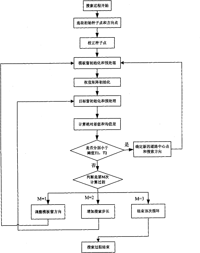
[0037] refer to figure 1 , the implementation steps of the present invention are as follows:

[0038] Step 1, select the initial seed point and the initial direction point to obtain the initial information of the road.

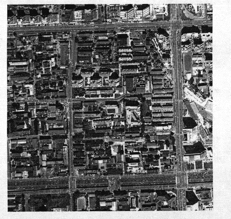
[0039] In the input to be detected figure 2 In the above, the initial seed point and the initial direction point are selected on the center line by means of human-computer interaction, where the initial seed point is the starting point of the algorithm search, and the angle between the initial direction point and the seed point is the angular direction of the road.

[0040] Step 2, correct the position of the initial seed point.

[0041] Due to the instability of manual point selection in interactive operation, the initial seed point may not be located on the centerline of the road accurately, so its position needs to be corrected. The correction is to establish a 7×7 correction window centered on the initial seed point, and search for the center line alon...


PUM


Abstract

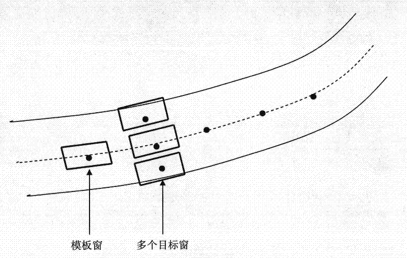
The invention discloses a semi-automatic detection method for the centerline of a road in a high-resolution remote sensing image, which relates to the technical field of remote sensing image processing, and mainly solves the problem of low detection accuracy and scope of application of remote sensing images with complex backgrounds and unclear roads in the prior art narrow question. The implementation steps are as follows: after selecting the initial seed point and direction point by means of human-computer interaction, a template window is established at the initial seed point, and the target window most similar to the template window is found along the direction of the road according to the set step length, and the center of the window is It is determined as the next seed point; loop iterations get a series of road center points, and connect them into a line to get the final road centerline detection result. The invention can process remote sensing images with complex road backgrounds and centerlines. When the road conditions on both sides of the road centerline are complex and it becomes difficult to directly detect the road, the road can be accurately positioned by detecting the centerline, and it is used to locate the centerline. Semi-automatic detection of roads.

Description

technical field [0001] The invention belongs to the technical field of image processing and relates to a target detection method for remote sensing images, which can be used for semi-automatic extraction of road centerlines in high-resolution urban remote sensing images. Background technique [0002] The extraction of geometric features of ground objects based on high-resolution remote sensing images and the research on corresponding methods have always attracted the attention of many researchers. Extracting roads from remote sensing images is one of the research hotspots, because roads are closely related to people's daily life. Most of the existing semi-automatic road extraction algorithms are aimed at different image types such as aerial or aerospace images, different scales, that is, image resolution, and different regions. Different images such as urban, rural or suburban areas, and different road types adopt different extraction methods. [0003] When using remote sen...

Claims


Application Information

Patent Timeline
Patent Type & Authority Patents(China)
IPC IPC(8): G06K9/62G06K9/46G01S17/89
Inventor 焦李成侯彪陈娟娟王爽刘芳马文萍张向荣
Owner XIDIAN UNIV
Learn More