System and method based on GPS for measuring farmland working area
A measurement system and measurement method technology, applied in measurement devices, information technology support systems, beacon systems using radio waves, etc., to achieve the effects of satisfying price, improving area measurement accuracy, and convenient operation
- Summary
- Abstract
- Description
- Claims
- Application Information
AI Technical Summary
Problems solved by technology
Method used
Image
Examples
Embodiment Construction
[0018] The present invention will be further described in detail below with reference to the accompanying drawings and specific embodiments.
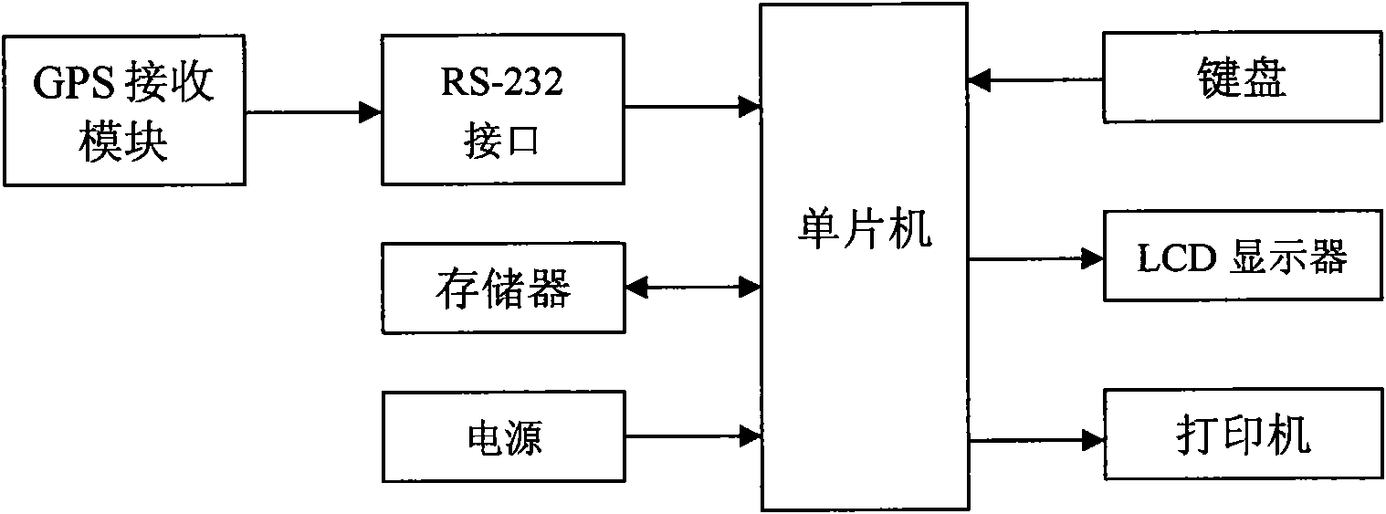
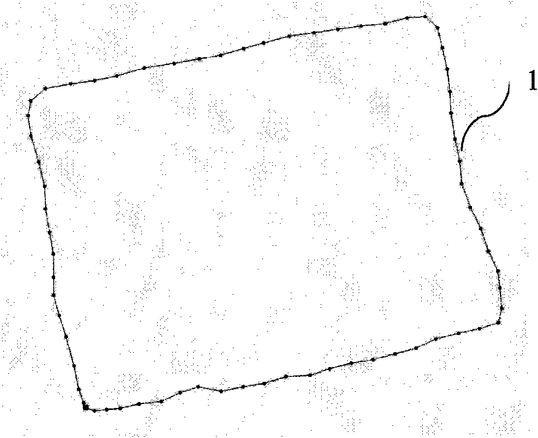
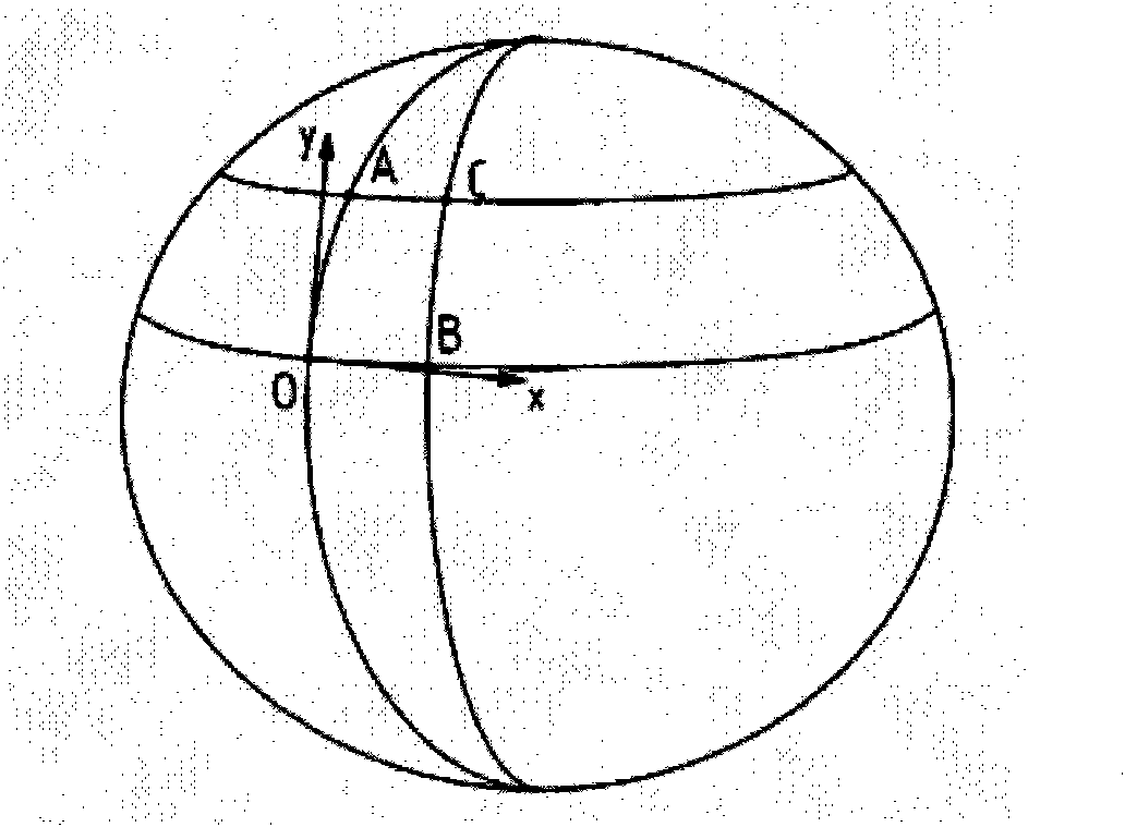
[0019] The GPS-based farmland operation area measurement system of the present invention adopts a general GPS positioning system and a single-chip microcomputer, and aims at the problem of low GPS positioning accuracy and the regular shape of the general farmland. After running the operation measurement area for one week, after automatically recording the coordinates of the operation route, the obtained farmland operation route is trimmed, and the fixed point coordinates are converted, and then the surrounding area is calculated.
[0020] like figure 1 As shown, the GPS-based farmland operation area measurement system of the present invention includes a GPS receiving module, a single-chip computer, a memory, a keyboard, an LCD display, a printer, a power supply, and the like. The GPS receiver module adopts UP500 GPS receiver, which int...
PUM
 Abstract
Description
Claims
Application Information
 - R&D Engineer
- R&D Manager
- IP Professional
- Industry Leading Data Capabilities
- Powerful AI technology
- Patent DNA Extraction
Browse by: Latest US Patents, China's latest patents, Technical Efficacy Thesaurus, Application Domain, Technology Topic, Popular Technical Reports.
© 2024 PatSnap. All rights reserved.Legal|Privacy policy|Modern Slavery Act Transparency Statement|Sitemap|About US| Contact US: help@patsnap.com


