
Dynamic terrain modeling method based on multi-resolution volume element

A modeling method and multi-resolution technology, applied in the field of virtual reality and computer graphics, can solve the problems of unrealistic models and low efficiency of large-scale dynamic terrain modeling, so as to simplify the model, satisfy the accuracy and realism, Efficiently Generated Effects

Inactive Publication Date: 2009-11-11
BEIJING INSTITUTE OF TECHNOLOGYGY
View PDF0 Cites 9 Cited by
  • Summary
  • Abstract
  • Description
  • Claims
  • Application Information

AI Technical Summary

Problems solved by technology

[0013] The purpose of the present invention is to overcome the defects of the above-mentioned prior art, solve the problems of low efficiency of large-scale dynamic terrain modeling and unrealistic models, and propose a dynamic terrain modeling method based on multi-resolution voxels

Method used

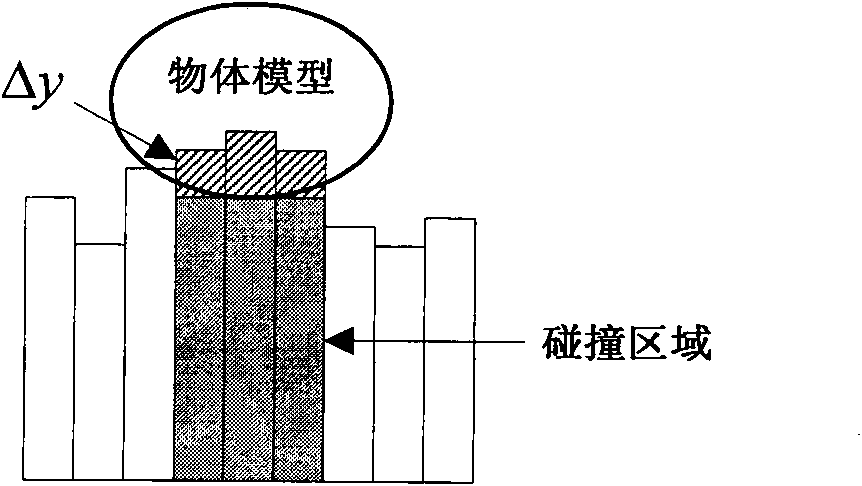
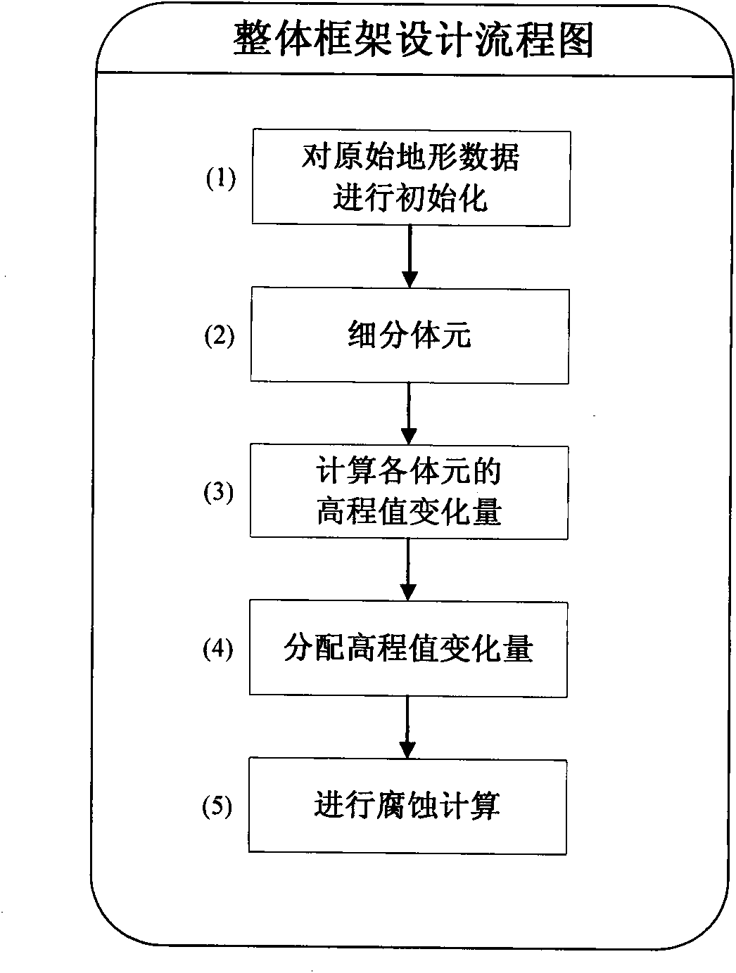
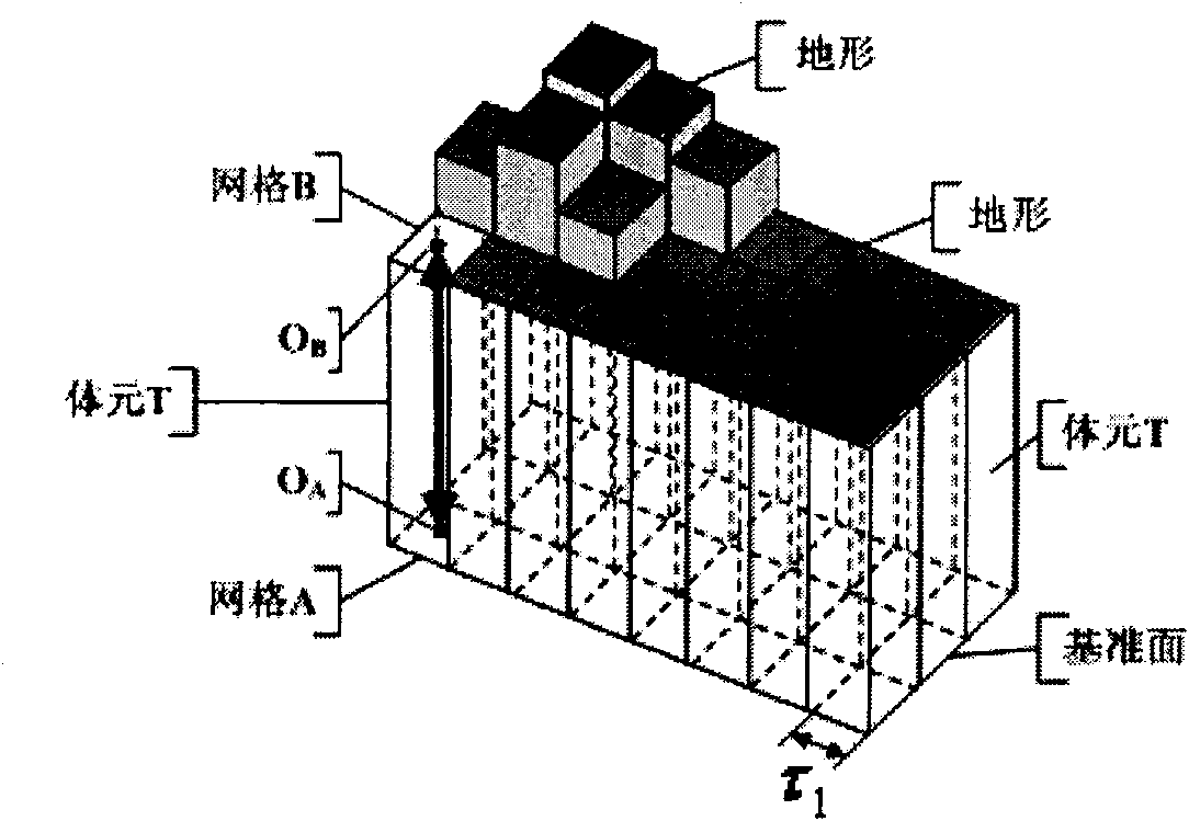

Image

  • Dynamic terrain modeling method based on multi-resolution volume element
  • Dynamic terrain modeling method based on multi-resolution volume element
  • Dynamic terrain modeling method based on multi-resolution volume element

Examples


Embodiment Construction

[0050] According to the above technical solutions, the present invention will be described in detail below in conjunction with the accompanying drawings and embodiments.

[0051] In this example, model the dynamically generated ruts of a tank as it drives through desert terrain. The original terrain is sandy land with a size of 102.4m×102.4m. The original terrain is flat, and all elevation values ​​are 1m. The speed of the tank is controlled by the four direction keys on the keyboard. Press the left key to turn left, press the right key to turn right, press the up key to speed up the vehicle, and press the down key to decrease the speed. The track width of the tank is 0.5m, the initial speed is 1.5m / frame, the direction angle is 0 degrees, and the initial position is the coordinate origin of the terrain. Since the tank is heavy in reality, it is assumed that the ground at the rut will sink by 0.1m after the tank passes by.

[0052] A dynamic terrain modeling method based on...


PUM


Abstract

The invention relates to a dynamic terrain modeling method based on multi-resolution volume element, belonging to the field of computer graphics and virtual reality technology. On the basis of the dynamic terrain modeling method based on the volume element, the method divides the movable terrain blocks into regular meshes with inconsistent resolutions according to the acuteness degree of the change, and allocates the volume element deformation quantity on the adjacent volume elements at the bump region boundary, and finally adopts a corrosion arithmetic to carry out smooth treatment of the images. Compared with the prior art, the method can focus the terrain edge change details and effectively simplify the model when carrying out the large-scale dynamic terrain modeling, meets the correctness and trueness requirements of the model, achieves the object of lightening the system burden, and has effects of dynamically and effectively generating the terrain model in real-time and carrying out the real-time interaction with the simulation system.

Description

technical field [0001] The invention relates to a method for real-time modeling and simulation of large-scale dynamic terrain, in particular to a method for modeling dynamic terrain based on multi-resolution voxels, which belongs to the technical fields of computer graphics and virtual reality. Background technique [0002] In the application of the simulation system, the first problem to be solved by a complex dynamic terrain real-time visualization system is the modeling of the terrain. Factors such as the correctness and complexity of the model directly determine the simulation effect and operating efficiency of the dynamic terrain real-time visualization system. [0003] According to the source of terrain data, terrain modeling methods can be divided into two types: randomly generated methods and methods based on real terrain physical properties. [0004] The generation methods of random terrain can be roughly divided into two categories based on surface fitting and cal...

Claims


Application Information

Patent Timeline
Patent Type & Authority Applications(China)
IPC IPC(8): G06T17/50G06T17/05
Inventor 李凤霞张艳李立杰黄天羽许仁杰王欣欣
Owner BEIJING INSTITUTE OF TECHNOLOGYGY
Learn More