Airport target decomposition method based on context

A context and airport technology, applied in the field of image interpretation, which can solve problems such as interpretation, low recognition accuracy, and inability to complete airport goals.

Inactive Publication Date: 2010-06-09
HUAZHONG UNIV OF SCI & TECH
View PDF0 Cites 0 Cited by
  • Summary
  • Abstract
  • Description
  • Claims
  • Application Information

AI Technical Summary

Problems solved by technology

This is a recognition method completely driven by knowledge, and it is easy to confuse the airport runway with the highway, which has the disadvantages of low recognition accuracy and poor adaptability
At the same time, this type of method also ignores other elements that constitute the airport target, such as aircraft nests, contact roads, airport buildings, etc., resulting in the inability of the existing methods to complete the interpretation of the airport target, but only complete the identification of the airport runway Task

Method used


Image

  • Airport target decomposition method based on context
  • Airport target decomposition method based on context
  • Airport target decomposition method based on context

Examples


Embodiment Construction

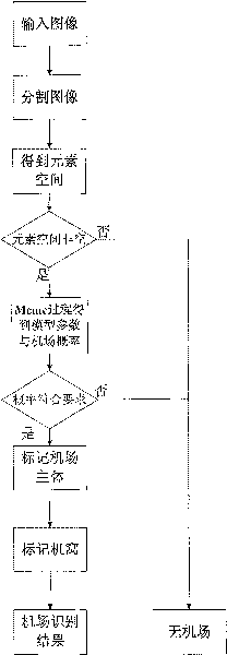
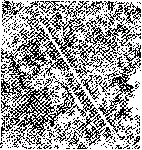
[0042]The airport interpretation defined in the present invention is to identify and output the various components of the airport in the image, including the airport lawn, the main runway, the auxiliary runway, the contact road and the aircraft nest group, respectively.

[0043] Assuming that the remote sensing image to be identified has been obtained, at most one complete airport may be contained in the remote sensing image.

[0044] Refer below figure 1 Describe the steps of the present invention in detail:

[0045] (1) carry out Otsu (Otsu) segmentation to the remote sensing image to be identified, and obtain the binary image I after segmentation;

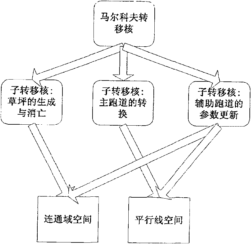
[0046] (2) Generate the basic element space from the segmented binary image, that is, extract the parallel line space and the connected domain space. The specific process is as follows:

[0047] (2.1) Through Radon transformation, we can get the response intensity, angle and projection of all straight lines. For any two stra...


PUM


Abstract

The invention provides a method for interpreting an airport object based on the context. The method takes a lawn, a main runway and an auxiliary runway of the airport as the main body of the airport,and determines the computation method of airport composition probability. An input image is data-driven from the bottom to the top to generate a basic element space, and search is conducted in the element space to enable the airport composition probability value is the maximum airport solution. If the maximum airport composition probability is larger than a threshold, the air port exists, and thelawn, the main runway and the auxiliary runway of the airport are respectively marked. The invention can effectively and completely identify and interpret the airport object in a remote sensing image.In addition, the method of the invention has the advantages of simple and convenient operation and high working efficiency.

Description

technical field [0001] The invention belongs to the technical field of image interpretation, and in particular relates to an airport target in a satellite picture, and uses context information to realize the interpretation of the airport target. Background technique [0002] Airports are important military targets, and the interpretation of airport targets in remote sensing images has important theoretical significance and application value. [0003] An airport is a place for aircraft to take off, land, park and organize flight activities. It is a larger target group, usually composed of runways, taxiways, aprons, aircraft bunkers, aircraft nests, command and communication equipment, flight control rooms, weather stations, aircraft repair equipment, oil depots, ammunition depots, barracks, living areas, etc. . These components have different characteristics in architectural form and configuration location, and the characteristics reflected in the images are also different....

Claims


Application Information

Patent Timeline
Patent Type & Authority Patents(China)
IPC IPC(8): G06T7/00G06K9/00
Inventor 曹志国范绎卓问
Owner HUAZHONG UNIV OF SCI & TECH
Why Eureka
Try Eureka