Method and apparatus of line segment intersection
A technology of line segment and line method, applied in the field of spatial information processing, to achieve the effect of improving algorithm efficiency, improving overall performance, and improving line segment intersection performance
- Summary
- Abstract
- Description
- Claims
- Application Information
AI Technical Summary
Problems solved by technology
Method used
Image
Examples
Embodiment 1
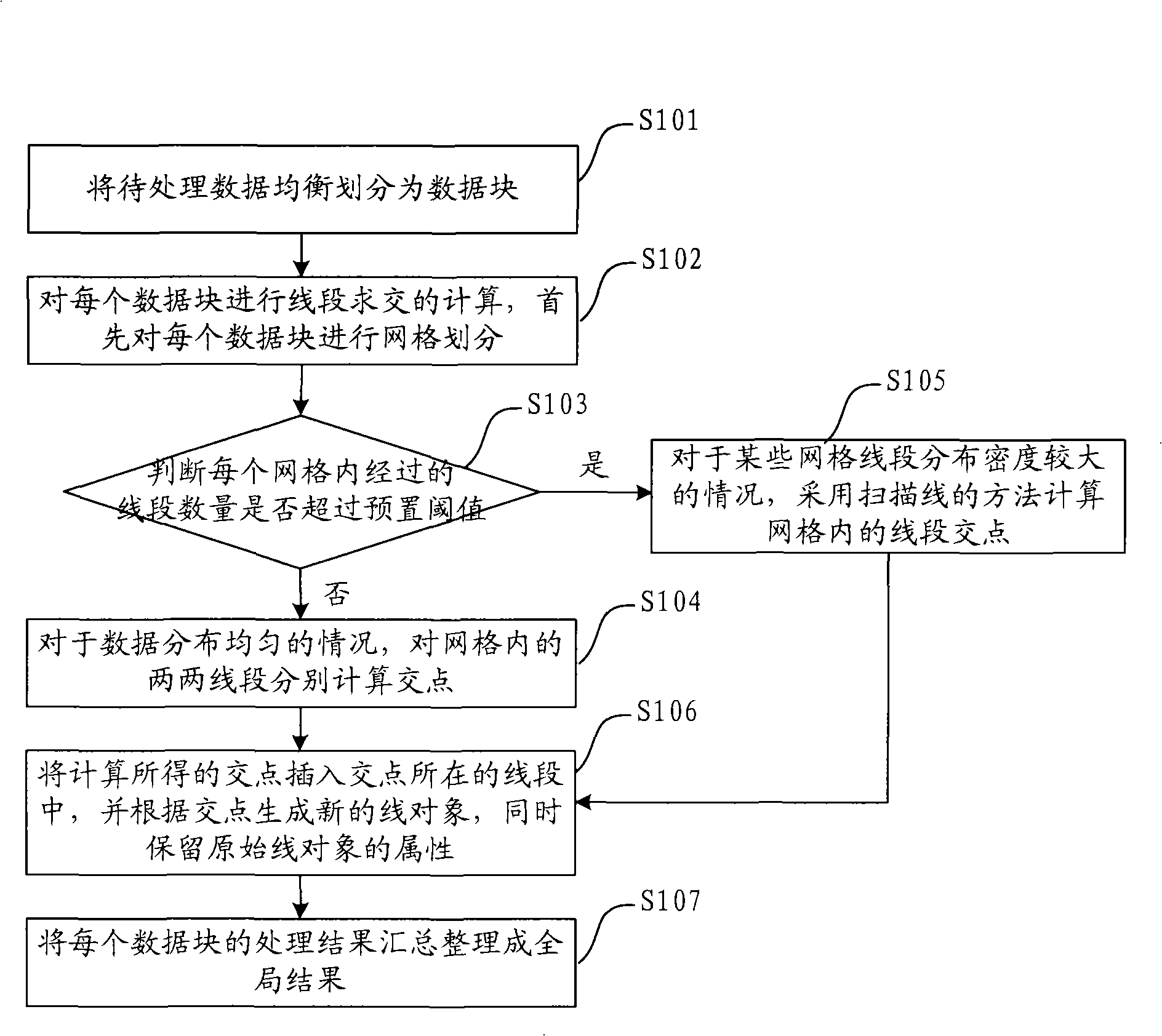
[0040] refer to figure 1 , is a flowchart of a method for intersecting line segments described in the embodiment.
[0041] S101. Evenly divide the data to be processed into data blocks, that is, logically divide the spatial data;
[0042] S102, performing line segment intersection calculation on each data block, first performing grid division on each data block;
[0043] Grid division is to divide a data block into multiple grids, that is, the line object of each line in the gridded data block, and all the line segments passing through the grid are kept in the grid. At this time, a line object in the data block Will be divided into multiple line objects.
[0044] S103, judging whether the number of passing line segments in each grid exceeds a preset threshold, if not, execute S104; if exceed, execute S105;
[0045] The judging criteria are used to measure whether the data distribution after gridding is uniform. If the data distribution is uniform, the distribution density ...
Embodiment 2
[0055] With the development of computer hardware equipment, mainstream computers have realized the transition from single-core, single-CPU to multi-core, multi-CPU. At present, most GIS spatial analysis algorithms are still based on the traditional single CPU implementation, so it is difficult to take advantage of the hardware on multi-core, multi-CPU machines, hindering performance improvement. In addition, with the rapid development of GIS technology, people have higher and higher requirements for the spatial analysis function of GIS software. It is becoming more and more difficult to adapt to the rapidly developing market demand of GIS.
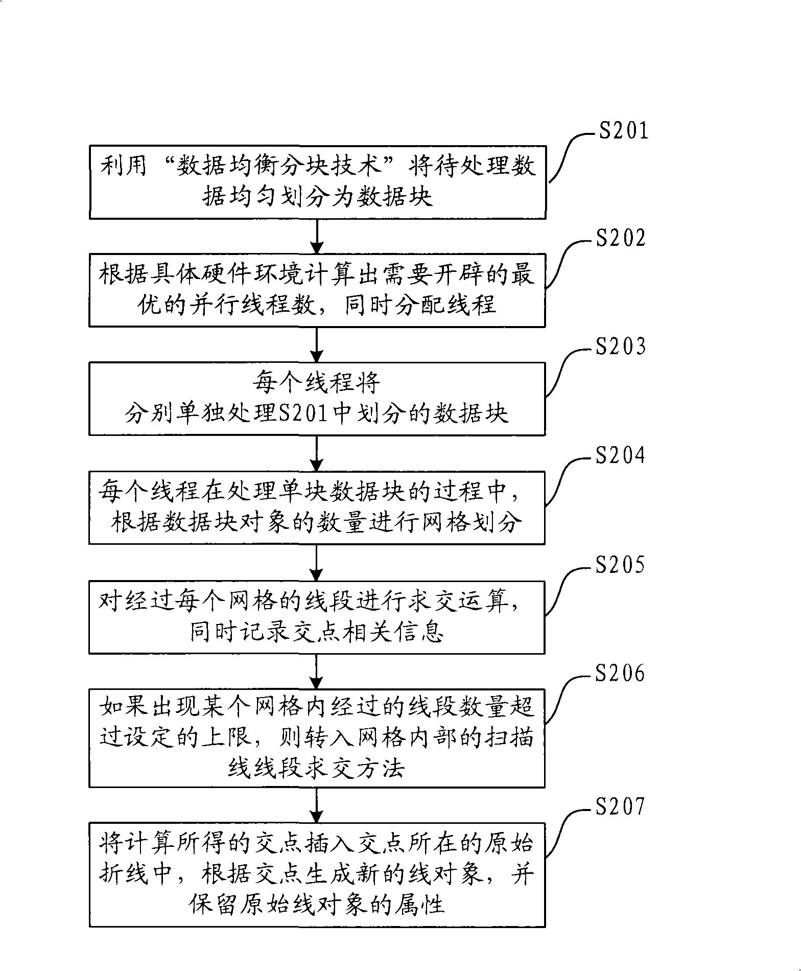
[0056] Therefore, based on the above method, the present invention also provides a preferred embodiment. This embodiment makes full use of computer system resources, adopts the mode of parallel computing to simultaneously intersect the line segments of multiple data blocks, realizes the full utilization of multi-core and multi-CPU hardwar...
PUM
 Abstract
Description
Claims
Application Information
 - Generate Ideas
- Intellectual Property
- Life Sciences
- Materials
- Tech Scout
- Unparalleled Data Quality
- Higher Quality Content
- 60% Fewer Hallucinations
Browse by: Latest US Patents, China's latest patents, Technical Efficacy Thesaurus, Application Domain, Technology Topic, Popular Technical Reports.
© 2025 PatSnap. All rights reserved.Legal|Privacy policy|Modern Slavery Act Transparency Statement|Sitemap|About US| Contact US: help@patsnap.com


