
War zone satellite navigation and location system

A satellite navigation and positioning system technology, applied in the field of satellite navigation and positioning, can solve problems such as weak satellite navigation signals, and achieve the effects of improving anti-interference ability, flexibility, and great military application value

Inactive Publication Date: 2007-12-12
NAT ASTRONOMICAL OBSERVATORIES CHINESE ACAD OF SCI
View PDF0 Cites 8 Cited by
  • Summary
  • Abstract
  • Description
  • Claims
  • Application Information

AI Technical Summary

Problems solved by technology

[0003] The purpose of the present invention is to disclose a satellite navigation and positioning system in a war zone to solve the problem that the satellite navigation signal is weak, overcome the enemy's interference to the satellite signal, and enable the satellite navigation system to perform normal navigation and positioning in an interfered environment

Method used


Image

  • War zone satellite navigation and location system
  • War zone satellite navigation and location system
  • War zone satellite navigation and location system

Examples


Embodiment Construction

[0015] specific implementation

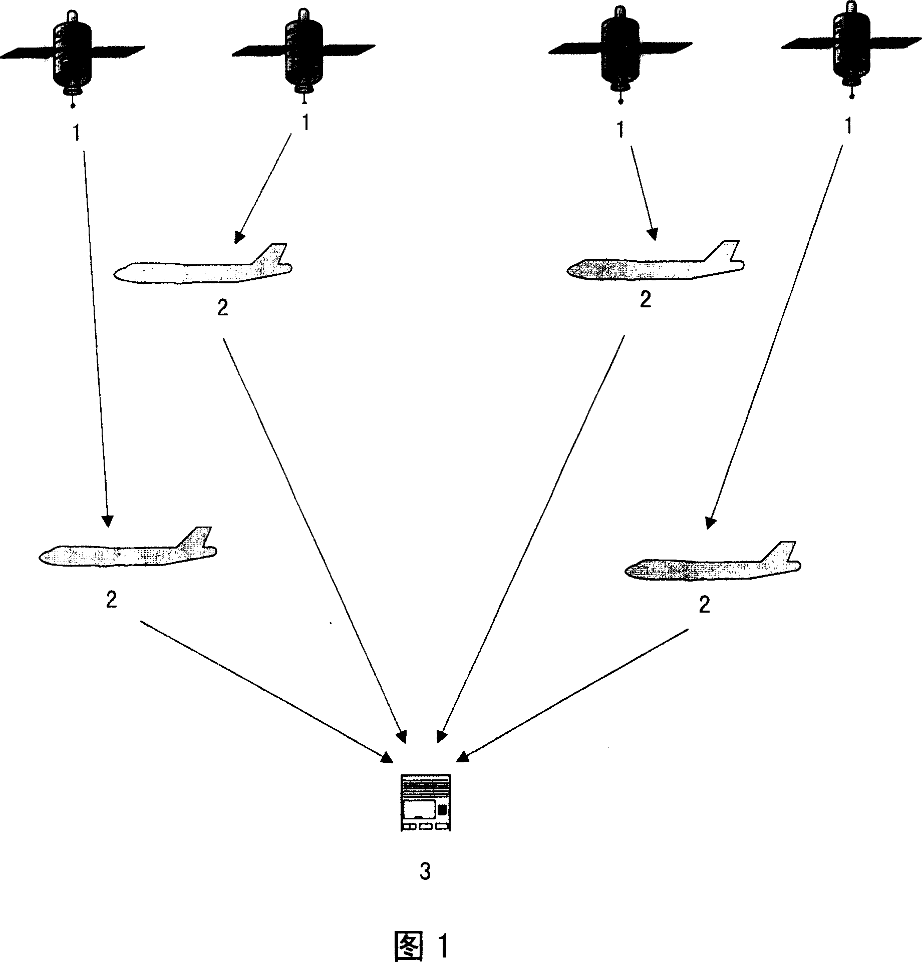
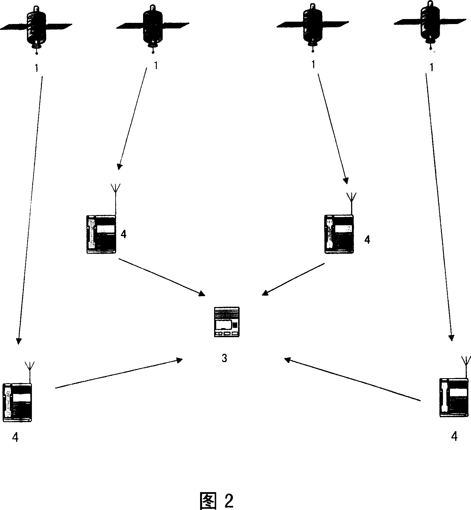
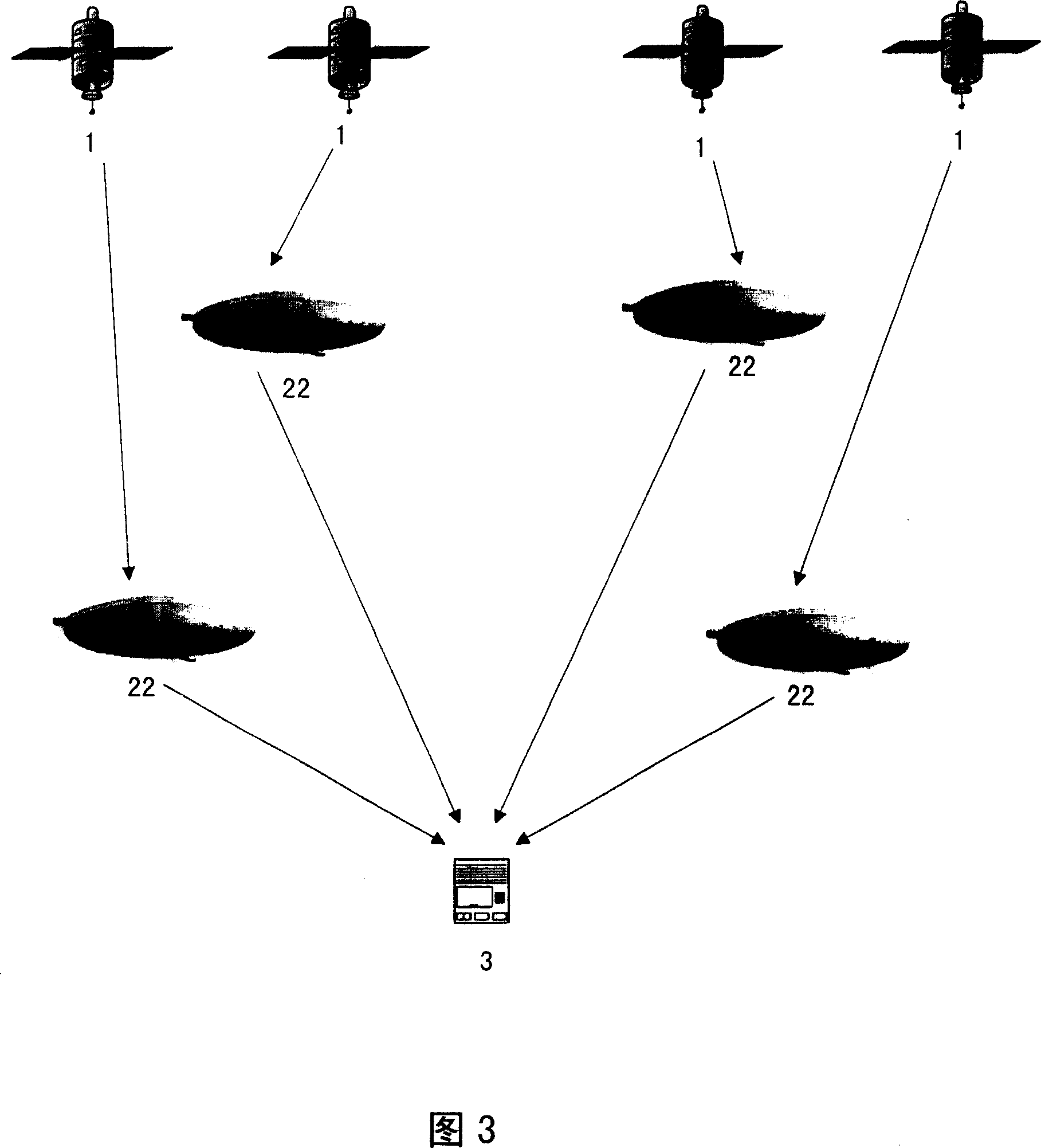
[0016] The patent of the present invention is a theater satellite navigation and positioning system, which enhances the satellite navigation system by using multiple different types of pseudolites. Because at least 4 satellite signals are required for satellite navigation and positioning, if pseudolites are used to form a theater satellite navigation and positioning system, at least 4 pseudolites are also required to form a pseudolite constellation composed of pseudolites. These pseudolites Broadcast high-power signals (signals can be directly generated by pseudolites, or pseudolites can receive navigation signals from geostationary satellites or other satellite navigation systems, and then amplify the signals and forward them), and serve as our own side in a disturbed battlefield environment Or friendly forces provide precise navigation information, so that the signal power of the pseudolite exceeds the enemy's jamming signal. Pseudolites can...


PUM


Abstract

A war field satellite navigation positioning system comprises the Earth synchronic satellite, false satellite, user navigation equipment, at least four false satellite formed satellite constellation being false satellite broadcasting big power navigation signal directly generated by false satellite, through false satellite receiving Earth synchronic satellite and other satellite navigation system navigating signal, which is amplified and transmitted, for the user navigation equipment receiver to receive the false constellation signal with the change of the software. It has limited coverage of the false satellite, agile and flexible, less in investment, strong in false satellite signal, improved in satellite navigation system interference ability, improved in satellite navigation positioning precision.

Description

technical field [0001] The invention relates to the technical field of satellite navigation and positioning, in particular to a satellite navigation and positioning system in a theater. Background technique [0002] The navigation signals transmitted by the navigation satellites in the satellite navigation and positioning system are relatively weak, and they are transmitted at a fixed frequency. If some anti-jamming measures are not taken, they will inevitably be interfered, especially in a war environment. It's an attempt to jam satellite signals. For example, a global positioning system (GPS) jammer with a transmission power of 1W can disable the C / A code receiver within 100km, and a 10W jammer can disable the P code receiver within 10km. The proportion of precision-guided weapons used in modern warfare has accounted for more than 95% of the total weapons used, and a considerable part of them are guided by satellite navigation, so weapons are very dependent on satellite n...

Claims


Application Information

Patent Timeline
IPC IPC(8): G01S5/02G01S5/14G01S19/01
Inventor 耿建平施浒立李圣明
Owner NAT ASTRONOMICAL OBSERVATORIES CHINESE ACAD OF SCI
Learn More