System for combining geographic information and visiting-card management and its method
An information management system and geographic information technology, applied in the field of systems integrating business card management and positioning coordinates
- Summary
- Abstract
- Description
- Claims
- Application Information
AI Technical Summary
Problems solved by technology
Method used
Image
Examples
Embodiment Construction
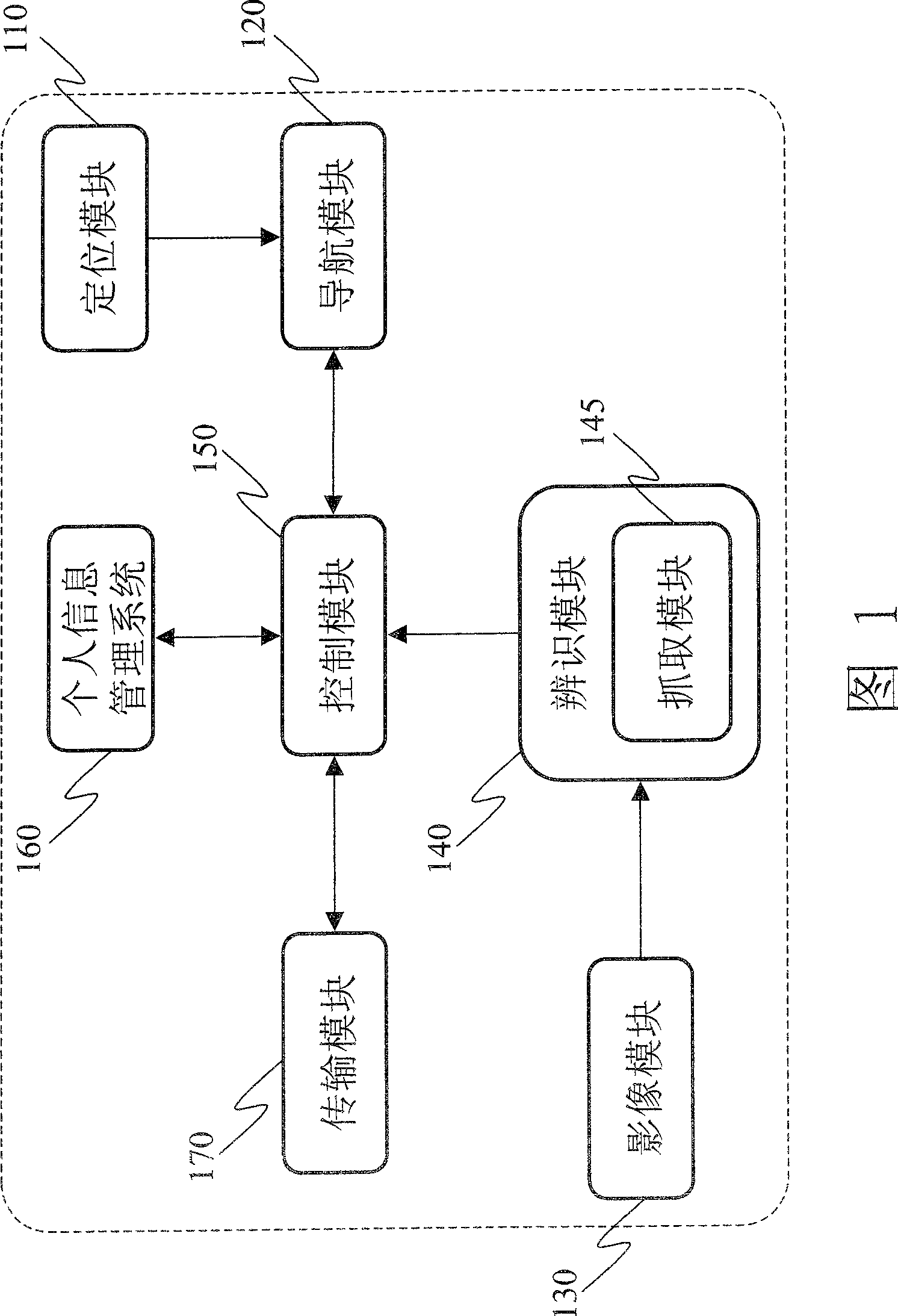
[0017] The invention provides a system and method combining geographic information and business card management. Please refer to FIG. 1, which is a system architecture diagram of the present invention, which includes an image module 130, and it is a small camera (camera) generally sold on the market, which can be used to photograph external objects, and through a charge-coupled device ( CCD, Charge-Coupled Device) or Complementary Metal-Oxide Semiconductor (CMOS, Complementary Metal-Oxide Semiconductor) and other photosensitive elements, so as to digitally store the image results of the subject.
[0018] A recognition module 140 is used to process the original digital image through text, and distinguish the obtained digital image into text and graphic parts, and use optical character recognition (OCR, optical character recognition) technology for the text part to convert the text part into plain text. Among them, the recognition module 140 also includes a capture module 145, ...
PUM
 Abstract
Description
Claims
Application Information
 - R&D
- Intellectual Property
- Life Sciences
- Materials
- Tech Scout
- Unparalleled Data Quality
- Higher Quality Content
- 60% Fewer Hallucinations
Browse by: Latest US Patents, China's latest patents, Technical Efficacy Thesaurus, Application Domain, Technology Topic, Popular Technical Reports.
© 2025 PatSnap. All rights reserved.Legal|Privacy policy|Modern Slavery Act Transparency Statement|Sitemap|About US| Contact US: help@patsnap.com


