
System and method of using automatically-identified prominent establishments in driving directions

a technology of automatic identification and prominent establishments, applied in the field of system and method, can solve the problems of not being familiar with street names and information not being readily visible to users

Inactive Publication Date: 2014-04-01
GOOGLE LLC
View PDF15 Cites 33 Cited by
  • Summary
  • Abstract
  • Description
  • Claims
  • Application Information

AI Technical Summary

Benefits of technology

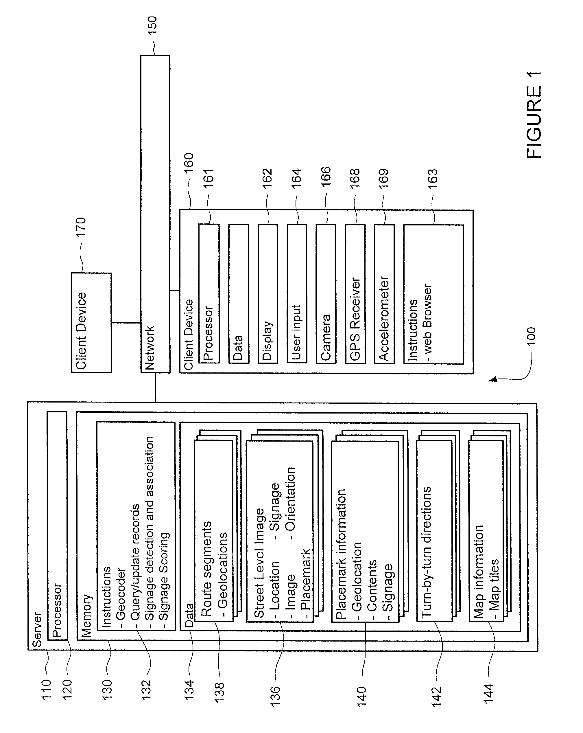
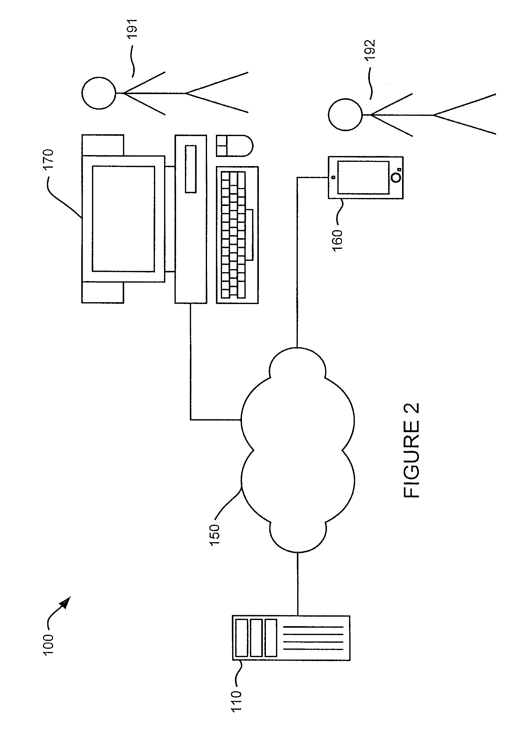
The invention provides a method and device for generating turn-by-turn directions on a network. The method involves receiving a request for directions, identifying a route, and selecting placemarks along the route based on their identifiability from the route. The placemarks are identified based on their signage that is associated with them. The selected placemark is then used to generate a turn-by-turn direction for the client device. The device includes a processor and memory for storing the instructions and directions. The device can also include a geographic location instrument to determine the current location of the device. The technical effect of the invention is to provide an efficient and effective way to generate turn-by-turn directions for users.

Problems solved by technology

However the user may not be familiar with the street names or route numbers provided by the navigation system, and this information may not be readily visible to the user while driving.

Method used


Image

  • System and method of using automatically-identified prominent establishments in driving directions
  • System and method of using automatically-identified prominent establishments in driving directions
  • System and method of using automatically-identified prominent establishments in driving directions

Examples


Embodiment Construction

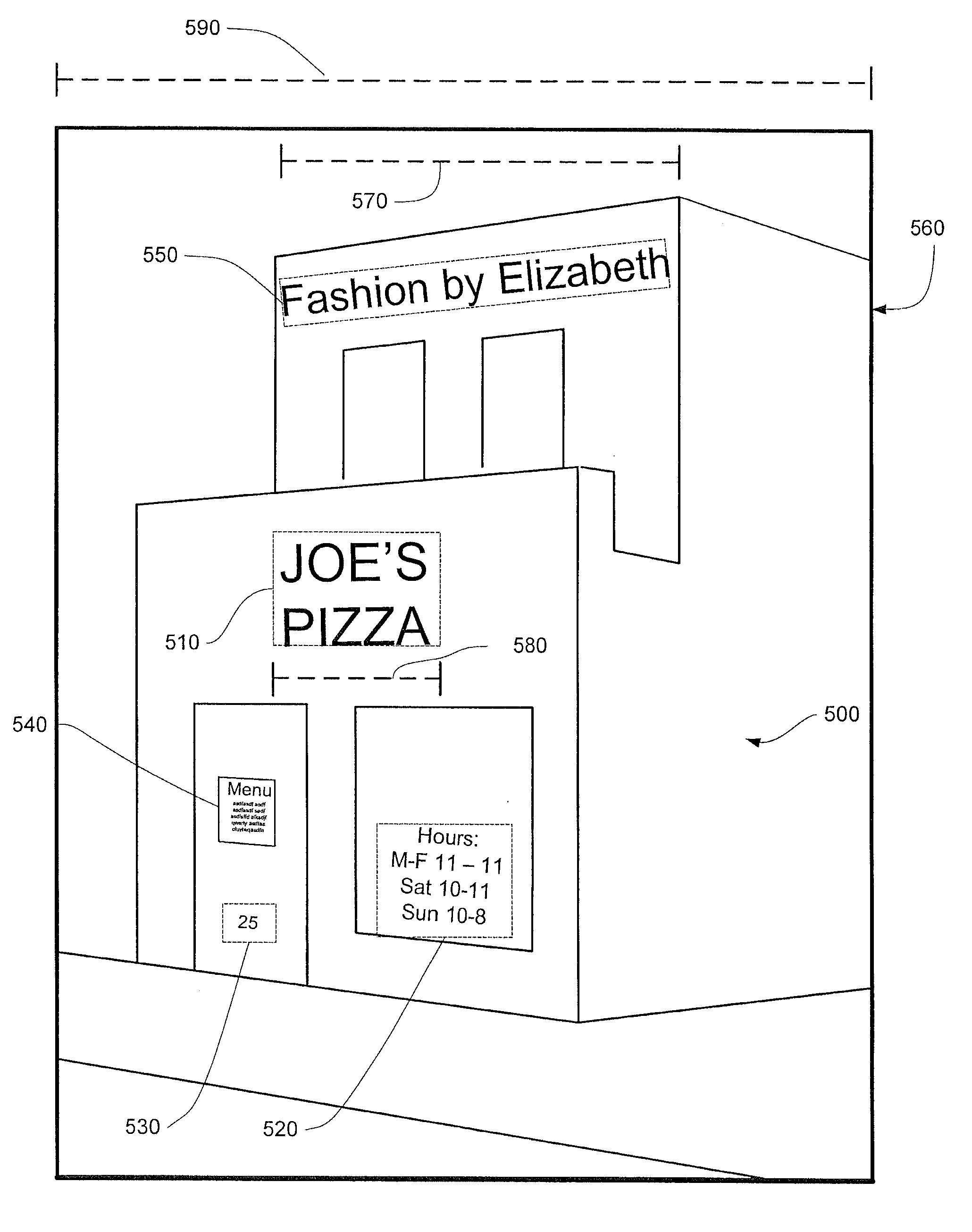
[0028]In one aspect, the system and method provides turn-by-turn directions including placemarks that are easily identifiable by a user. Each placemark represents a geographically located object such as a business or landmark. A client device of the user may transmit an initial and a final location. Upon receipt of the locations, a server may determine a route comprised of a plurality of route segments. For each route segment associated with a plurality of placemarks, the server may determine whether signage is associated with each placemark and whether the signage is visible from the route. The server may also determine how prominent the signage is from the route. The server selects the placemark by determining how easily the placemark may be identified from the route, based on the signage's visibility and prominence. The selected placemark is associated with the route segment and is used to generate a turn-by-turn direction for the route segment, where information associated with ...


PUM


Abstract

A system and method provides turn-by-turn directions by identifying placemarks, such as businesses or other landmarks that appear along a traveled route. The system may determine whether signage is associated with each placemark along the route and whether the signage is visible from the route. The system may also determine how prominent the signage is from the route. The system selects the placemark by determining how easily the placemark may be identified from the route, based on the signage's visibility and prominence. The selected placemark may then be identified in connection with the turn-by-turn directions.

Description

BACKGROUND[0001]Various navigation systems provide users with turn-by-turn directions. These systems include handheld GPS devices, mobile phones, vehicle-mounted devices, or other computers with access to mapping websites. In such systems, users input one or more locations and receive a route and turn-by-turn directions. The user may then follow the turn-by-turn directions to reach the one or more locations.[0002]In navigation systems which include portable devices such as handheld or vehicle-mounted devices, the device may provide instructions visually and / or audibly in order to assist the driver follow the route and turn-by-turn directions. These instructions may provide, for example, the name of the street, or the route number, onto which the driver is to turn, or the distance to the next turn. However the user may not be familiar with the street names or route numbers provided by the navigation system, and this information may not be readily visible to the user while driving.BRI...

Claims


Application Information

Patent Timeline
IPC IPC(8): G01C21/00G01C21/30
CPCG01C21/30G01C21/00G01C21/3644G01C21/32G01C21/3889G01C21/3881
Inventor URBACH, SHLOMORON, LIORGELLER, FELIX
Owner GOOGLE LLC
Learn More