
Resource tracking and communication system

a technology of resource tracking and communication system, applied in the field of emergency response systems and emergency equipment, can solve the problems of applicant experiencing the inefficiencies of the current resource management system, no guarantee of resource coordination in the rotation system, and the expectation of witnessing the loss of life and property, etc., and achieve the effect of negative impact on the execution of the im

Active Publication Date: 2013-09-03
MESSERLY JAMES PATRICK
View PDF15 Cites 45 Cited by
  • Summary
  • Abstract
  • Description
  • Claims
  • Application Information

AI Technical Summary

Benefits of technology

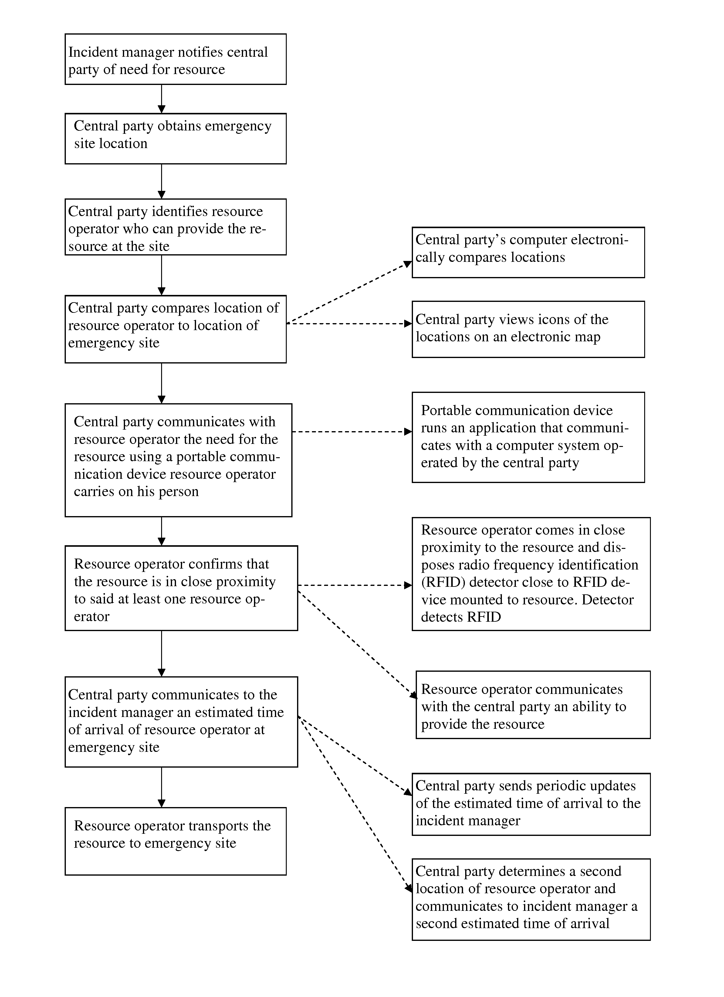
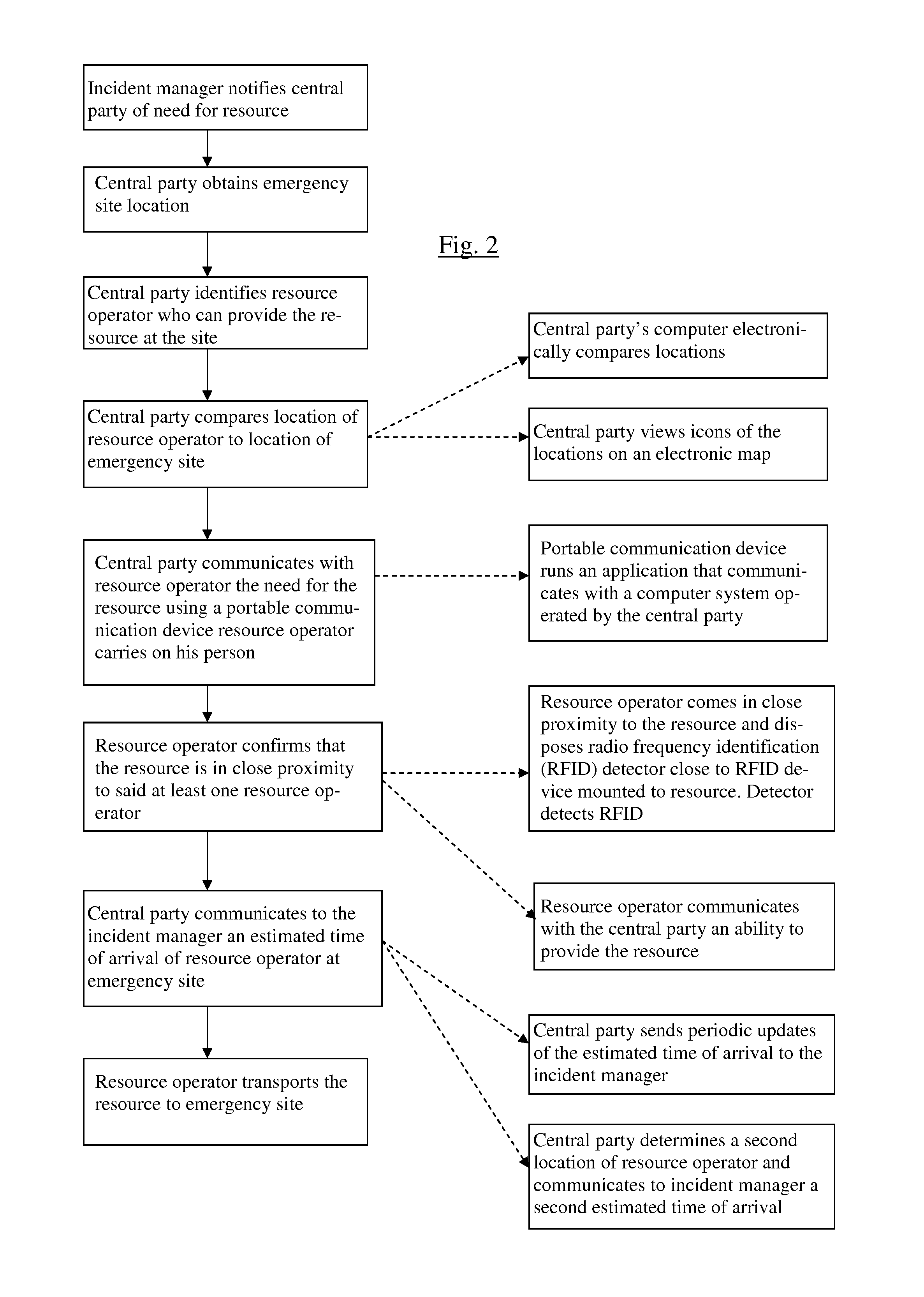
The patent describes a system and method for managing emergency resources in response to an incident. The system uses GPS-based cellular devices to track the location and confirm the arrival time of resource operators. This helps the incident manager know who is available to respond to the incident and ensures that the resources are in close proximity to the incident site. The system also allows for real-time communication between the incident manager and the resource operators, improving the efficiency of the response. Overall, the system helps to optimize resource allocation and improve the overall response to emergency incidents.

Problems solved by technology

This congestion was related to traffic slowing for incidents that blocked lanes, many of which required a tow truck to clear damaged or disabled vehicles.
With extensive experience in transportation, one can expect to witness the loss of life and property resulting from inadequate methods used to provide assistance at emergencies.
In thousands of incidents, Applicant experienced the inefficiencies of the current resource management system with which ancillary resources for government emergencies are selected and deployed.
The rotation system had no guarantee that the resources were coordinated by their proximity to the emergency.
This method does not provide the quickest clearance for events that produce congestion, and this results in collateral accidents.
It is apparent that these limited technologies have impeded other resource managers.
The failure to provide the quickest response to emergencies affects every government response to an emergency when civilian or other third party emergency response resources are summoned to assist.

Method used


Image

  • Resource tracking and communication system
  • Resource tracking and communication system
  • Resource tracking and communication system

Examples


example 1

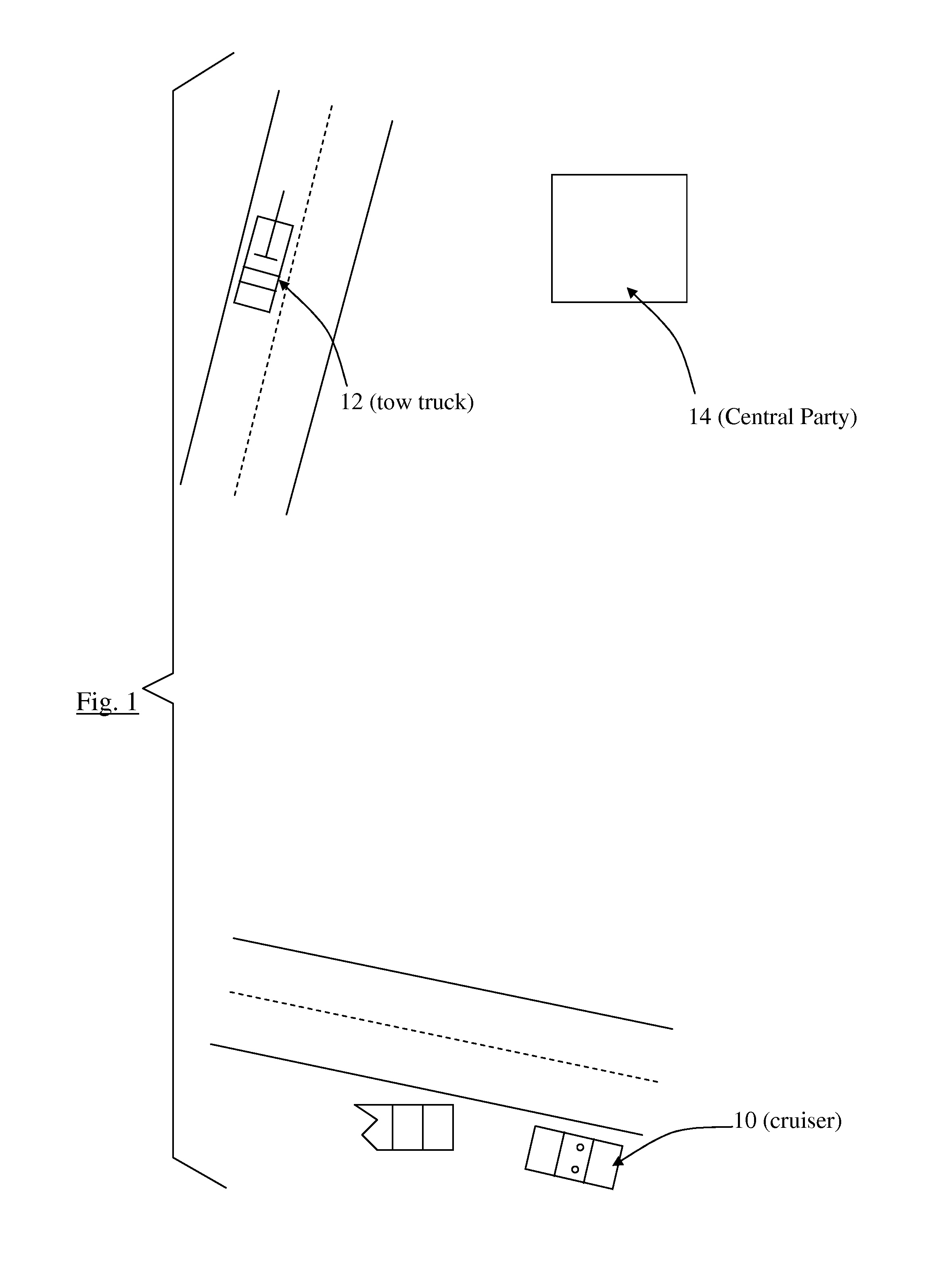
[0051]As shown in FIG. 1, a highway patrol officer arrives at a site and serves in the role of IM as he requests a tow truck 12 for an accident at the junction of two highways. The system recognizes the officer's cruiser 10 GPS coordinates and notifies the CP of the location of the site. This requested resource is entered into the system by the CP 14 using a graphical user interface that permits the selection of one or more of many pre-programmed resource options. Upon identifying the location, the system searches for and locates the closest available towing responders, and then presents the SLR operators in order of proximity to the incident. These responders have a pre-existing contract to have an operator standing by to respond within minutes and are an SLR A for the highway patrol. The closest SLR operator is contacted and the SLR A operator confirms proximity to the tow truck. After the confirmation is entered into the system, an ETA is created by the system and the CP is notif...

example 2

[0052]In the course of managing a mudslide incident which compromised the availability of drinking water for a rural community, the government officer IM uses a cellular phone to request privately owned water trucks of her dispatcher CP. These resource vehicles have a pre-existing contract with the government to respond on an intermittent basis as needed. They are not normally in daily service for the government, so there is no expectation that an operator is standing by to respond in minutes. The operators of these vehicles are considered to be an SLR B, and after arriving at the resource equipment, the operators confirm proximity using their smartphones to scan QR codes on the equipment and sending that scan to the CP. The operators then travel to the emergency site. The SLR B's are tracked as they travel to the site, and ETA's for each SLR B are communicated periodically to the IM via the radio. The locations of the SLR B's are also tracked afterward as they supply water to the c...

example 3

[0053]While managing a large HAZMAT spill in a mountainous area, the IM decides there is a need for locally owned dump trucks to assist with placing material in the path of HAZMAT draining down a ravine. These resources are not operating with prior contractual agreements and are not equipped with RFID cellular devices, and therefore are are SLR C status responders. While their locations are not determined by RFID cellular devices, the SLR C operators communicate their current location and proximity to their equipment to a CAD dispatcher at the RMC while departing to the incident. The dispatcher enters this into the system which creates a GPS location for the SLR C operators. The additional and updated locations while in transit for SLR C operators are determined as deemed necessary by the RMC. These actions will facilitate the tracking and determinations of ETA's for a responding SLR C. Once they arrive on the scene, the SLRC's are tracked to ensure that all invoiced miles invoiced ...


PUM


Abstract

A system and method for confirming that emergency resources are available to be used at a particular location, communicating to the incident manager at that location and estimated time of arrival of the resource, and tracking the resource during transit to the location for updating the estimated time of arrival.

Description

CROSS-REFERENCES TO RELATED APPLICATIONS[0001]This application claims the benefit of U.S. Provisional Application No. 61 / 508,761 filed Jul. 18, 2011. This prior application is hereby incorporated by reference.STATEMENT REGARDING FEDERALLY-SPONSORED RESEARCH AND DEVELOPMENT[0002](Not Applicable)REFERENCE TO AN APPENDIX[0003](Not Applicable)BACKGROUND OF THE INVENTION[0004]The invention relates to emergency response systems, emergency equipment and tracking of the emergency equipment, and to communication devices and processes used in responding to emergencies.[0005]Government has long held a responsibility to respond with rapid efficiency to geographically diverse, public emergencies. This need to coordinate the expedient dispatch of resources is intended to save lives, reduce injury and prevent any further loss of property. While the elements of natural disasters, traffic collisions and terrorism are greatly diverse, the solutions to efficiently responding to them are strikingly sim...

Claims


Application Information

Patent Timeline
Patent Type & Authority Patents(United States)
IPC IPC(8): H04M11/04H04B7/00H04M1/00G08B5/22G08B1/08H04W4/90H04W4/80
CPCH04W4/22G06Q10/06H04W4/023H04W4/008H04W4/90H04W4/80
Inventor MESSERLY, JAMES PATRICK
Owner MESSERLY JAMES PATRICK
Learn More