
Fusion of ground-based facade models with 3D building models

Active Publication Date: 2013-06-18
GOOGLE LLC
View PDF0 Cites 23 Cited by
  • Summary
  • Abstract
  • Description
  • Claims
  • Application Information

AI Technical Summary

Benefits of technology

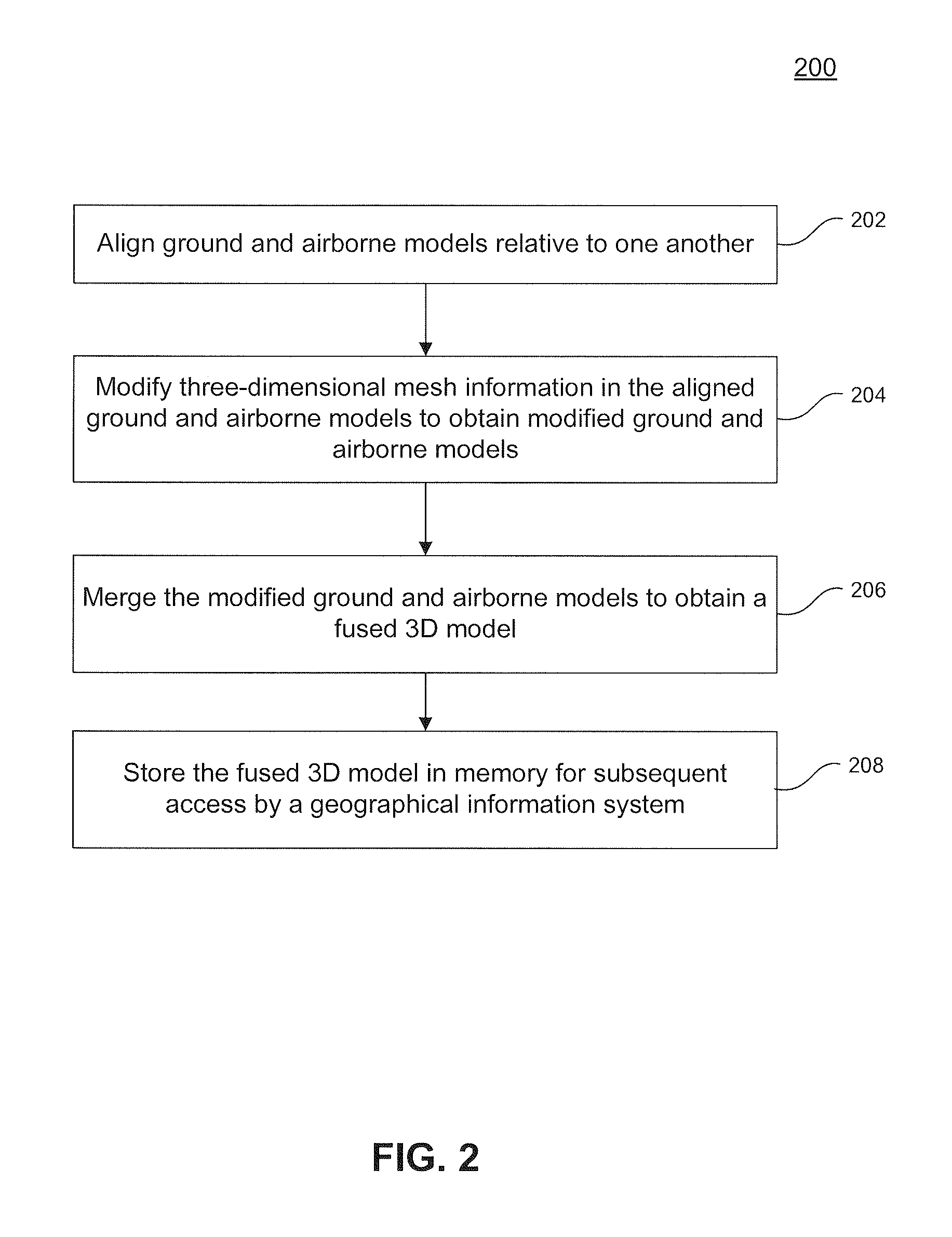
The patent describes a method and system for combining ground-based and airborne models to create a fused 3D model. This involves aligning the models, modifying the mesh information, and merging them to create a final model that describes a geographical area with greater detail and accuracy. This fused model can be stored for future reference by a geographical information system. The technical effect of this invention is better precision and accuracy in creating geographical information models, which can aid in various applications such as mapping and navigation.

Problems solved by technology

3D models can be manually made or custom-made with modeling creation and editing tools; however, adding enough detail is expensive and time consuming.
Like the manually created models mentioned before, such 3D models may be useful for flythroughs, but not for walk- or drive-throughs because of their low resolution.
On the other hand, 3D models can be created from ground-based views with very high texture and geometry-resolution, but may lack rooftops or back sides of buildings making them less attractive or undesirable in many GIS environments.
Attempts have been made to fuse airborne and ground-based models but these have limitations.
First, alignment of the models was done by correcting the vehicle pose with respect to airborne data, which does not work if the individual airborne models are not consistent with respect to each other (e.g., when an overhanging roof causes the street canyons to appear narrower for the airborne models).
This is not applicable for any model not created from DSMs.
Even for models created from DSMs it creates a process flow dependency since the ground-based models would always need to be created first.
Also, removal under this approach is typically inaccurate due to limited DSM resolution and the presence of foreground objects.
Finally, re-triangulation and hole closing in this approach was done with a blend mesh which resulted in a substantial increase in triangle count.

Method used


Image

  • Fusion of ground-based facade models with 3D building models
  • Fusion of ground-based facade models with 3D building models
  • Fusion of ground-based facade models with 3D building models

Examples


example computer embodiment

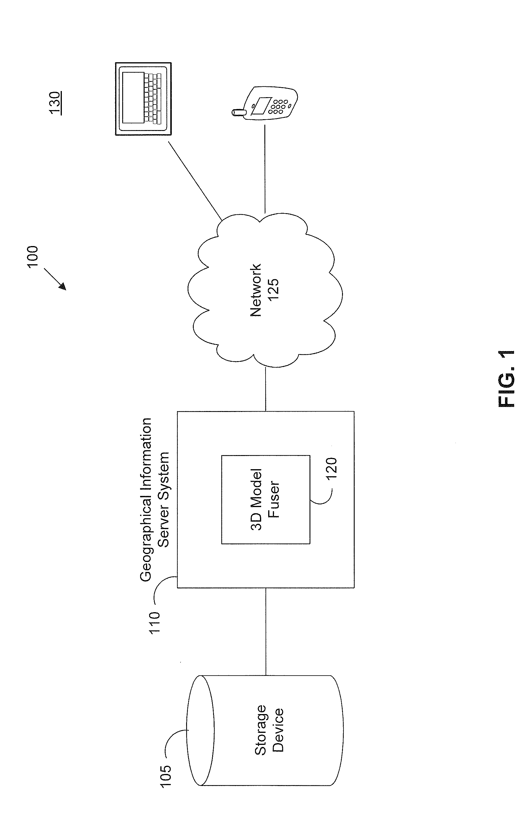
[0055]In an embodiment, the system and components of embodiments described herein are implemented using well known computing devices, such as the example computer 602 shown in FIG. 6. For example, geographical information server system 110 and 3D model fuser 120 can be implemented in software, firmware, hardware, or a combination thereof on one or more computer(s) 602.

[0056]The computer 602 can be any commercially available and well known computer capable of performing the functions described herein, such as computers available from International Business Machines, Apple, Sun, HP, Dell, Compaq, Cray, etc.

[0057]The computer 602 includes one or more processors (also called central processing units, or CPUs), such as a processor 606. The processor 606 is connected to a communication infrastructure 604.

[0058]The computer 602 also includes a main or primary memory 608, such as random access memory (RAM). The primary memory 608 has stored therein control logic 626A (computer software), an...


PUM


Abstract

Systems and methods for fusing three-dimensional (3D) ground and airborne models for a geographical information system are described herein. A method embodiment includes aligning the ground and airborne models relative to one another, modifying three-dimensional mesh information in the ground and airborne models after the aligning to obtain modified ground and airborne models, merging the modified ground and airborne models to obtained a fused 3D model and storing the fused 3D model in memory for subsequent access by the geographical information system. A system embodiment includes a 3D model fuser configured to align the ground and airborne models relative to one another, modify three-dimensional mesh information in the ground and airborne models after the aligning to obtain modified ground and airborne models, and merge the modified ground and airborne models to obtained a fused 3D model, and a storage device that stores the fused 3D model for subsequent access by the geographical information system.

Description

BACKGROUND[0001]1. Field[0002]The field relates to modeling for geographic information systems and services.[0003]2. Background Art[0004]Geographic information systems (GISs) are computer systems that provide an ability to store and to display spatial data. Geographic information systems often allow users to view, display, or navigate through environments that include spatial data. Spatial data can be any type of data relating to location including, but not limited to, maps, terrain, satellite imagery, photographic imagery, and / or other geographical information. Annotation, models, and other images, such as photographic images, can also be added to spatial data to enrich the environment and enhance user experience.[0005]Increasingly, it is desirable to provide even richer three-dimensional (3D) detail and imagery in GIS environments. One way is to add 3D models to a GIS. 3D models can be manually made or custom-made with modeling creation and editing tools; however, adding enough de...

Claims


Application Information

Patent Timeline
IPC IPC(8): G06T17/00
CPCG06T17/05
Inventor FRUEH, CHRISTIAN
Owner GOOGLE LLC
Learn More