
Satellite positioning-based guidance system that utilizes simulated inertial navigation system

a satellite positioning and navigation system technology, applied in the direction of using reradiation, navigation instruments, instruments, etc., can solve the problems of high gs acceleration, failure of g-unhardened imu system g-spinning gyroscopes, and high cost of g-hardening process

Inactive Publication Date: 2002-09-24
HUA CUONG TU +1
View PDF3 Cites 37 Cited by
  • Summary
  • Abstract
  • Description
  • Claims
  • Application Information

AI Technical Summary

Problems solved by technology

In some applications, however (for instance, for a non-thrusted vehicle such as a projectile), the Gs-accelerations are so high (G.apprxeq.20,000), that the G-unhardened inertial sensors of the IMU system (spinning gyroscopes) fail.
The G-hardening is a very expensive process.

Method used


Image

  • Satellite positioning-based guidance system that utilizes simulated inertial navigation system
  • Satellite positioning-based guidance system that utilizes simulated inertial navigation system
  • Satellite positioning-based guidance system that utilizes simulated inertial navigation system

Examples


Embodiment Construction

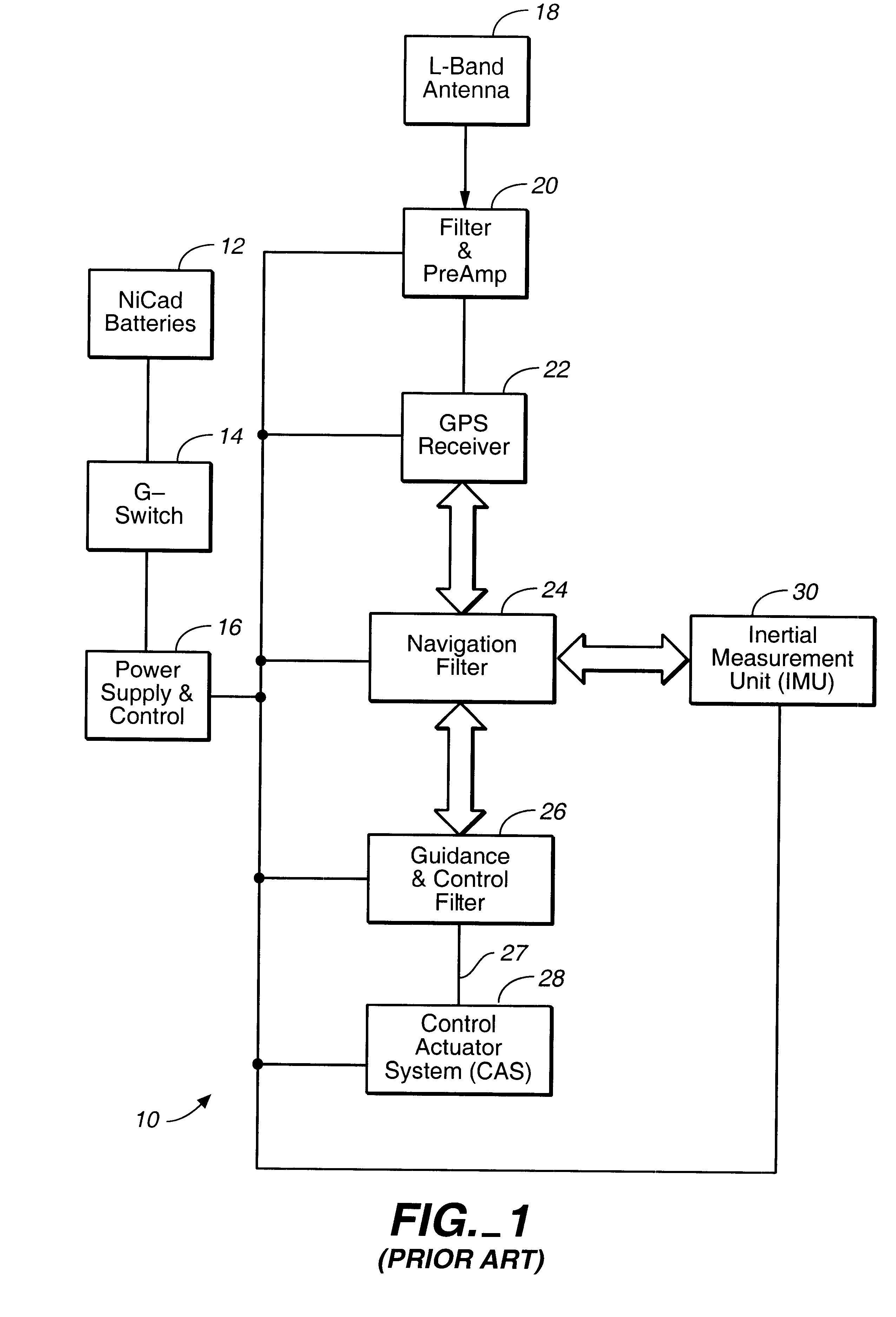
A prior art Navigation, Guidance, and Control (NG&C) system for a flight vehicle is based on, and constructed around, an Inertial Navigation System (INS). The GPS is used as a support device to update the Kalman filter equations. (Please, see discussion below).

The present invention, on the other hand, is directed to certain applications, especially to a Navigation, Guidance, and Control (NG&C) system for a non-thrusted flight vehicle such as a projectile. Indeed, the ballistic trajectory of a non-thrusted flight vehicle is very well defined, and the body motion of the non-thrusted flight vehicle itself is used as an inertial sensor that is implemented in software, for instance, by an Adaptive Kalman filter. The GPS is used as the only sensor hardware. The Adaptive Kalman filter regularly uses the GPS sensor output signals during the flight to provide corrections to initial conditions to a ballistic trajectory, to update the non-thrusted flight vehicle drag and other aerodynamic coef...


PUM


Abstract

A satellite positioning-based guidance system and method that utilize a simulated inertial navigation system are disclosed. The trajectory of the body of a non-thrusted flight vehicle is used instead of a conventional inertial navigation system. The attitude of the flight vehicle is determined using a satellite receiver, and the Extended Kalman filter is used to implement the navigation function.

Description

The current invention is in the field of optimization of the satellite-based navigation, guidance, and control system.DESCRIPTION OF THE BACKGROUND ARTA prior art conventional Navigation, Guidance, and Control (NG&C) system of missiles and space vehicles includes a GPS-based guidance system combined with an Inertial Navigation System (INS). The INS includes an Inertial Measurement Unit (IMU) designed to measure motions of a host vehicle. Specifically, the IMU block measures the swing of the proof mass of its accelerometers to infer translational accelerations of the host vehicle. Similarly, the IMU block measures the movement of the axes of its spinning gyroscopes to calculate rotational rates. Thus, the accuracy of an IMU-derived data is a function of how well motions of its inertial sensors are known and characterized.In some applications, however (for instance, for a non-thrusted vehicle such as a projectile), the Gs-accelerations are so high (G.apprxeq.20,000), that the G-unhard...

Claims


Application Information

Patent Timeline
IPC IPC(8): G05D1/10
CPCG05D1/107
Inventor HUA, CUONG TU
Owner HUA CUONG TU
Learn More