
Inversion of large, nearly-homogeneous geobodies via ultra low-dimensional shape representation using orthogonal basis functions

Active Publication Date: 2020-02-27
EXXON RES & ENG CO
View PDF0 Cites 5 Cited by
  • Summary
  • Abstract
  • Description
  • Claims
  • Application Information

AI Technical Summary

Benefits of technology

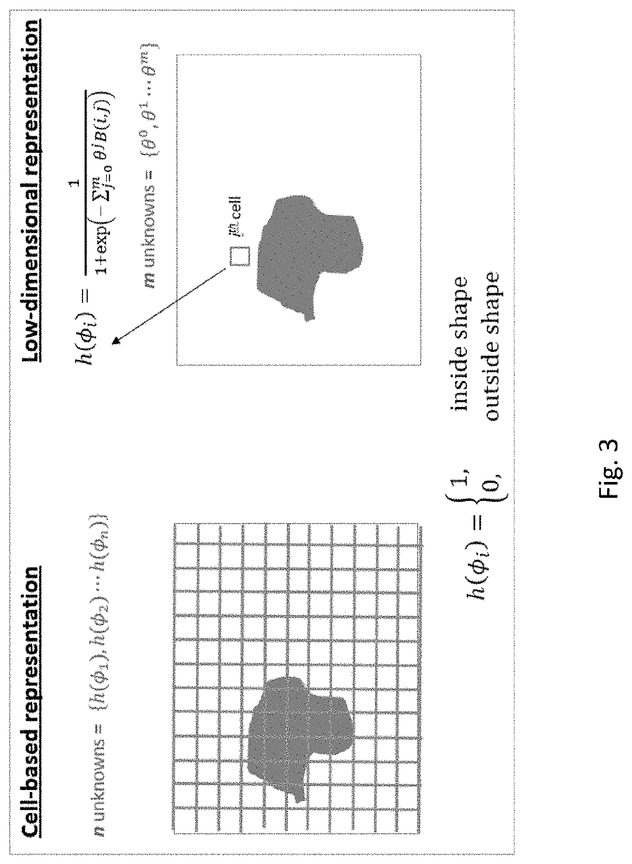
The patent describes a method for inverting geophysical data to create an image of the subsurface. The method involves defining the geometry of the subsurface using a set of basis functions, which are significantly smaller in number than the number of cells used in traditional representations. The method first updates the initial subsurface model using low-dimensional inversion, reducing the misfit between simulated geophysical data and the real data. This results in an image of the subsurface. The method then updates the subsurface model with the inverted geobody using cell-based inversion, again reducing the misfit between simulated geophysical data and the real data. The technical effect of the patent is a more precise and accurate method for interpreting geophysical data and creating images of the subsurface.

Problems solved by technology

Although parametric level-set methods can achieve a significant reduction in the dimensionality of the inversion space, it may not be enough for large 2D and, even more so, for 3D domains.

Method used


Image

  • Inversion of large, nearly-homogeneous geobodies via ultra low-dimensional shape representation using orthogonal basis functions
  • Inversion of large, nearly-homogeneous geobodies via ultra low-dimensional shape representation using orthogonal basis functions
  • Inversion of large, nearly-homogeneous geobodies via ultra low-dimensional shape representation using orthogonal basis functions

Examples


Embodiment Construction

[0037]Exemplary embodiments are described herein. However, to the extent that the following description is specific to a particular embodiment, this is intended to be for exemplary purposes only and simply provides a description of the exemplary embodiments. Accordingly, the invention is not limited to the specific embodiments described below, but rather, it includes all alternatives, modifications, and equivalents falling within the true spirit and scope of the appended claims.

[0038]The present technological advancement addresses the problem of geophysical inversion of large, nearly-homogeneous geobodies in a Full Waveform Inversion (FWI) framework. Of particular interest are subsurface salt bodies, as they serve as excellent seals for hydrocarbon reservoirs. For instance, there are many examples in the Gulf of Mexico and more recently offshore Brazil, where oil-bearing carbonate rocks are buried under thick complex layers of salt. Salt bodies offer a sharp contrast (with respect t...


PUM


Abstract

A two-stage method for iteratively inverting geophysical data for the purpose of subsurface imaging, including: obtaining at least one geophysical dataset and an initial subsurface model; representing subsurface such that a geometry of a geobody is defined using a set of basis functions, and a number of such basis functions is significantly smaller than the number of cells used in cell-based geobody representations, wherein an order of magnitude reduction is two or more for 2-D domains and 3 or more for 3-D domains; in a first stage, successively updating the initial subsurface model, only for the geobody, by performing iterative low-dimensional geophysical inversion based on minimizing a misfit between simulated geophysical data and the geophysical dataset, wherein the simulated geophysical data is generated from a current subsurface model at each iteration; generating a subsurface image from a final updated subsurface model obtained via the low-dimensional geophysical inversion, wherein the subsurface image includes an inverted geobody; in a second stage, successively updating the subsurface model with the inverted geobody by performing iterative cell-based geophysical inversion based on minimizing a misfit between simulated geophysical data and the geophysical dataset, wherein the simulated geophysical data is generated from a current subsurface model at each iteration.

Description

CROSS-REFERENCE TO RELATED APPLICATIONS[0001]This application claims the benefit of U.S. Provisional Application No. 62 / 723,191 filed Aug. 27, 2018, which is herein incorporated by reference in its entirety. The present application is related to U.S. patent application Ser. No. 15 / 492,316.FIELD OF THE INVENTION[0002]This disclosure relates generally to the field of geophysical prospecting and, more particularly, to seismic data processing. Specifically the disclosure relates to a method for performing full wavefield inversion (“FWI”) of geophysical data of subsurface regions with salt bodies.BACKGROUND OF THE INVENTION[0003]This section is intended to introduce various aspects of the art, which may be associated with exemplary embodiments of the present technological advantage. This discussion is believed to assist in providing a framework to facilitate a better understanding of particular aspects of the present technological advancement. Accordingly, it should be understood that th...

Claims


Application Information

Patent Timeline
IPC IPC(8): G06T17/05G06T17/20G06F17/50G06F17/16
CPCG06T17/05G06F30/23G06T17/20G06F17/16G01V1/282G01V1/301G01V2210/614G01V2210/665G01V2210/675
Inventor TEWARI, ASHUTOSHTRENEV, DIMITAR
Owner EXXON RES & ENG CO
Learn More