
Systems and methods for controlling aerial vehicles

a technology for controlling aerial vehicles and aircraft, applied in the direction of aircraft traffic control, balloon aircraft, instruments, etc., can solve the problem of undesirable reliance on forecast weather data alon

Active Publication Date: 2019-01-31
LOON LLC
View PDF24 Cites 4 Cited by
  • Summary
  • Abstract
  • Description
  • Claims
  • Application Information

AI Technical Summary

Benefits of technology

The patent text is about a system that can adjust the height of an aerial vehicle to a new height. One way to do this is to increase the altitude of the vehicle. The technical effect of this system is to enable more efficient and flexible navigation at different altitudes, improving the efficiency and accuracy of data collection and analysis.

Problems solved by technology

However, reliance on predicted weather data alone may be undesirable in planning and / or controlling flight paths of the aerial vehicles, because predicted weather data may be locally inaccurate and / or outdated.

Method used


Image

  • Systems and methods for controlling aerial vehicles
  • Systems and methods for controlling aerial vehicles
  • Systems and methods for controlling aerial vehicles

Examples


Embodiment Construction

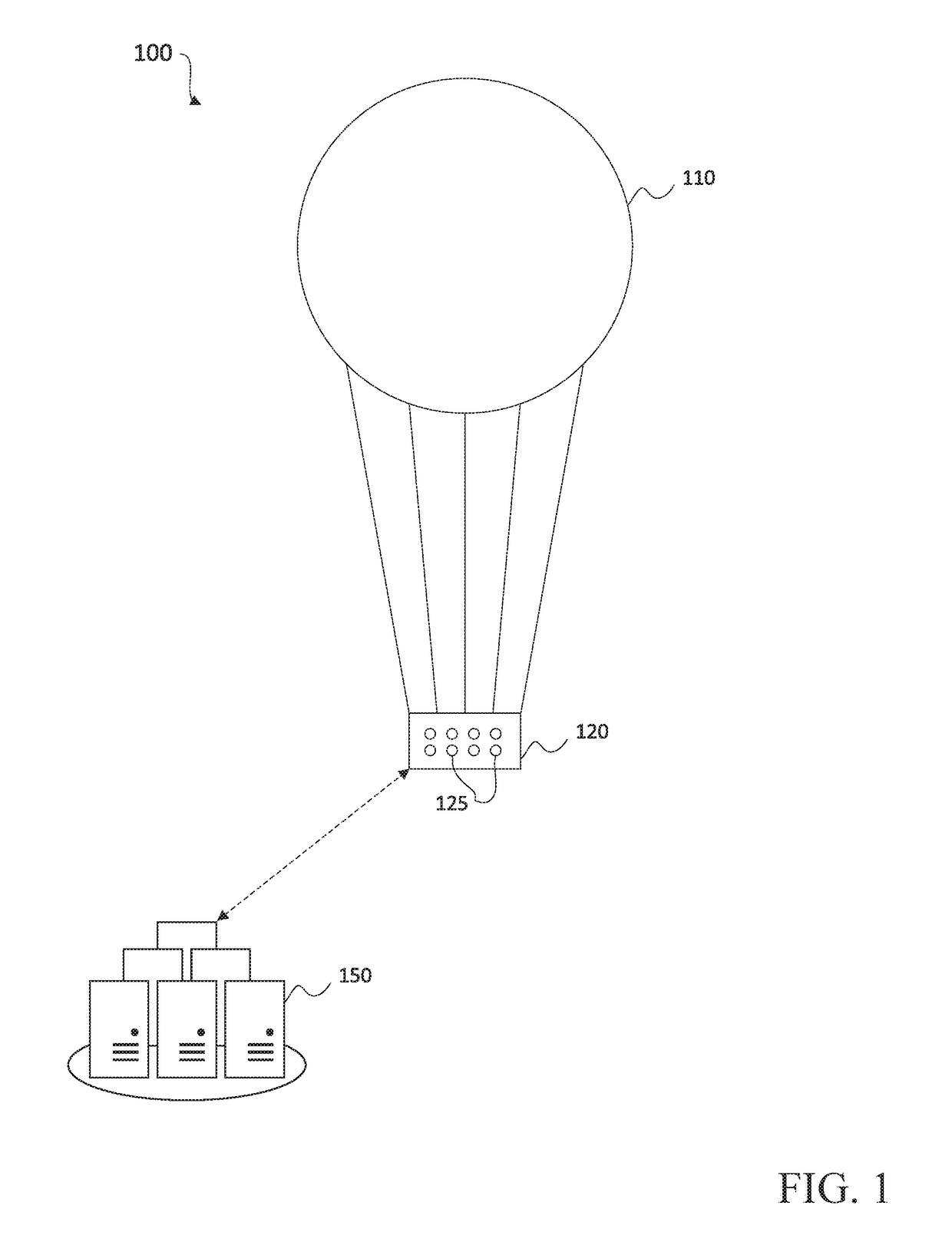
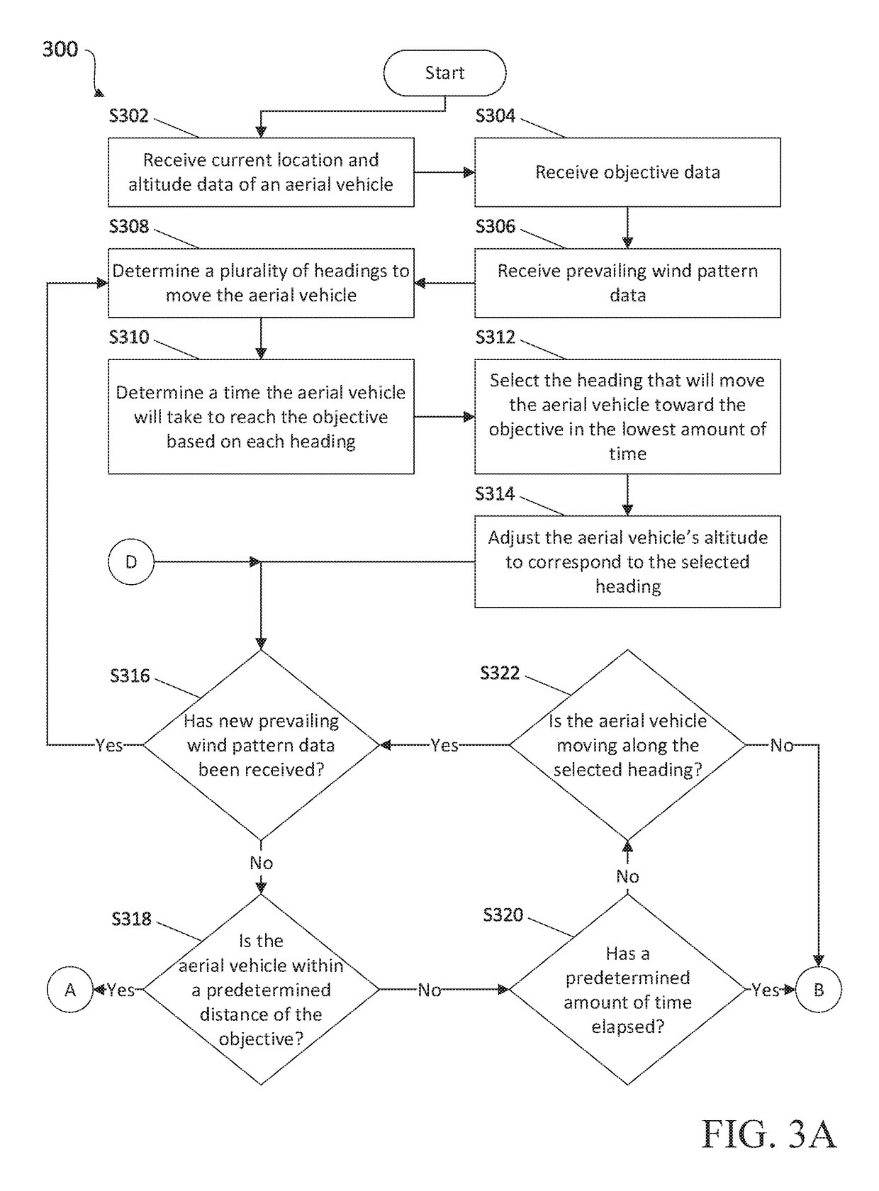
[0029]The present disclosure relates to systems and methods for controlling flight paths of aerial vehicles. More particularly, the present disclosure relates to planning a flight path or course of an aerial vehicle based on prevailing wind patterns, and seeking an optimal altitude for the aerial vehicle to move along a desired heading and / or at a desired speed, based on uncertainty in the prevailing wind patterns. The optimal altitude may be determined based on weather data received from external sources, and / or based on observations made by sensors and / or devices included in and / or coupled to the aerial vehicle. Wind vectors may be determined for various headings and altitudes, and the aerial vehicle may be allowed to move in a desired heading for a predetermined amount of time and / or until new prevailing wind pattern data is received. After a predetermined amount of time, or if it is determined that the aerial vehicle is not moving along the desired heading or otherwise not satis...


PUM


Abstract

Disclosed are systems, devices, and methods for controlling an aerial vehicle. An exemplary method may include receiving data indicating a location and an altitude of the aerial vehicle, receiving data indicating a destination of the aerial vehicle, determining a vector from the location of the aerial vehicle to the destination of the aerial vehicle, receiving prevailing wind pattern data regarding winds at the location and altitude of the aerial vehicle, planning a path for the aerial vehicle to move along the vector based on the prevailing wind pattern data, and causing the aerial vehicle to adjust the altitude of the aerial vehicle based on the prevailing wind pattern data and the planned path.

Description

BACKGROUNDTechnical Field[0001]The present disclosure relates to controlling flight of aerial vehicles, and, more particularly, to systems and methods for planning flight paths for the aerial vehicles and updating such flight paths when new data becomes available.Description of Related Art[0002]Unmanned aerial vehicles may travel at very high altitudes, including up to approximately 20 kilometers above the Earth's surface in the stratosphere, which is well above the altitudes of airplanes, wildlife, and weather events. In the stratosphere, winds are stratified, and each layer of wind may vary in speed and / or direction. The aerial vehicles may be moved using such winds, and a direction and / or speed of movement of the aerial vehicles may be controlled based on the winds in the various layers of the stratosphere. However, reliance on predicted weather data alone may be undesirable in planning and / or controlling flight paths of the aerial vehicles, because predicted weather data may be ...

Claims


Application Information

Patent Timeline
Patent Type & Authority Applications(United States)
IPC IPC(8): G05D1/04G08G5/00B64B1/40
CPCG05D1/042B64B1/40G08G5/0091G08G5/0034G05D1/105G08G5/0013G08G5/0026G08G5/0039G08G5/0052G08G5/0069B64U10/30B64U2201/10
Inventor CANDIDO, SALVATORE J.PONDA, SAMEERA SYLVIA
Owner LOON LLC
Learn More