
Navigation method and device

Active Publication Date: 2015-08-20
ARIEL UNIV RES & DEV
View PDF11 Cites 19 Cited by
  • Summary
  • Abstract
  • Description
  • Claims
  • Application Information

AI Technical Summary

Benefits of technology

This patent is about a method for identifying the location of a mobile device by using changes in the orientation of the imaging element during operation. Specifically, the changes in orientation help to break the symmetry between pixels in the image, which can identify the specific location of the mobile device. The method also includes obtaining a map of anchors in the specified area, which can improve future calculations. Additionally, the patent also mentions the possibility of identifying landmarks in the area, which can further enhance the accuracy of the mobile device's position.

Problems solved by technology

The utility of known SLAM techniques is limited in an indoor environment due to the lack of suitable landmarks.

Method used


Image

  • Navigation method and device
  • Navigation method and device
  • Navigation method and device

Examples


Embodiment Construction

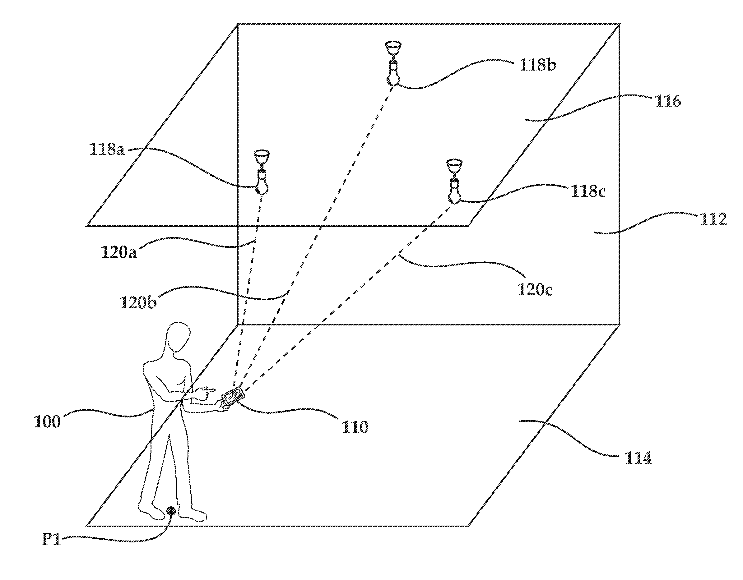
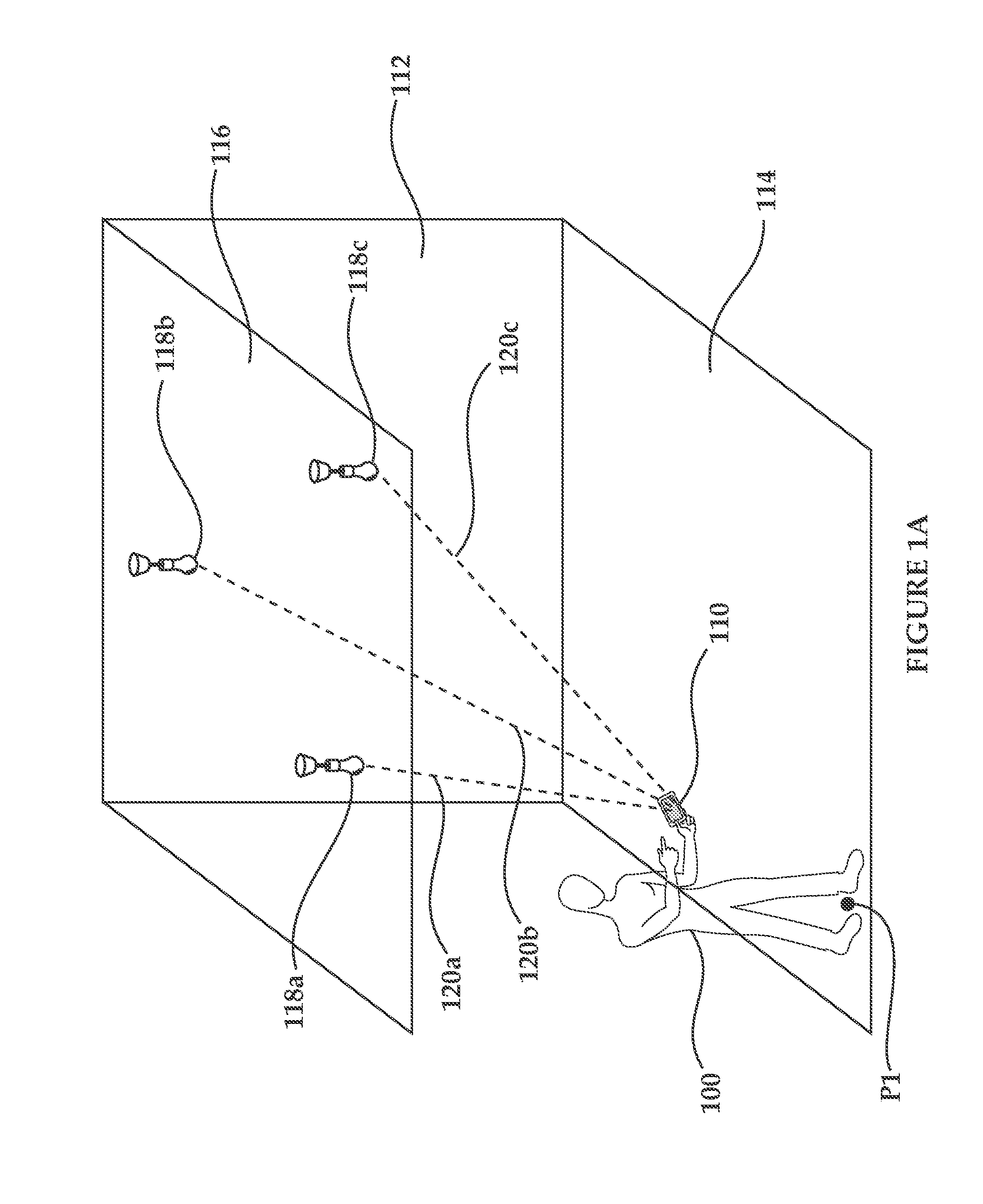
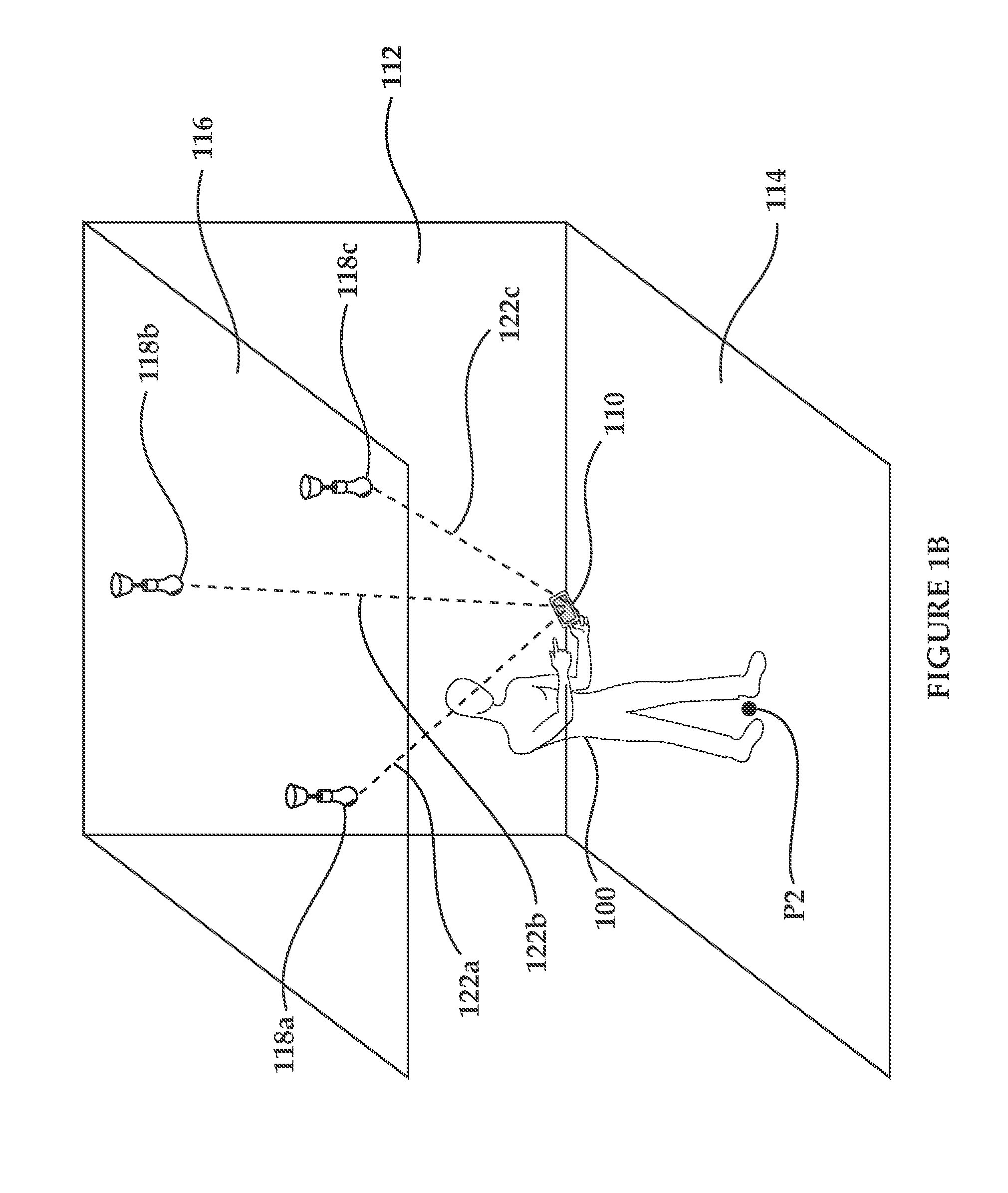
[0104]The invention, in some embodiments, relates to the field of mapping and location determination, and more particularly, but not exclusively, to methods, asssemblies and devices useful for assisting in accurately identifying the motion and / or location of a device in a specified area and mapping anchors in the specified area.

[0105]According to an aspect of some embodiments of the teachings herein, there is provided a method for determining the location of a mobile device in a specified area, comprising:[0106]from an imaging element forming part of a mobile device, at an imaging rate, capturing at least two images of a portion of a specified area at different time points; in each of the at least two captured images, identifying at least two anchors located in the portion that are found in the at least two captured images;[0107]processing the at least two images to identify changes in locations of the at least two identified anchors within the at least two images;[0108]from an orie...


PUM


Abstract

Disclosed are methods, assemblies and devices useful for identifying the location and / or motion of a mobile device in a specified area, for assisting in mapping a specified area and also to methods, assemblies and devices for determining a location of anchors found at fixed locations in a specified area.

Description

RELATED APPLICATION[0001]The present application gains priority from U.S. Provisional Patent Application 61 / 677,495 filed 31 Jul. 2012, which is incorporated by reference as if fully set-forth herein.FIELD AND BACKGROUND OF THE INVENTION[0002]The invention, in some embodiments, relates to the field of mapping and location determination, and more particularly, but not exclusively, to methods, assemblies and devices useful for identifying the location and / or motion of a mobile device in a specified area, for assisting in mapping a specified area and also to methods, assemblies and devices for determining a location of anchors found at fixed locations in a specified area.[0003]There is often a need to determine the location of an object found in a specified area with great accuracy. For example, in the field of Location-Based Services (LBS), it is often required to known the location of a person with great accuracy.[0004]An inertial navigation system (INS) is a navigation aid that uses...

Claims


Application Information

Patent Timeline
IPC IPC(8): H04W4/04H04W4/00H04W4/02H04W4/029H04W4/021H04W4/80
CPCG01S5/163H04W4/029H04W4/026H04W4/021H04W4/80H04W4/023H04W4/027G01S2201/01G01S1/7034H04W84/12
Inventor BEN-MOSHE, BOAZSHVALB, NIR
Owner ARIEL UNIV RES & DEV
Learn More