Method for imaging the earth's subsurface using passive seismic sensing
a technology of seismic sensing and earth's subsurface, which is applied in the field of seismic imaging of the earth's subsurface, can solve the problems of unsafe or impracticable use of seismic sources, and the inability to use conventional controlled source seismic techniques
- Summary
- Abstract
- Description
- Claims
- Application Information
AI Technical Summary
Problems solved by technology
Method used
Image

Examples
Embodiment Construction
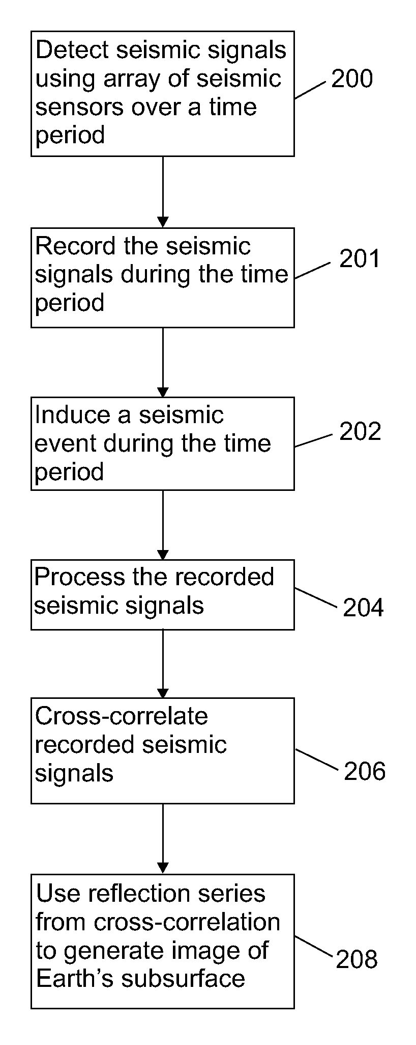
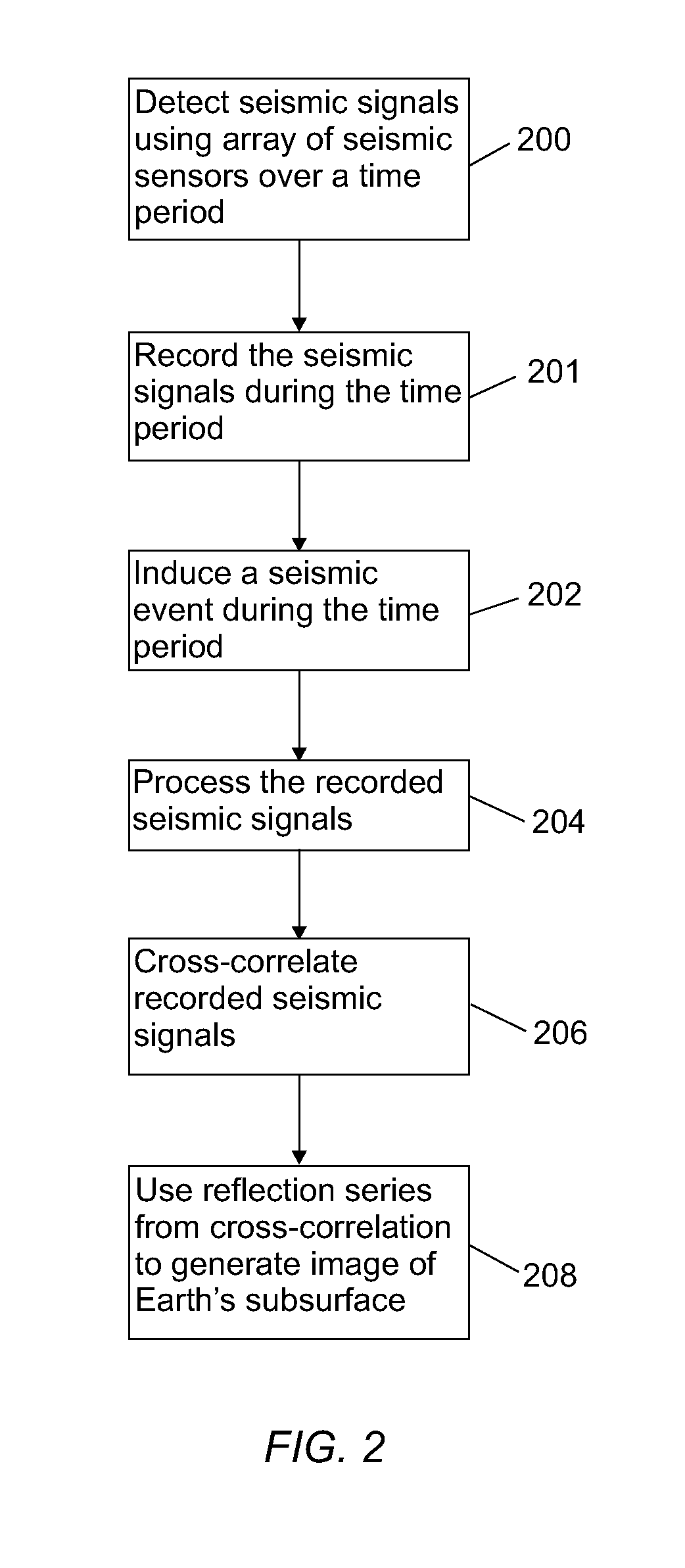
[0012]The invention will now be described in detail with reference to a few examples, as illustrated in the accompanying drawings. In describing the examples, numerous specific details are set forth in order to provide a thorough understanding of the invention. However, it will be apparent to those skilled in the art that the invention may be practiced without some or all of such specific details. In other instances, well-known features and / or process steps have not been described in detail so as not to unnecessarily obscure the invention. In addition, like or identical reference numerals are used to identify common or similar elements.
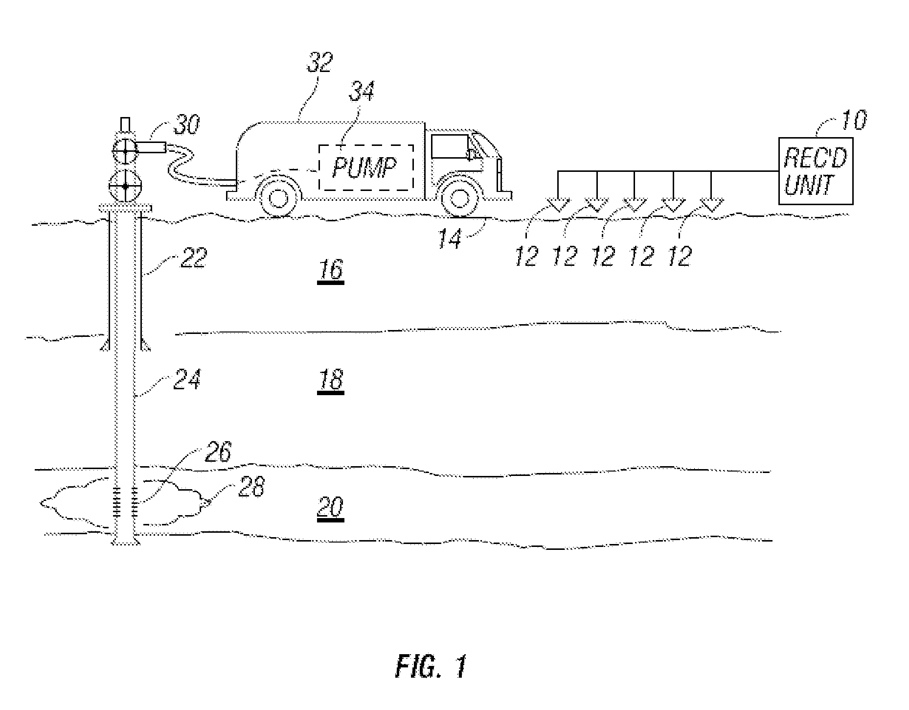
[0013]FIG. 1 shows a wellbore 22 drilled through subsurface formations 16, 18, 20. In this example, one of the subsurface formations, shown at 20 can be a hydrocarbon producing formation. A wellbore tubing 24 including perforations 26 for receiving fluid from the hydrocarbon producing formation 20 is deployed in the wellbore 22. The wellbore tubing 24...
PUM
 Abstract
Description
Claims
Application Information
 - R&D
- Intellectual Property
- Life Sciences
- Materials
- Tech Scout
- Unparalleled Data Quality
- Higher Quality Content
- 60% Fewer Hallucinations
Browse by: Latest US Patents, China's latest patents, Technical Efficacy Thesaurus, Application Domain, Technology Topic, Popular Technical Reports.
© 2025 PatSnap. All rights reserved.Legal|Privacy policy|Modern Slavery Act Transparency Statement|Sitemap|About US| Contact US: help@patsnap.com