
Method And Apparatus For Creating Map Data And Method And Apparatus For Route Search

a map data and mapping technology, applied in maps/plans/charts, navigation instruments, maps, etc., can solve the problems of increasing communication costs, large amount of difference data of exclusive networks, large data size of road information, etc., to reduce the size of difference data used when the map is updated, narrow down the search range, and reduce the effect of communication cos

Inactive Publication Date: 2007-08-02
ALPINE ELECTRONICS INC +1
View PDF26 Cites 22 Cited by
  • Summary
  • Abstract
  • Description
  • Claims
  • Application Information

AI Technical Summary

Benefits of technology

[0019]In the present invention, the map data includes, for individual combinations of two meshes at a predetermined level, data for identifying meshes at the predetermined level that are used to search for routes from one mesh in each of the combinations of two meshes to the other mesh in each of the combinations of two meshes as search range data. Thus, the search range can be narrowed down using the search range data, thereby enabling a high-speed route search.
[0020]Furthermore, in the present invention, only identification data of meshes subject to search needs to be stored as search range data. Thus, the size of the search range data and the size of difference data that is used when the map is updated can be reduced.
[0021]Furthermore, in the present invention, a search is performed from boundary-exit links in a first mesh until the search cannot be performed and, after performing the search, all routes from the boundary-exit links in the first mesh to boundary-entrance links in a second mesh are obtained with reference to the search result, and search range data corresponding to a combination of the first and second meshes is created by determining meshes to which links that constitute each of the searched routes belong. Thus, search range data can be created at a high speed.

Problems solved by technology

In the first known technique, a problem exists in that the data size of road information is large because the number of exclusive networks is very large.
Furthermore, when difference map data is created and when the map data is updated with the difference map data, the amount of difference data of exclusive networks is large.
Thus, when the difference map data is obtained through a network, the time necessary to transmit the difference map data is disadvantageously long, thereby increasing the communication cost.
Furthermore, the time necessary to update the map is long.
However, even in this case, unnecessary search branches are disadvantageously extended, so that the search time is extended. FIG. 17 shows how search branches are extended when a route from the Tokyo station to the Osaka station is searched.

Method used


Image

  • Method And Apparatus For Creating Map Data And Method And Apparatus For Route Search
  • Method And Apparatus For Creating Map Data And Method And Apparatus For Route Search
  • Method And Apparatus For Creating Map Data And Method And Apparatus For Route Search

Examples


Embodiment Construction

(A) Outline of the Invention

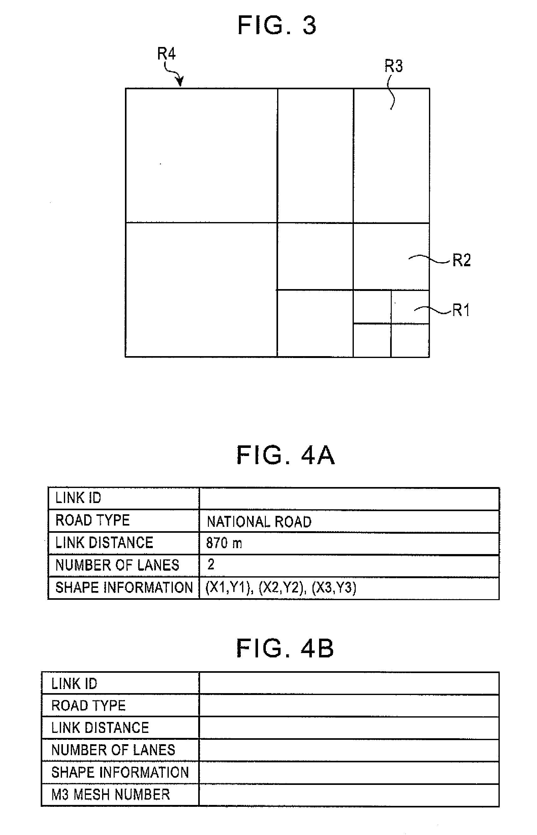
[0039]FIG. 1 is an illustration of road information included in map data according to the present invention. A plurality of levels (levels 1 to 4) corresponding to levels of detail are set, meshes at the individual levels are stratified, and road information is constructed of road information RI1 to RI4 of the individual meshes at the individual levels and search range data SRD that is used when a route search is performed.

[0040]Level 1 is a part for identifying map information of roads subject to guidance and roads not subject to guidance. Level 2 is a part for identifying road information of roads subject to guidance. Level 3 is a part for identifying map information of main roads. Level 4 is a part for identifying map information of superior main roads (prefectural roads, national roads, and expressways).

[0041]The search range data SRD in the map data includes, for the combination of two particular meshes M1 and M2 at a predetermined level (for example...


PUM


Abstract

A method for creating map data for navigation includes setting a plurality of levels corresponding to levels of detail, stratifying meshes at the individual levels, and creating map data that includes road information of the individual meshes at the individual levels. The map data includes, for individual combinations of two meshes at a predetermined level, data for identifying meshes at the predetermined level that are used to search for routes from one mesh in each of the combinations of two meshes to the other mesh in each of the combinations of two meshes as search range data.

Description

RELATED APPLICATIONS[0001]The present application claims priority to Japanese Patent Application Number 2006-020436, filed Jan. 30, 2006, the entirety of which is hereby incorporated by reference.BACKGROUND OF THE INVENTION[0002]1. Field of the Invention[0003]The present invention relates to methods and apparatuses for creating map data and methods and apparatuses for conducting a route search, and in particular, relates to a method for creating map data and a method for conducting a route search for navigation, and apparatuses that realize these methods, in which a plurality of levels corresponding to levels of detail are set, meshes at the individual levels are stratified, and map data that includes road information of the individual meshes at the individual levels is created.[0004]2. Description of the Related Art[0005]A navigation apparatus reads map data corresponding to the current position of a vehicle from a medium for storing a map, such as a compact disk read only memory (...

Claims


Application Information

Patent Timeline
IPC IPC(8): G01C21/32
CPCG01C21/32G09B29/102G01C21/3446G01C21/3881G01C21/3815G01C21/3878
Inventor SEKINE, MINORUOHIRA, MASAAKI
Owner ALPINE ELECTRONICS INC
Learn More