
Map based estimations, and information search

Inactive Publication Date: 2006-06-08
ATHALYE RAVI G A
View PDF5 Cites 28 Cited by
  • Summary
  • Abstract
  • Description
  • Claims
  • Application Information

AI Technical Summary

Benefits of technology

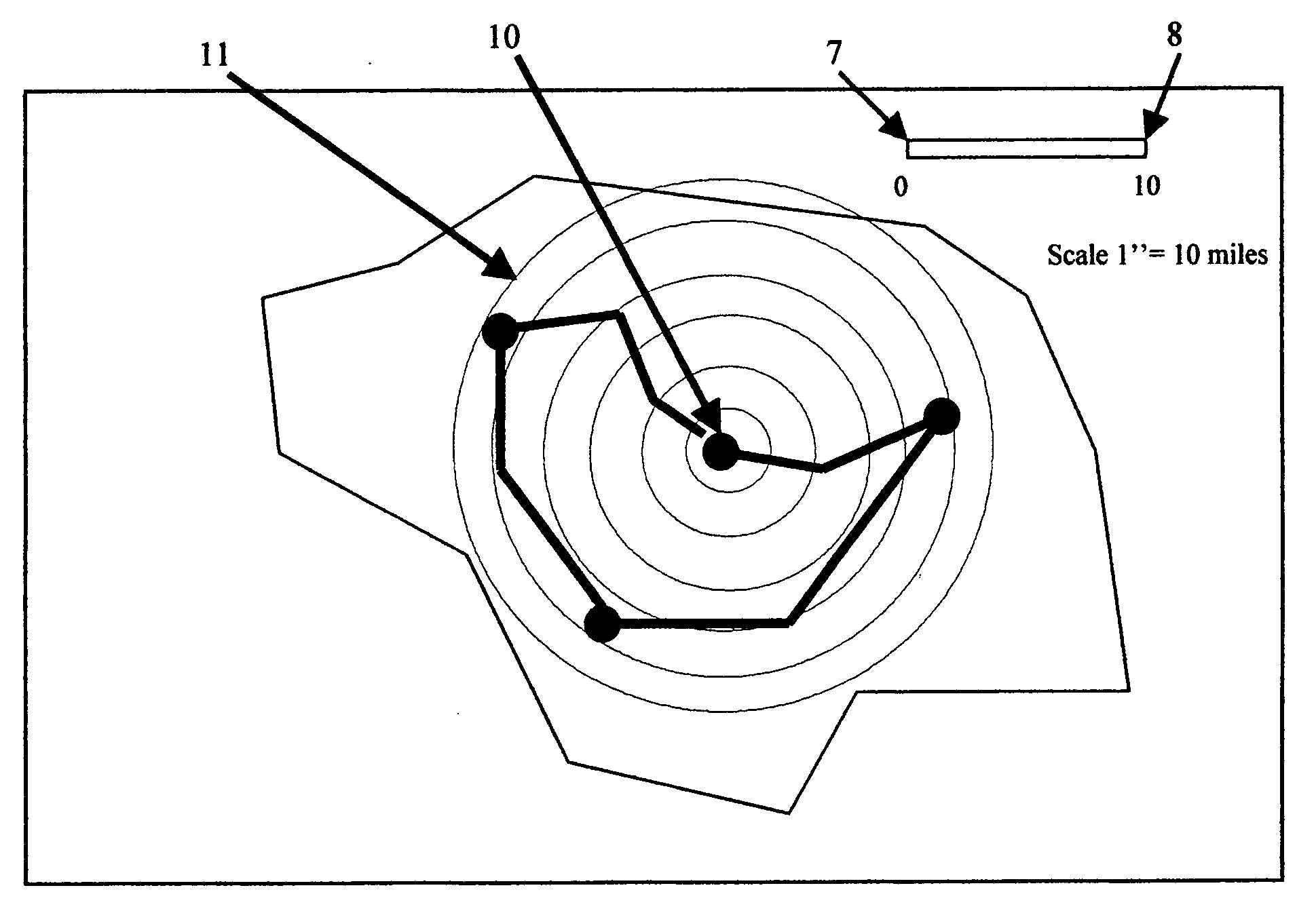
[0022] It is an object of this invention to provide a system which provides a visual tool in the form of a mobile circular scale that enables accurate visualization of distances around locations of interest.

Problems solved by technology

The scale has limited functionality.
The software available today though can provide driving instructions and distances between locations, the maps are inconvenient for a family trying to identify location that are optimally located from multiple addresses of work and schools.

Method used


Image

  • Map based estimations, and information search
  • Map based estimations, and information search
  • Map based estimations, and information search

Examples


Embodiment Construction

[0073] The method described herein is one way of enabling the functions and that there can be other ways to do the same and are within the scope of this patent application.

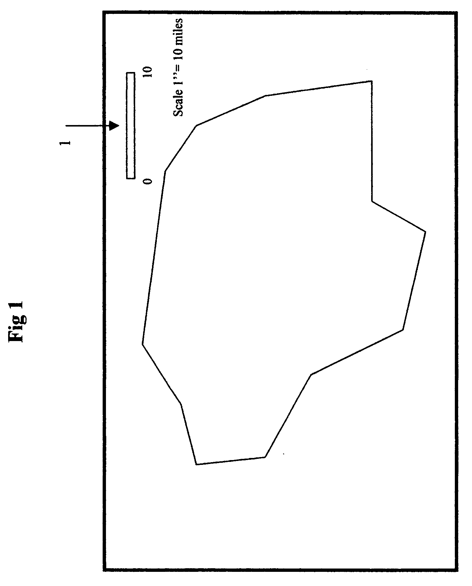
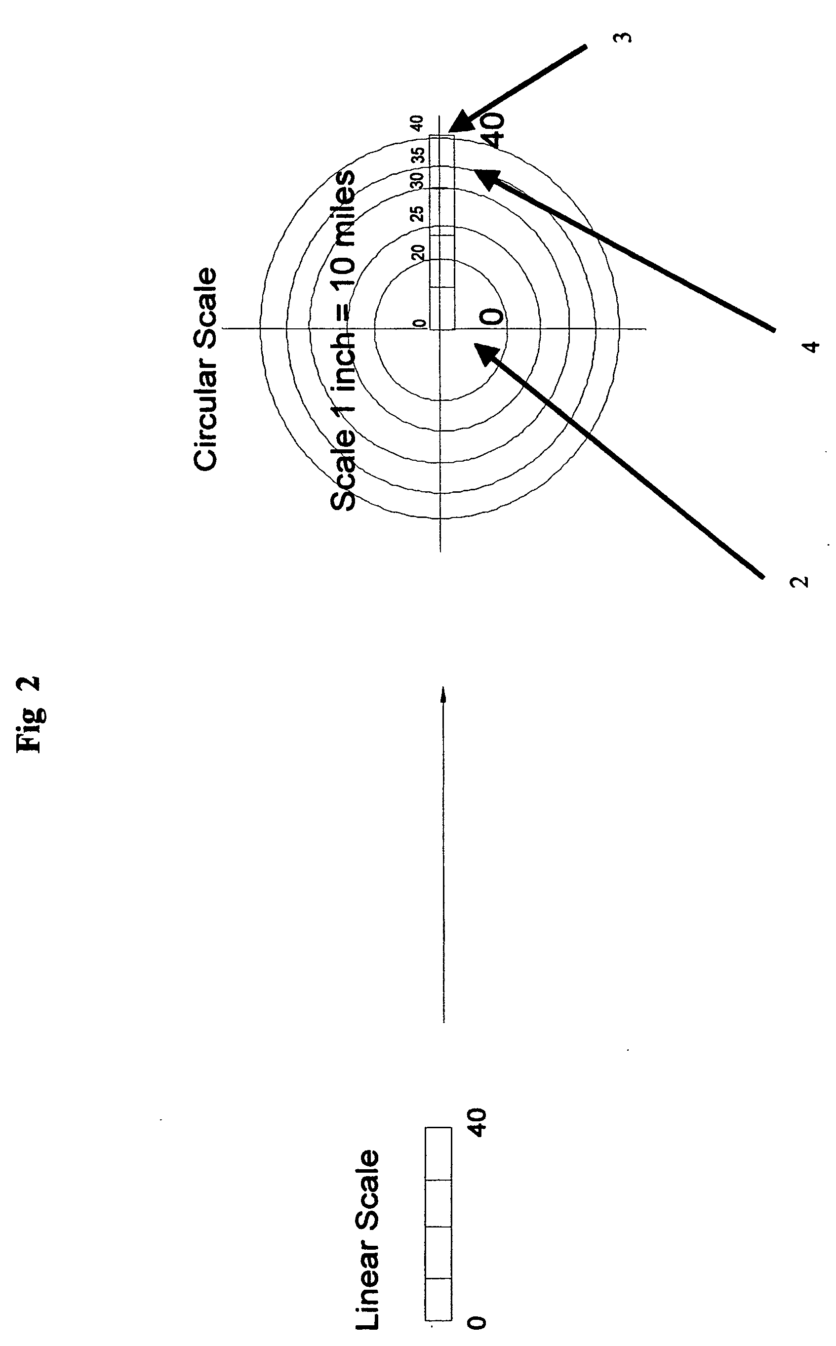
[0074] Function 1: Creation of Circular Scale from a Linear Scale: The circular scale is created by placing the cursor on one end of the linear scale and clicking the mouse and repeating the process on the other end of the linear scale followed by inputting the number of units that represent the distance between the two ends as recorded on the linear scale of the map. This creates the circular scale to match the linear scale except the largest distance represented by the circular scale is sufficient to cover the entire map. The center of the circular scale can be moved and placed at any location on the map. The circular scale with concentric divisions now enables the user to quickly scan the distances of the various locations from any the location placed at the center of the circular scale.

[0075] A ‘fill’ functi...


PUM


Abstract

Typically a family relocating to a new place is faced in making a number of decisions with respect to identifying a location to live. Identification of such a location, is dependent on the distances from places of work and the amenities available at the various locations that fit the distances criteria. During the process of identification there is a need to generate the routes between the locations for a quick assessment of the commuting involved between the locations and even generate the driving instructions between the locations so marked on the map. Current software maps and related software do not have an easy way to identify the regions on the map that meet the distance criteria and then to connect the address on the map to specific information. The current invention creates an easy way to use a map to, estimate distances of the various towns / cities around the target locations. generate routes connecting locations and directions without having to know the zip codes to the locations visually marked on the map and generate driving directions associated with the routes. research amenities availability around the target location. create report consolidating the information pertinent to the user needs. Using a map that can be marked enables an easy graphical method of identifying areas that meet the distance criteria, the connecting routes and obtain information associated with the areas pertinent to the user requirements.

Description

FIELD OF THE INVENTION [0001] A family trying to relocate to another city or town is faced with making many decisions, amongst them, identifying neighborhoods located centrally to places of work and schools. It then becomes necessary to identify neighborhoods that fall within the commuting distance and having amenities that are specific to the needs of the family. The routes between locations are also researched for the ease of commuting. Zeroing down to a single location is a matter of optimizing distances / amenities / connecting routes and affordability. [0002] The current invention is an information search system that utilizes a map to be the starting point to a relocation process. It does not require knowledge of zip codes by the user. It is a convenient method to visually scan the map for the criteria mentioned requiring minimum input from keyboard. It is intended to be a quick first scan in the decision process. [0003] The relocation process requirements in general are: [0004] Ne...

Claims


Application Information

Patent Timeline
IPC IPC(8): G01C21/00
CPCG01C21/00G01C21/367
Inventor ATHALYE, RAVI G.A.
Owner ATHALYE RAVI G A
Learn More