
Improved satellite ground trajectory intersection extraction method

An extraction method and intersection technology, applied in the field of satellite altimetry intersection solution, can solve problems such as low efficiency, irregular distribution of altimetry points, and inability to solve intersections, etc., to increase the number of intersections and increase spatial resolution and accuracy, and improve operational efficiency

Pending Publication Date: 2022-08-09
WUHAN UNIV
View PDF0 Cites 0 Cited by
  • Summary
  • Abstract
  • Description
  • Claims
  • Application Information

AI Technical Summary

Problems solved by technology

The first type of method is to obtain the theoretical intersection point based on the earth rotation model and satellite orbit parameters. The second type of method is to use the actual satellite orbit data to solve the intersection point. This method can obtain its precise position based on the approximate position of the intersection point, such as the iterative method. It is also possible to directly solve the precise position of the intersection point, such as fast repulsion and straddle detection. In areas with complex terrain, the altimetry points are usually not regularly distributed due to the influence of the terrain. In this case, the iterative method cannot solve the intersection point or can not be solved accurately. For the intersection point, if the fast repulsion and straddle detection method is used directly to solve the intersection point, because there are too many altimetry points in the satellite orbit, the process needs to make multiple judgments, and the efficiency is too low

Method used


Image

  • Improved satellite ground trajectory intersection extraction method
  • Improved satellite ground trajectory intersection extraction method
  • Improved satellite ground trajectory intersection extraction method

Examples


Embodiment Construction

[0025] The present invention will be described in further detail below with reference to the accompanying drawings and embodiments.

[0026] The embodiment of the present invention provides an improved method for extracting intersection points of satellite ground trajectories, and the process is as follows Image 6 shown:

[0027] Step 1, satellite altimetry data preprocessing, and further the preferred solution includes the following sub-steps:

[0028] Step 1.1, data reading, extraction including longitude, latitude, elevation, track number, etc.;

[0029] The embodiment is based on the CryoSat-2 (CS2) satellite altimetry data, and reads the GDR data in the secondary product of the CS2 satellite in 2013, which contains information such as longitude, latitude, elevation, orbit number, etc.; GDR represents a geophysical data set.

[0030] In the specific implementation, the corresponding satellite products can be used according to the situation. Generally, data including lon...


PUM


Abstract

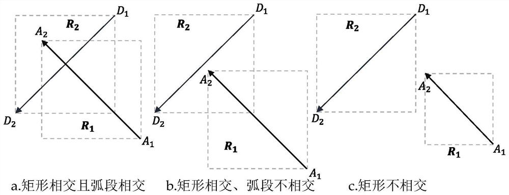
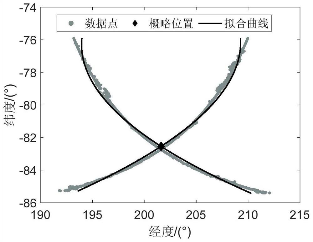
The invention provides an improved satellite ground trajectory intersection point extraction method, which is used for preprocessing satellite height measurement data, and comprises the following steps of: extracting longitude, latitude, elevation and orbit number based on the satellite height measurement data, cutting the data according to a target area, and carrying out lifting orbit separation; track screening: before calculating the position of the intersection point, judging whether the intersection point exists in the rail lifting arc section and the rail descending arc section, and removing the arc section combination without the intersection point; performing curve fitting to solve the initial approximate position of the cross point; solving the accurate position of the cross point and interpolating the elevation of the cross point, namely determining an operation area of rapid rejection and straddling detection based on the initial approximate position, carrying out rapid rejection and straddling detection on a lifting rail arc section of a selected area, and selecting an optimal cross point position from a plurality of cross points. According to the method, the calculation efficiency and the position precision of the intersection point are improved, the spatial resolution and accuracy of the ice shelf elevation change long-time sequence are improved, and the method is of great significance to ice shelf ground wire monitoring.

Description

technical field [0001] The invention belongs to the field of geodetic surveying and surveying and mapping engineering, and particularly relates to a technical scheme for solving intersection points in satellite surveying high altitudes. Background technique [0002] Affected by the earth's rotation and orbital perturbation, the sub-satellite trajectories of satellites will form intersections on the earth's surface. Using the height discrepancy value at the intersection of satellite altimetry for adjustment calculation can effectively weaken the satellite radial orbit error, backscatter error and systematic error, etc., and can weaken the sea surface time-varying error (such as sea surface height, Effective wave height, wind speed, etc.), the intersection data can be used to establish the time series of ice sheet, sea surface, lake elevation change and monitoring of surface subsidence, generate lunar surface DEM, inversion of the earth's gravity field and satellite gravity da...

Claims


Application Information

Patent Timeline
Patent Type & Authority Applications(China)
IPC IPC(8): G06T7/70G06T7/11G06F17/11G01C5/00
CPCG06T7/70G06T7/11G06F17/11G01C5/00G06T2207/20132G06T2207/10032Y02A90/10
Inventor 李潇张胜凯肖峰李佳星耿通龚力朱本鑫
Owner WUHAN UNIV
Learn More