Vector geographic information acquisition method and device based on remote sensing image

A technology of vector geography and information collection, which is applied in the direction of camera devices, machines/brackets, supporting machines, etc., can solve the problems of delaying the progress of geographic information collection and inconvenient operation, and achieves saving erection and dismantling time, saving time and improving efficiency Effect

Active Publication Date: 2022-07-12
湖南地科院规划设计有限公司
View PDF12 Cites 0 Cited by
  • Summary
  • Abstract
  • Description
  • Claims
  • Application Information

AI Technical Summary

Problems solved by technology

[0004] A method and device for collecting vector geographic information based on remote sensing images proposed by this application solves the problem that the existing geographic information collecting device is inconvenient to operate during erection and delays the progress of geographic information collection

Method used


Image

  • Vector geographic information acquisition method and device based on remote sensing image
  • Vector geographic information acquisition method and device based on remote sensing image
  • Vector geographic information acquisition method and device based on remote sensing image

Examples


Embodiment 1

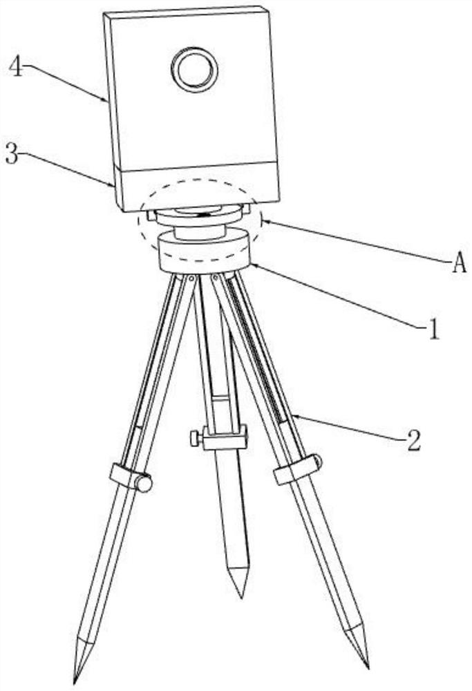
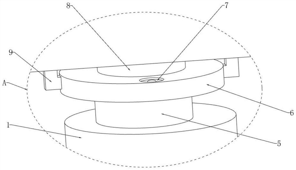
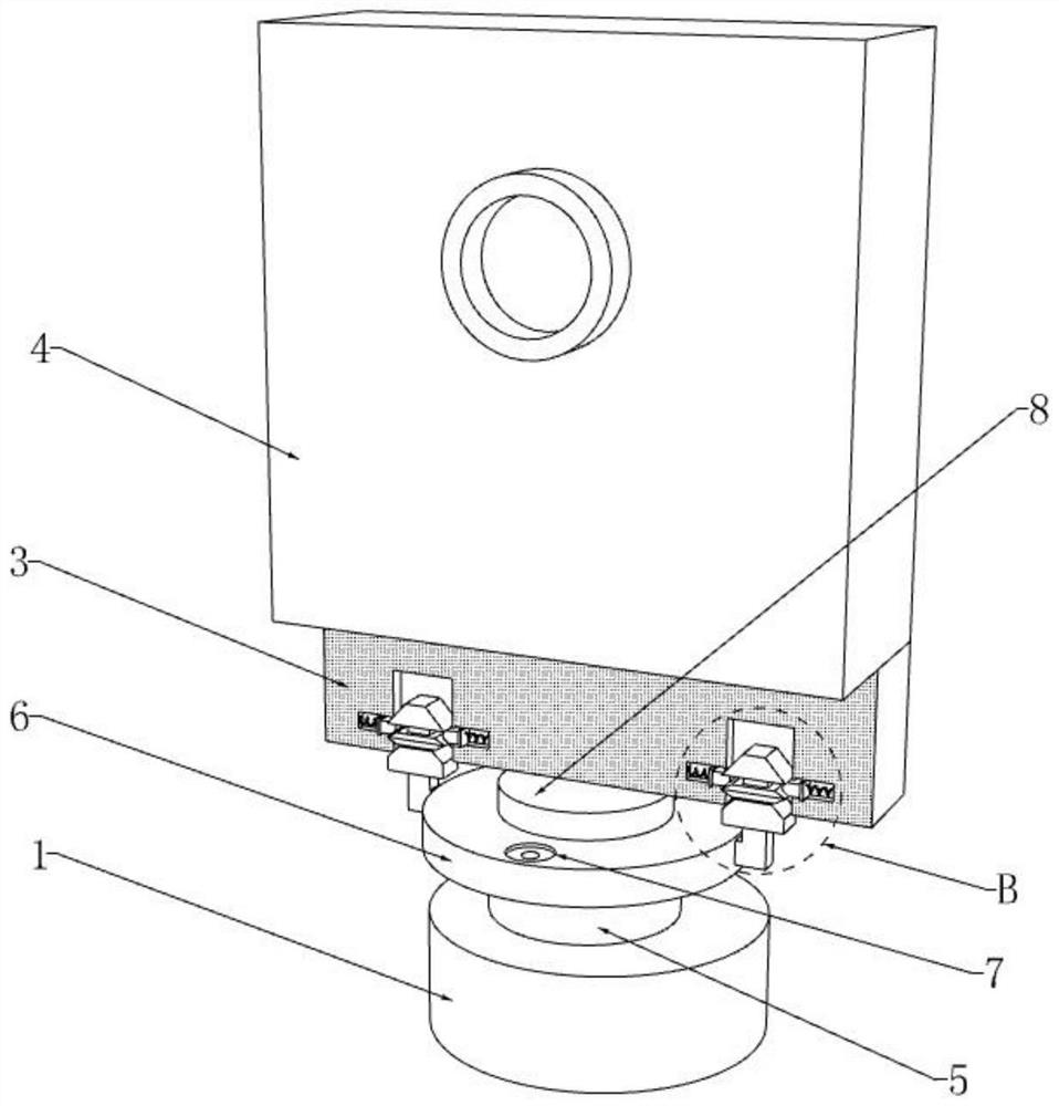
[0039] refer to figure 1 and Figure 5 , a vector geographic information collection device based on remote sensing images, comprising a base 1, a triangular support 2 and a collection device body 4, the triangular support 2 includes an upper support rod 201, a lower support rod 202, a sleeve 203 and a positioning screw 204, an upper support The bottom end of the rod 201 is fixedly connected with a sleeve 203, the lower support rod 202 slides through the sleeve 203, a set screw 204 is threadedly installed on one side of the sleeve 203, and the end of the set screw 204 extends to the inside of the sleeve 203 and is connected to the sleeve 203. The side walls of the lower support rod 202 are in contact with each other, and the bottom end of the lower support rod 202 is fixedly mounted with a sharp cone 205 .

[0040] When the height of the tripod 2 needs to be adjusted, the positioning screw 204 is first rotated so that the lower support rod 202 can slide inside the sleeve 203, ...


PUM


Abstract

The invention discloses a vector geographic information acquisition method and device based on a remote sensing image, relates to the field of geographic information acquisition, and provides the following scheme aiming at the problems that an existing geographic information acquisition device is inconvenient to erect and delays the geographic information acquisition progress: the device comprises a base, a triangular bracket and an acquisition device body, the base is fixedly mounted at the top end of the triangular bracket, a rotating seat is rotatably mounted at the top end of the base, a connecting plate is fixedly connected to the top end of the rotating seat, a level bubble is arranged at the top end of the connecting plate, and a mounting seat is fixedly connected to the bottom end of the collecting device body. And a connecting mechanism is arranged between the mounting seat and the connecting plate. According to the invention, the acquisition device body and the base can be quickly disassembled and assembled, the erection and disassembly time of the acquisition device body is saved, and the efficiency of geographic information acquisition is improved.

Description

technical field [0001] The present application relates to the field of geographic information collection, and in particular, to a method and device for collecting vector geographic information based on remote sensing images. Background technique [0002] Geographical information belongs to spatial information, which is identified by data. This is the most significant sign that geographic information systems distinguish other types of information. It is the positioning feature of geographic information. Data collection refers to the simulation and The digital measured unit automatically collects non-electricity or electric quantity signals, and sends them to the host computer for analysis and processing. The data acquisition system is a flexible, user-defined measurement system that combines measurement software and hardware products based on computers or other special test platforms. [0003] The existing geographic information collecting device needs to stably install the ...

Claims


Application Information

Patent Timeline
Patent Type & Authority Applications(China)
IPC IPC(8): F16M11/04F16M11/08F16M11/16F16M11/32F16M11/36G01C11/02
CPCF16M11/04F16M11/08F16M11/16F16M11/32F16M11/36G01C11/02
Inventor 徐文海钟毅吴柏生覃魏王忠武袁方
Owner 湖南地科院规划设计有限公司
Why Eureka
Try Eureka